TopoQuest Logo
Do you find TopoQuest useful?
Help keep TopoQuest running and adding new maps/features by donating!
Bitcoin:  19c7KJd3qBynnjoSw5npx9KScwjBe4ifkT
Litecoin:  LXs6TkuXGGXo1vDsWCkWVdjQX94eUKd6ui
Home View Maps Find Maps Find Places Resources & Links


Dellwood, Florida Topographic Map

USGS Map Title: Dellwood, FL
USGS Map MRC: 30085G1
DRG (GeoTIFF) Download: o30085g1.tif


Neighboring USGS Topographic Map Quads:


  Malone, FL  
30085H2
 

  Bascom, FL  
30085H1
 

  Steam Mill, GA  
30084H8
 

  Marianna, FL  
30085G2
 

  Dellwood, FL  
30085G1
 

  Fairchild, GA  
30084G8
 

  Oakdale, FL  
30085F2
 

  Cypress, FL  
30085F1
 

  Sneads, FL  
30084F8


Map MRC Location:

N31°
W86°
N31°
W85°
H8 H7 H6 H5 H4 H3 H2 H1
G8 G7 G6 G5 G4 G3 G2 G1
F8 F7 F6 F5 F4 F3 F2 F1
E8 E7 E6 E5 E4 E3 E2 E1
D8 D7 D6 D5 D4 D3 D2 D1
C8 C7 C6 C5 C4 C3 C2 C1
B8 B7 B6 B5 B4 B3 B2 B1
A8 A7 A6 A5 A4 A3 A2 A1
N30°
W86°
N30°
W85°

Dellwood, FL USGS 1:24K Topographic Map Preview:
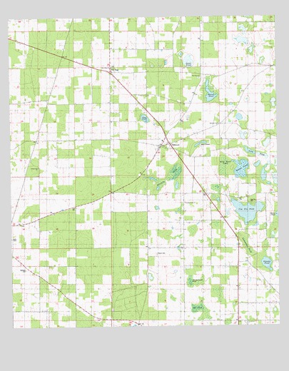
Dellwood, FL USGS Topographic Map
Click on map above to begin viewing in our Map Viewer.

This topographic map contains these locations and features:
Feature Name Type Latitude Longitude GNIS ID View Map
Allen ChapelChurchN30.8527°W85.0655°277756View Map
Bateau PondLakeN30.8136°W85.0170°278171View Map
Brandy Beach PondLakeN30.7682°W85.0415°279331View Map
Burns PondLakeN30.8441°W85.0310°279705View Map
Cottage Hill ChurchChurchN30.8144°W85.1116°300060View Map
Cottage Hill SchoolSchoolN30.8144°W85.1110°280876View Map
Cow Pen CemeteryCemeteryN30.7994°W85.0119°280936View Map
Cow Pen PondLakeN30.7966°W85.0142°280938View Map
Cypress Grove ChurchChurchN30.7999°W85.0430°281212View Map
Deer PondLakeN30.8244°W85.0342°281455View Map
DellwoodPopulated PlaceN30.8238°W85.0496°281484View Map
Dellwood Volunteer Fire DepartmentBuildingN30.8146°W85.0616°2644046View Map
Fivemile PondSwampN30.8096°W85.0505°282534View Map
Flag PondLakeN30.8343°W85.0616°282539View Map
Fulgum CemeteryCemeteryN30.7794°W85.0569°282850View Map
Greenwood DivisionCivilN30.8713°W85.0835°1935785View Map
Long PondLakeN30.8199°W85.0103°286061View Map
New Hope ChurchChurchN30.8502°W85.0355°287644View Map
Newcumber PondSwampN30.7825°W85.0152°287712View Map
Rat PondLakeN30.7574°W85.0385°289477View Map
Stevens PondLakeN30.7752°W85.0056°291686View Map
Sweet PondLakeN30.8558°W85.0409°291934View Map
Two EggPopulated PlaceN30.8527°W85.0763°295680View Map
Welcome ChurchChurchN30.8316°W85.0271°293015View Map
Wildwood ChurchChurchN30.7799°W85.0444°294448View Map
Wolf Head PondSwampN30.8149°W85.0252°293464View Map

Note: Coordinates in the location and feature list above are referenced to NAD83 datum.


Copyright (C) 2008-2024 Ryan Niemi / Sunset Dynamics ... All Rights Reserved