TopoQuest Logo
Do you find TopoQuest useful?
Help keep TopoQuest running and adding new maps/features by donating!
Bitcoin:  19c7KJd3qBynnjoSw5npx9KScwjBe4ifkT
Litecoin:  LXs6TkuXGGXo1vDsWCkWVdjQX94eUKd6ui
Home View Maps Find Maps Find Places Resources & Links


Biscay, Minnesota Topographic Map

USGS Map Title: Biscay, MN
USGS Map MRC: 44094G3
DRG (GeoTIFF) Download: o44094g3.tif


Neighboring USGS Topographic Map Quads:


  Hutchinson West, MN  
44094H4
 

  Hutchinson East, MN  
44094H3
 

  Silver Lake, MN  
44094H2
 

  Heatwole, MN  
44094G4
 

  Biscay, MN  
44094G3
 

  Glencoe, MN  
44094G2
 

  Stewart, MN  
44094F4
 

  Brownton, MN  
44094F3
 

  New Auburn, MN  
44094F2


Map MRC Location:

N45°
W95°
N45°
W94°
H8 H7 H6 H5 H4 H3 H2 H1
G8 G7 G6 G5 G4 G3 G2 G1
F8 F7 F6 F5 F4 F3 F2 F1
E8 E7 E6 E5 E4 E3 E2 E1
D8 D7 D6 D5 D4 D3 D2 D1
C8 C7 C6 C5 C4 C3 C2 C1
B8 B7 B6 B5 B4 B3 B2 B1
A8 A7 A6 A5 A4 A3 A2 A1
N44°
W95°
N44°
W94°

Biscay, MN USGS 1:24K Topographic Map Preview:
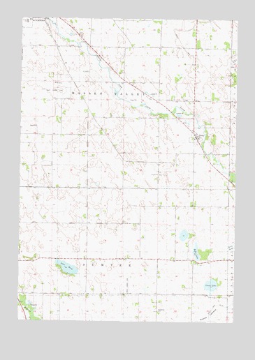
Biscay, MN USGS Topographic Map
Click on map above to begin viewing in our Map Viewer.

This topographic map contains these locations and features:
Feature Name Type Latitude Longitude GNIS ID View Map
BiscayPopulated PlaceN44.8275°W94.2750°655408View Map
Biscay Post Office (historical)Post OfficeN44.8275°W94.2747°2065385View Map
City of BiscayCivilN44.8263°W94.2741°2394175View Map
Clear LakeLakeN44.7652°W94.2638°655740View Map
County Ditch Number TwentysevenCanalN44.8602°W94.2766°1817767View Map
Elks ParkParkN44.8742°W94.3667°2065350View Map
Emmanuel CemeteryCemeteryN44.7541°W94.2947°658539View Map
Evangelical CemeteryCemeteryN44.8416°W94.2806°2065271View Map
Ewald Landing Strip (historical)AirportN44.7652°W94.3114°1817765View Map
Lake MaryLakeN44.7720°W94.3468°657335View Map
McCuen CreekStreamN44.8416°W94.3175°657352View Map
McLeod CountyCivilN44.8235°W94.2724°659491View Map
McLeod County Waterfowl Production AreaParkN44.8085°W94.2826°2765402View Map
Nobles LakebedFlatN44.7527°W94.2641°1817766View Map
Quast AirportAirportN44.8500°W94.3503°660224View Map
Rice LakeSwampN44.7811°W94.2508°1817773View Map
Ridgewater collegeSchoolN44.8733°W94.3553°2065328View Map
Ryan LakeLakeN44.7794°W94.2727°658121View Map
Saint John's CemeteryCemeteryN44.8108°W94.2939°2065270View Map
Saint Johns ChurchChurchN44.8105°W94.2950°658134View Map
School Number 985SchoolN44.7825°W94.2841°658181View Map
Township of Hassan ValleyCivilN44.8465°W94.3112°664410View Map
Township of SumterCivilN44.7616°W94.3145°665739View Map

Note: Coordinates in the location and feature list above are referenced to NAD83 datum.


Copyright (C) 2008-2024 Ryan Niemi / Sunset Dynamics ... All Rights Reserved