TopoQuest Logo
Do you find TopoQuest useful?
Help keep TopoQuest running and adding new maps/features by donating!
Bitcoin:  19c7KJd3qBynnjoSw5npx9KScwjBe4ifkT
Litecoin:  LXs6TkuXGGXo1vDsWCkWVdjQX94eUKd6ui
Home View Maps Find Maps Find Places Resources & Links


Hutchinson West, Minnesota Topographic Map

USGS Map Title: Hutchinson West, MN
USGS Map MRC: 44094H4
DRG (GeoTIFF) Download: o44094h4.tif


Neighboring USGS Topographic Map Quads:


  Litchfield South, MN  
45094A5
 

  Darwin, MN  
45094A4
 

  Dassel, MN  
45094A3
 

  Cedar Mills, MN  
44094H5
 

  Hutchinson West, MN  
44094H4
 

  Hutchinson East, MN  
44094H3
 

  Lake Allie, MN  
44094G5
 

  Heatwole, MN  
44094G4
 

  Biscay, MN  
44094G3


Map MRC Location:

N45°
W95°
N45°
W94°
H8 H7 H6 H5 H4 H3 H2 H1
G8 G7 G6 G5 G4 G3 G2 G1
F8 F7 F6 F5 F4 F3 F2 F1
E8 E7 E6 E5 E4 E3 E2 E1
D8 D7 D6 D5 D4 D3 D2 D1
C8 C7 C6 C5 C4 C3 C2 C1
B8 B7 B6 B5 B4 B3 B2 B1
A8 A7 A6 A5 A4 A3 A2 A1
N44°
W95°
N44°
W94°

Hutchinson West, MN USGS 1:24K Topographic Map Preview:
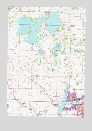
Hutchinson West, MN USGS Topographic Map
Click on map above to begin viewing in our Map Viewer.

This topographic map contains these locations and features:
Feature Name Type Latitude Longitude GNIS ID View Map
Acoma CemeteryCemeteryN44.9130°W94.4386°639194View Map
Acoma SchoolSchoolN44.9227°W94.4600°639195View Map
AFS ParkParkN44.8925°W94.3931°2065357View Map
Belle LakeLakeN44.9815°W94.4269°639888View Map
Bethlehem United Methodist ChurchChurchN44.8833°W94.3794°2065310View Map
Campbell LakeLakeN44.9507°W94.3904°640851View Map
Campbell LakeReservoirN44.9014°W94.4047°640854View Map
Campbell Lake Seaplane BaseAirportN44.9027°W94.4025°660223View Map
Cedar LakeLakeN44.9577°W94.4614°641011View Map
Christ the King Lutheran ChurchChurchN44.8772°W94.3869°2065300View Map
City of HutchinsonCivilN44.8856°W94.3766°2394460View Map
Clear LakeLakeN44.9484°W94.4449°641281View Map
Clear Lake SchoolSchoolN44.9508°W94.4705°641306View Map
Country Club Terrace Mobile Home ParkPopulated PlaceN44.8978°W94.3928°2065313View Map
County Ditch Number ThreeCanalN44.9472°W94.4786°1815331View Map
Crow River Country ClubLocaleN44.9039°W94.4017°1815328View Map
Dettman LakeLakeN44.9631°W94.3958°1815334View Map
Ferrell LakeSwampN44.9422°W94.4655°1815332View Map
French LakeLakeN44.9457°W94.4218°643937View Map
GreenleafPopulated PlaceN44.9964°W94.4994°644445View Map
Greenleaf Post Office (historical)Post OfficeN44.9964°W94.4992°2065923View Map
Greenleaf Post Office (historical)Post OfficeN44.9964°W94.4992°2066560View Map
Hunters Ridge Community ChurchChurchN44.8811°W94.3958°2065298View Map
Hutchinson Baptist ChurchChurchN44.8869°W94.3794°2065297View Map
Hutchinson Evangelical Free ChurchChurchN44.8894°W94.3844°2065337View Map
Hutchinson High SchoolSchoolN44.8845°W94.3929°2065335View Map
Hutchinson MallLocaleN44.8753°W94.3758°2065317View Map
Hutchinson Middle SchoolSchoolN44.8790°W94.3909°2065333View Map
Hutchinson State Wildlife Management AreaParkN44.8955°W94.4153°1815329View Map
Hutchinson Wayside ParkParkN44.9172°W94.4611°2065386View Map
Hutchinson West Elementary SchoolSchoolN44.8799°W94.3947°2065334View Map
Immanuel Evangelical Lutheran CemeteryCemeteryN44.9203°W94.4619°2065278View Map
Immanuel Evangelical Lutheran ChurchChurchN44.9197°W94.4597°2065303View Map
Immanuel Lutheran CemeteryCemeteryN44.9194°W94.4586°2065277View Map
Immanuel Lutheran SchoolSchoolN44.9197°W94.4599°645389View Map
Junior Community Women ParkParkN44.8828°W94.3889°2065355View Map
Kohn LakeLakeN44.9336°W94.4408°646226View Map
Lake FernoldSwampN44.9257°W94.3967°646009View Map
Linden ParkParkN44.8800°W94.3817°1815325View Map
Lions Park WestParkN44.8825°W94.3831°2065354View Map
McDonalds Lakeview TerracePopulated PlaceN44.8847°W94.4028°2065319View Map
McDonalds ParkParkN44.8877°W94.4030°1815324View Map
McLeod County Historical Society / MuseumBuildingN44.8939°W94.3969°2065320View Map
Meadow Links Public Golf CourseLocaleN44.9042°W94.3806°2065321View Map
Miller ParkParkN44.8972°W94.3975°1815326View Map
Mud LakeLakeN44.9521°W94.4089°1815335View Map
Northview CourtPopulated PlaceN44.9064°W94.3817°2065312View Map
Odd Fellow's ParkParkN44.8922°W94.3972°2065358View Map
Otter LakeLakeN44.8864°W94.4122°649055View Map
Peace CemeteryCemeteryN44.9144°W94.4044°649200View Map
Piepenburg CampgroundLocaleN44.9750°W94.4194°2065339View Map
Piepenburg County ParkParkN44.9722°W94.4169°1815371View Map
Pierce LakeLakeN44.9286°W94.4273°649392View Map
Popp SloughLakeN44.9528°W94.4157°1815336View Map
Prieve State Wildlife Management AreaParkN44.8944°W94.4947°1815330View Map
Riverside Jaycee ParkParkN44.8944°W94.3792°2065356View Map
Rotary ParkParkN44.9008°W94.3922°2065360View Map
Saint Anastasia Catholic ChurchChurchN44.8869°W94.3864°2065302View Map
Saint Anastasia Catholic SchoolSchoolN44.8866°W94.3868°1815322View Map
Shady Ridge ParkParkN44.9017°W94.4000°2065349View Map
Shalom Baptist ChurchChurchN44.8858°W94.3933°2065304View Map
Sitz SchoolSchoolN44.8786°W94.4583°652096View Map
Stahl LakeLakeN44.9548°W94.4202°652534View Map
Stahl Lake SchoolSchoolN44.9625°W94.4083°652535View Map
Stahls Lake County ParkParkN44.9494°W94.4280°1815333View Map
The Church of Jesus Christ of Latter Day SaintsChurchN44.9000°W94.3958°2065301View Map
Township of AcomaCivilN44.9371°W94.4426°663376View Map
Vineyard ChurchChurchN44.8786°W94.3950°1815323View Map
West River ParkParkN44.8930°W94.3869°1815327View Map
West River Park CampgroundLocaleN44.8931°W94.3875°2065322View Map
Woman's Club ParkParkN44.8967°W94.4014°2065359View Map
Word of Life Christian AcademySchoolN44.8794°W94.3933°2065332View Map
Word of Life ChurchChurchN44.8794°W94.3933°2065331View Map

Note: Coordinates in the location and feature list above are referenced to NAD83 datum.


Copyright (C) 2008-2024 Ryan Niemi / Sunset Dynamics ... All Rights Reserved