TopoQuest Logo
Do you find TopoQuest useful?
Help keep TopoQuest running and adding new maps/features by donating!
Bitcoin:  19c7KJd3qBynnjoSw5npx9KScwjBe4ifkT
Litecoin:  LXs6TkuXGGXo1vDsWCkWVdjQX94eUKd6ui
Home View Maps Find Maps Find Places Resources & Links


Brownton, Minnesota Topographic Map

USGS Map Title: Brownton, MN
USGS Map MRC: 44094F3
DRG (GeoTIFF) Download: o44094f3.tif


Neighboring USGS Topographic Map Quads:


  Heatwole, MN  
44094G4
 

  Biscay, MN  
44094G3
 

  Glencoe, MN  
44094G2
 

  Stewart, MN  
44094F4
 

  Brownton, MN  
44094F3
 

  New Auburn, MN  
44094F2
 

  Winthrop SW, MN  
44094E4
 

  Winthrop, MN  
44094E3
 

  Gaylord, MN  
44094E2


Map MRC Location:

N45°
W95°
N45°
W94°
H8 H7 H6 H5 H4 H3 H2 H1
G8 G7 G6 G5 G4 G3 G2 G1
F8 F7 F6 F5 F4 F3 F2 F1
E8 E7 E6 E5 E4 E3 E2 E1
D8 D7 D6 D5 D4 D3 D2 D1
C8 C7 C6 C5 C4 C3 C2 C1
B8 B7 B6 B5 B4 B3 B2 B1
A8 A7 A6 A5 A4 A3 A2 A1
N44°
W95°
N44°
W94°

Brownton, MN USGS 1:24K Topographic Map Preview:
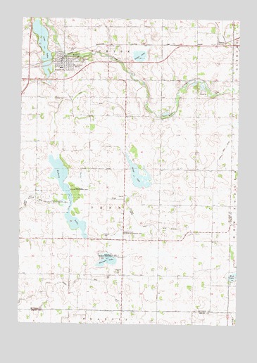
Brownton, MN USGS Topographic Map
Click on map above to begin viewing in our Map Viewer.

This topographic map contains these locations and features:
Feature Name Type Latitude Longitude GNIS ID View Map
Bakers LakeLakeN44.6791°W94.3493°659749View Map
Bremers LakeLakeN44.6511°W94.3250°1817738View Map
BrowntonLocaleN44.7339°W94.3525°2065285View Map
BrowntonPopulated PlaceN44.7319°W94.3503°640549View Map
Brownton Police DepartmentBuildingN44.7333°W94.3505°2065291View Map
Brownton Post OfficePost OfficeN44.7319°W94.3518°2065283View Map
Brownton Public LibraryBuildingN44.7333°W94.3494°2065289View Map
Brownton Volunteer Fire DepartmentBuildingN44.7326°W94.3511°2065290View Map
City of BrowntonCivilN44.7326°W94.3510°2393442View Map
County Ditch Number ThirtyCanalN44.7150°W94.3322°1817742View Map
Grace Lutheran ChurchChurchN44.7303°W94.3533°2065288View Map
Immanuel CemeteryCemeteryN44.6605°W94.3252°645390View Map
Immanuel CemeteryCemeteryN44.7288°W94.3503°1817746View Map
Immanuel Lutheran ChurchChurchN44.7322°W94.3478°2065287View Map
Judicial Ditch Number EighteenCanalN44.6255°W94.3016°1817792View Map
Kings LakeLakeN44.6864°W94.3069°646159View Map
Lake AddieLakeN44.7409°W94.3635°639212View Map
Lewis LakeLakeN44.7347°W94.3075°1817744View Map
McLeod West Senior High SchoolSchoolN44.7297°W94.3519°2065286View Map
Mud LakeLakeN44.6448°W94.2514°648353View Map
Oak Grove CemeteryCemeteryN44.7327°W94.3419°1817745View Map
Penn State Wildlife Management AreaParkN44.6730°W94.3489°1817740View Map
Saint Matthew's CemeteryCemeteryN44.6463°W94.3201°2065292View Map
Saint Matthews ChurchChurchN44.6461°W94.3183°650899View Map
Shade Tree Retirement CenterHospitalN44.7314°W94.3517°2065284View Map
Spiering State Wildlife Management AreaParkN44.6611°W94.3178°1817739View Map
Streich CemeteryCemeteryN44.7172°W94.3555°1817743View Map
SumterPopulated PlaceN44.7394°W94.2633°654968View Map
Sumter Post Office (historical)Post OfficeN44.7394°W94.2631°2065362View Map
Township of PennCivilN44.6741°W94.3151°665276View Map

Note: Coordinates in the location and feature list above are referenced to NAD83 datum.


Copyright (C) 2008-2024 Ryan Niemi / Sunset Dynamics ... All Rights Reserved