TopoQuest Logo
Do you find TopoQuest useful?
Help keep TopoQuest running and adding new maps/features by donating!
Bitcoin:  19c7KJd3qBynnjoSw5npx9KScwjBe4ifkT
Litecoin:  LXs6TkuXGGXo1vDsWCkWVdjQX94eUKd6ui
Home View Maps Find Maps Find Places Resources & Links


Spicer, Minnesota Topographic Map

USGS Map Title: Spicer, MN
USGS Map MRC: 45094B8
DRG (GeoTIFF) Download: o45094b8.tif


Neighboring USGS Topographic Map Quads:


  Mount Tom, MN  
45095C1
 

  New London, MN  
45094C8
 

  Hawick, MN  
45094C7
 

  Solomon Lake, MN  
45095B1
 

  Spicer, MN  
45094B8
 

  Atwater, MN  
45094B7
 

  Willmar, MN  
45095A1
 

  Little Kandiyohi Lake, MN  
45094A8
 

  Lake Elizabeth, MN  
45094A7


Map MRC Location:

N46°
W95°
N46°
W94°
H8 H7 H6 H5 H4 H3 H2 H1
G8 G7 G6 G5 G4 G3 G2 G1
F8 F7 F6 F5 F4 F3 F2 F1
E8 E7 E6 E5 E4 E3 E2 E1
D8 D7 D6 D5 D4 D3 D2 D1
C8 C7 C6 C5 C4 C3 C2 C1
B8 B7 B6 B5 B4 B3 B2 B1
A8 A7 A6 A5 A4 A3 A2 A1
N45°
W95°
N45°
W94°

Spicer, MN USGS 1:24K Topographic Map Preview:
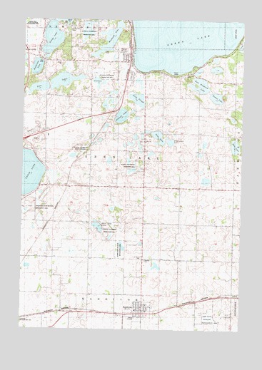
Spicer, MN USGS Topographic Map
Click on map above to begin viewing in our Map Viewer.

This topographic map contains these locations and features:
Feature Name Type Latitude Longitude GNIS ID View Map
Alvig SloughLakeN45.2180°W94.9348°639314View Map
Bass LakeLakeN45.1991°W94.8797°639673View Map
Burr Oak LakeLakeN45.1664°W94.9565°640678View Map
Carlson LakeLakeN45.2250°W94.9581°640904View Map
Church of ChristChurchN45.1336°W94.9278°2067716View Map
City of KandiyohiCivilN45.1320°W94.9324°2395488View Map
City of SpicerCivilN45.2329°W94.9401°2395925View Map
Decision Hills CampLocaleN45.2461°W94.9739°1815539View Map
Downs LakeLakeN45.2194°W94.8892°1815540View Map
Eagle Lake State Wildlife Management AreaParkN45.1727°W94.9956°1815538View Map
East Woodcock LakeLakeN45.2238°W94.8995°643119View Map
Ebenezer CemeteryCemeteryN45.1529°W94.9300°643135View Map
Ebenezer Lutheran ChurchChurchN45.1322°W94.9308°2067717View Map
Elkhorn LakeLakeN45.2113°W94.9436°643268View Map
Elkhorn LakeReservoirN45.2083°W94.9420°1776657View Map
Elkhorn Lake Rearing Pond DamDamN45.2083°W94.9420°1776656View Map
Faith Lutheran ChurchChurchN45.2342°W94.9389°2067666View Map
George LakeLakeN45.2427°W94.9850°644074View Map
Gina LakeLakeN45.2028°W94.9226°1815532View Map
Green Lake Baseball DiamondsParkN45.2250°W94.9431°2067659View Map
Green Lake CampLocaleN45.2277°W94.9086°1815541View Map
Green Lake ChurchChurchN45.2008°W94.9317°644420View Map
Green Lake Lutheran CemeteryCemeteryN45.2010°W94.9314°2067748View Map
Green Lake MallLocaleN45.2250°W94.9403°2067657View Map
Henderson LakeLakeN45.2307°W94.9926°644863View Map
Kandi State Wildlife Management AreaParkN45.1577°W94.9433°1815537View Map
KandiyohiLocaleN45.1319°W94.9314°2067720View Map
KandiyohiPopulated PlaceN45.1322°W94.9311°646033View Map
Kandiyohi Fire DepartmentBuildingN45.1328°W94.9311°2067718View Map
Kandiyohi Post OfficePost OfficeN45.1322°W94.9308°2067719View Map
Saint Patrick Catholic ChurchChurchN45.1347°W94.9281°2067715View Map
Saint Patrick CemeteryCemeteryN45.1540°W94.9314°650938View Map
School Number 28SchoolN45.2105°W94.9011°651602View Map
School Number 44SchoolN45.1300°W94.9881°651659View Map
School Number 51SchoolN45.2116°W94.9720°651674View Map
School Number 60SchoolN45.1830°W94.9847°651693View Map
School Number 78SchoolN45.1539°W94.9622°651735View Map
SpicerPopulated PlaceN45.2330°W94.9400°652380View Map
Spicer (historical)LocaleN45.2347°W94.9392°2067663View Map
Spicer City CemeteryCemeteryN45.2336°W94.9456°2067774View Map
Spicer City HallBuildingN45.2364°W94.9400°2067655View Map
Spicer City ParkParkN45.2367°W94.9367°2067658View Map
Spicer Family CemeteryCemeteryN45.2325°W94.9460°2067773View Map
Spicer Fire DepartmentBuildingN45.2368°W94.9404°2067660View Map
Spicer Health CenterHospitalN45.2331°W94.9397°2067661View Map
Spicer LibraryBuildingN45.2364°W94.9400°2067656View Map
Spicer Post OfficePost OfficeN45.2283°W94.9419°2067662View Map
Thompson LakeLakeN45.2011°W94.9161°1815531View Map
Township of Green LakeCivilN45.1952°W94.9404°664342View Map
Twin LakesLakeN45.2253°W94.9770°653434View Map
Woodcock LakeLakeN45.2427°W94.9503°654350View Map
Yohi State Wildlife Management AreaParkN45.1300°W94.8919°1815536View Map

Note: Coordinates in the location and feature list above are referenced to NAD83 datum.


Copyright (C) 2008-2024 Ryan Niemi / Sunset Dynamics ... All Rights Reserved