TopoQuest Logo
Do you find TopoQuest useful?
Help keep TopoQuest running and adding new maps/features by donating!
Bitcoin:  19c7KJd3qBynnjoSw5npx9KScwjBe4ifkT
Litecoin:  LXs6TkuXGGXo1vDsWCkWVdjQX94eUKd6ui
Home View Maps Find Maps Find Places Resources & Links


Solomon Lake, Minnesota Topographic Map

USGS Map Title: Solomon Lake, MN
USGS Map MRC: 45095B1
DRG (GeoTIFF) Download: o45095b1.tif


Neighboring USGS Topographic Map Quads:


  Sunburg, MN  
45095C2
 

  Mount Tom, MN  
45095C1
 

  New London, MN  
45094C8
 

  Pennock, MN  
45095B2
 

  Solomon Lake, MN  
45095B1
 

  Spicer, MN  
45094B8
 

  Raymond, MN  
45095A2
 

  Willmar, MN  
45095A1
 

  Little Kandiyohi Lake, MN  
45094A8


Map MRC Location:

N46°
W96°
N46°
W95°
H8 H7 H6 H5 H4 H3 H2 H1
G8 G7 G6 G5 G4 G3 G2 G1
F8 F7 F6 F5 F4 F3 F2 F1
E8 E7 E6 E5 E4 E3 E2 E1
D8 D7 D6 D5 D4 D3 D2 D1
C8 C7 C6 C5 C4 C3 C2 C1
B8 B7 B6 B5 B4 B3 B2 B1
A8 A7 A6 A5 A4 A3 A2 A1
N45°
W96°
N45°
W95°

Solomon Lake, MN USGS 1:24K Topographic Map Preview:
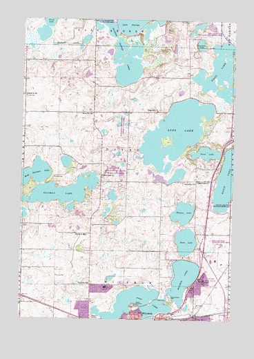
Solomon Lake, MN USGS Topographic Map
Click on map above to begin viewing in our Map Viewer.

This topographic map contains these locations and features:
Feature Name Type Latitude Longitude GNIS ID View Map
Carlson LakeLakeN45.2399°W95.0204°640905View Map
Cloverleaf Memorial Park CemeteryCemeteryN45.1279°W95.0005°641359View Map
College View ParkParkN45.1364°W95.0817°2067619View Map
Eagle Creek Golf CourseLocaleN45.1597°W95.0306°2067622View Map
Eagle LakeLakeN45.1847°W95.0008°643027View Map
Eagle Lake CemeteryCemeteryN45.1828°W95.0217°2067750View Map
Eagle Lake ChurchChurchN45.1827°W95.0217°643031View Map
Endresen CemeteryCemeteryN45.1839°W95.1064°643371View Map
Fairview CemeteryCemeteryN45.1258°W95.0803°643503View Map
Fischer Unit DamDamN45.1850°W95.0753°1776652View Map
Florida LakeReservoirN45.2466°W95.0703°1775999View Map
Florida Lake DamDamN45.2466°W95.0703°1775998View Map
Florida Slough LakeLakeN45.2270°W95.0689°643760View Map
Florida Slough Lake Structure DamDamN45.2400°W95.0953°1776653View Map
Foot LakeLakeN45.1322°W95.0604°643789View Map
Geology of the Willmar Region Historical MarkerParkN45.1264°W95.0444°2067784View Map
Guri Endresen Rosseland State MonumentParkN45.1856°W95.0792°2067782View Map
Hanson ParkParkN45.1411°W95.0667°2067618View Map
Hedin ParkParkN45.1375°W95.0411°2067612View Map
Infinia at WillmarHospitalN45.1264°W95.0583°2067566View Map
Kandiyohi CountyCivilN45.1524°W95.0047°659479View Map
Kandiyohi County FairgroundsLocaleN45.1306°W95.0558°2067611View Map
Kandiyohi County Historical Society MuseumBuildingN45.1272°W95.0367°2067575View Map
Kandiyohi County JailBuildingN45.1459°W95.0135°2758722View Map
Kandiyohi County Sheriff's OfficeBuildingN45.1458°W95.0141°2067578View Map
KQIC-FM (Willmar)TowerN45.1944°W95.0839°663138View Map
KQIC-FM (Willmar)TowerN45.2302°W95.1125°663139View Map
KWLM-AM (Willmar)TowerN45.1333°W95.0433°662995View Map
Long LakeLakeN45.2031°W95.0349°647049View Map
Long Lake CemeteryCemeteryN45.2119°W95.0450°2067749View Map
Long Lake ChurchChurchN45.2122°W95.0458°647127View Map
Lunby CemeteryCemeteryN45.2175°W95.1228°647289View Map
Northside ParkParkN45.1256°W95.0592°2067614View Map
Oslo LakeLakeN45.1422°W95.0694°2067620View Map
Parkwood EstatesPopulated PlaceN45.1300°W95.0847°2067577View Map
Point LakeLakeN45.1946°W95.0165°649606View Map
Rau ParkParkN45.1314°W95.0478°2067613View Map
Ridgewater College - Willmar CampusSchoolN45.1375°W95.0722°2067617View Map
Ringo LakeLakeN45.2287°W95.0097°650090View Map
Robbins Island ParkParkN45.1341°W95.0364°650162View Map
Saint Johns CemeteryCemeteryN45.1430°W95.1039°650677View Map
School Number 761SchoolN45.2186°W95.1236°651727View Map
School Number 776SchoolN45.1822°W95.0225°651734View Map
School Number 781SchoolN45.1400°W95.0845°651737View Map
School Number 790SchoolN45.2108°W95.0839°651740View Map
School Number 801SchoolN45.1602°W95.0864°651743View Map
Skataas LakeLakeN45.1697°W95.0295°652114View Map
Solomon LakeLakeN45.1780°W95.1004°652242View Map
Solomon Lake ChurchChurchN45.1850°W95.0789°652243View Map
Sperry ParkParkN45.1278°W95.0361°2067609View Map
Spiritual Life ChurchChurchN45.1367°W95.0222°2067560View Map
Swan LakeLakeN45.1578°W95.0275°652888View Map
Thompson ParkParkN45.1278°W95.0417°2067610View Map
Township of DovreCivilN45.1970°W95.0637°663999View Map
Triumphant Life ChurchChurchN45.1328°W95.0844°2067561View Map
Valleyside ParkParkN45.1314°W95.0889°2067616View Map
Vikor Lutheran Church CemeteryCemeteryN45.1856°W95.0792°2067783View Map
Vos ParkParkN45.1269°W95.0839°2067615View Map
Weber Unit Fish and Wildlife Control DamDamN45.1816°W95.0153°1776651View Map
West Solomon LakeLakeN45.1830°W95.1238°654012View Map
Willmar Air Force Station (historical)MilitaryN45.1383°W95.0750°2090224View Map
Willmar Chemical Dependency ServicesBuildingN45.1433°W95.0182°2697210View Map
Willmar Child and Adolescent Behavioral Health ServicesBuildingN45.1425°W95.0197°2697211View Map
Willmar LakeLakeN45.1386°W95.0334°654179View Map
Willmar Police DepartmentBuildingN45.1457°W95.0144°2067579View Map
Willmar Regional Treatment CenterBuildingN45.1390°W95.0261°654180View Map
Willmar Senior High SchoolSchoolN45.1514°W95.0022°2067604View Map
Willmar State Wildlife Management AreaParkN45.1569°W95.0142°1815542View Map

Note: Coordinates in the location and feature list above are referenced to NAD83 datum.


Copyright (C) 2008-2024 Ryan Niemi / Sunset Dynamics ... All Rights Reserved