TopoQuest Logo
Do you find TopoQuest useful?
Help keep TopoQuest running and adding new maps/features by donating!
Bitcoin:  19c7KJd3qBynnjoSw5npx9KScwjBe4ifkT
Litecoin:  LXs6TkuXGGXo1vDsWCkWVdjQX94eUKd6ui
Home View Maps Find Maps Find Places Resources & Links


Lake Elizabeth, Minnesota Topographic Map

USGS Map Title: Lake Elizabeth, MN
USGS Map MRC: 45094A7
DRG (GeoTIFF) Download: o45094a7.tif


Neighboring USGS Topographic Map Quads:


  Spicer, MN  
45094B8
 

  Atwater, MN  
45094B7
 

  Grove City, MN  
45094B6
 

  Little Kandiyohi Lake, MN  
45094A8
 

  Lake Elizabeth, MN  
45094A7
 

  Rosendale, MN  
45094A6
 

  Lake Lillian, MN  
44094H8
 

  Thorpe, MN  
44094H7
 

  Cosmos, MN  
44094H6


Map MRC Location:

N46°
W95°
N46°
W94°
H8 H7 H6 H5 H4 H3 H2 H1
G8 G7 G6 G5 G4 G3 G2 G1
F8 F7 F6 F5 F4 F3 F2 F1
E8 E7 E6 E5 E4 E3 E2 E1
D8 D7 D6 D5 D4 D3 D2 D1
C8 C7 C6 C5 C4 C3 C2 C1
B8 B7 B6 B5 B4 B3 B2 B1
A8 A7 A6 A5 A4 A3 A2 A1
N45°
W95°
N45°
W94°

Lake Elizabeth, MN USGS 1:24K Topographic Map Preview:
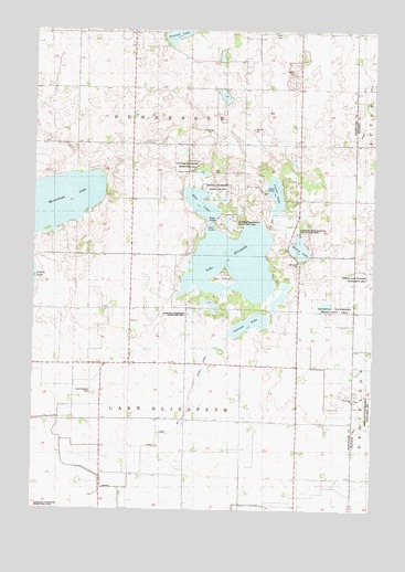
Lake Elizabeth, MN USGS Topographic Map
Click on map above to begin viewing in our Map Viewer.

This topographic map contains these locations and features:
Feature Name Type Latitude Longitude GNIS ID View Map
Big IslandIslandN45.0611°W94.8053°1815518View Map
Branch Number TwoCanalN45.0055°W94.8483°1815520View Map
Carrie LakeLakeN45.0827°W94.7863°640933View Map
Charlotte LakeLakeN45.0077°W94.8708°641118View Map
County Ditch Number TwentyeightCanalN45.1008°W94.7536°641906View Map
Ella LakeLakeN45.0797°W94.8147°643274View Map
Gennesse State Wildlife Management AreaParkN45.0744°W94.7808°1815517View Map
Henry LakeLakeN45.0683°W94.7775°644884View Map
Johnson LakeLakeN45.0485°W94.7955°645685View Map
KYRS-FM (Atwater)TowerN45.0733°W94.7558°663010View Map
Lake ElizabethLakeN45.0645°W94.8018°643256View Map
Lake Elizabeth CemeteryCemeteryN45.0304°W94.8531°1815521View Map
Lake Elizabeth ChurchChurchN45.0302°W94.8536°646343View Map
Mennetaga LakeLakeN45.0807°W94.8655°647766View Map
Oak Grove CemeteryCemeteryN45.0642°W94.7771°648796View Map
Otter LakeLakeN45.0377°W94.8139°649048View Map
Rosendale CemeteryCemeteryN45.0287°W94.7569°2066034View Map
Rosendale ChurchChurchN45.0291°W94.7575°650282View Map
School Number 38SchoolN45.0383°W94.8267°651647View Map
School Number 75SchoolN45.0589°W94.7792°651726View Map
School Number 96SchoolN45.0016°W94.7889°651766View Map
State Ditch Number OneCanalN45.0277°W94.8175°1815519View Map
Township of GennesseeCivilN45.1090°W94.8196°664256View Map
Township of Lake ElizabethCivilN45.0230°W94.8186°664669View Map

Note: Coordinates in the location and feature list above are referenced to NAD83 datum.


Copyright (C) 2008-2024 Ryan Niemi / Sunset Dynamics ... All Rights Reserved