TopoQuest Logo
Do you find TopoQuest useful?
Help keep TopoQuest running and adding new maps/features by donating!
Bitcoin:  19c7KJd3qBynnjoSw5npx9KScwjBe4ifkT
Litecoin:  LXs6TkuXGGXo1vDsWCkWVdjQX94eUKd6ui
Home View Maps Find Maps Find Places Resources & Links


South Greenfield, Missouri Topographic Map

USGS Map Title: South Greenfield, MO
USGS Map MRC: 37093C7
DRG (GeoTIFF) Download: o37093c7.tif


Neighboring USGS Topographic Map Quads:


  Lockwood, MO  
37093D8
 

  Greenfield, MO  
37093D7
 

  Dadeville, MO  
37093D6
 

  Kings Point, MO  
37093C8
 

  South Greenfield, MO  
37093C7
 

  Everton, MO  
37093C6
 

  Rescue, MO  
37093B8
 

  Miller, MO  
37093B7
 

  Halltown, MO  
37093B6


Map MRC Location:

N38°
W94°
N38°
W93°
H8 H7 H6 H5 H4 H3 H2 H1
G8 G7 G6 G5 G4 G3 G2 G1
F8 F7 F6 F5 F4 F3 F2 F1
E8 E7 E6 E5 E4 E3 E2 E1
D8 D7 D6 D5 D4 D3 D2 D1
C8 C7 C6 C5 C4 C3 C2 C1
B8 B7 B6 B5 B4 B3 B2 B1
A8 A7 A6 A5 A4 A3 A2 A1
N37°
W94°
N37°
W93°

South Greenfield, MO USGS 1:24K Topographic Map Preview:
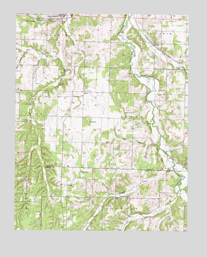
South Greenfield, MO USGS Topographic Map
Click on map above to begin viewing in our Map Viewer.

This topographic map contains these locations and features:
Feature Name Type Latitude Longitude GNIS ID View Map
Antioch BridgeBridgeN37.3389°W93.7797°754986View Map
Antioch ChurchChurchN37.3398°W93.7808°713329View Map
Bishop CemeteryCemeteryN37.2959°W93.8305°714271View Map
Bishop SpringsSpringN37.3231°W93.8641°714276View Map
Bowles CemeteryCemeteryN37.3131°W93.8630°714577View Map
Bryant MoundSummitN37.3198°W93.7980°714933View Map
Buffalo BranchStreamN37.3687°W93.8413°715002View Map
Buffalo SpringSpringN37.3706°W93.8621°715014View Map
Cuba BluffCliffN37.2937°W93.7705°716577View Map
Dadeville (historical)LocaleN37.3295°W93.8255°746309View Map
Daughtrey BluffCliffN37.3425°W93.8399°716682View Map
Daughtrey CemeteryCemeteryN37.3737°W93.8705°716683View Map
Dilday MillPopulated PlaceN37.3253°W93.7808°740811View Map
Eddington BranchStreamN37.2742°W93.7527°717396View Map
Felter School (historical)SchoolN37.2692°W93.8374°746366View Map
Friend CemeteryCemeteryN37.3623°W93.7749°718225View Map
Gambill CemeteryCemeteryN37.3073°W93.7902°718322View Map
Glass Hollow BranchStreamN37.3528°W93.8688°718489View Map
Guffy BluffCliffN37.3106°W93.7777°718915View Map
Honey CreekStreamN37.3664°W93.8413°719752View Map
Hopper CemeteryCemeteryN37.3100°W93.7830°719824View Map
Itson BranchStreamN37.3014°W93.7705°720185View Map
Jordan CreekStreamN37.3453°W93.7555°720437View Map
Limestone School (historical)SchoolN37.3600°W93.8708°746300View Map
Meek School (historical)SchoolN37.3248°W93.7566°746302View Map
Merrick CemeteryCemeteryN37.3345°W93.8605°722240View Map
Morris CemeteryCemeteryN37.3528°W93.8460°722638View Map
New KirkPopulated PlaceN37.2876°W93.8302°755638View Map
North Sycamore BranchStreamN37.2937°W93.7649°736179View Map
North Sycamore ChurchChurchN37.2698°W93.7924°723502View Map
North Sycamore School (historical)SchoolN37.2693°W93.7926°746367View Map
OlingerPopulated PlaceN37.2767°W93.8372°723803View Map
Patten ChapelChurchN37.2839°W93.8277°724078View Map
PennsboroPopulated PlaceN37.3273°W93.8341°724209View Map
Picket School (historical)SchoolN37.2962°W93.7627°746303View Map
PilgrimPopulated PlaceN37.3575°W93.7755°741152View Map
Pilgrim School (historical)SchoolN37.3570°W93.7705°746301View Map
Shiloh ChurchChurchN37.2856°W93.7638°726371View Map
Sinking CreekStreamN37.3720°W93.7938°726484View Map
Snadon BluffCliffN37.3342°W93.8435°726650View Map
Snadon FordPopulated PlaceN37.3406°W93.7894°741271View Map
Snadon HollowValleyN37.3003°W93.7724°726651View Map
Stillhouse HollowValleyN37.2867°W93.7530°727112View Map
Sycamore BranchStreamN37.2734°W93.7549°727400View Map
Sycamore HollowValleyN37.2734°W93.7569°727417View Map
The MoundSummitN37.3128°W93.8227°727557View Map
Township of PilgrimCivilN37.3627°W93.7646°766557View Map
Township of SouthCivilN37.3137°W93.7906°766562View Map
Township of WashingtonCivilN37.3672°W93.8467°766564View Map
Turnback (historical)Populated PlaceN37.3073°W93.7902°740558View Map
Turnback Post Office (historical)Post OfficeN37.3250°W93.7813°759630View Map
Walnut HollowValleyN37.2992°W93.8594°728323View Map
West Fork Limestone CreekStreamN37.3500°W93.8455°728568View Map

Note: Coordinates in the location and feature list above are referenced to NAD83 datum.


Copyright (C) 2008-2024 Ryan Niemi / Sunset Dynamics ... All Rights Reserved