TopoQuest Logo
Do you find TopoQuest useful?
Help keep TopoQuest running and adding new maps/features by donating!
Bitcoin:  19c7KJd3qBynnjoSw5npx9KScwjBe4ifkT
Litecoin:  LXs6TkuXGGXo1vDsWCkWVdjQX94eUKd6ui
Home View Maps Find Maps Find Places Resources & Links


Rescue, Missouri Topographic Map

USGS Map Title: Rescue, MO
USGS Map MRC: 37093B8
DRG (GeoTIFF) Download: o37093b8.tif


Neighboring USGS Topographic Map Quads:


  Dudenville, MO  
37094C1
 

  Kings Point, MO  
37093C8
 

  South Greenfield, MO  
37093C7
 

  La Russell, MO  
37094B1
 

  Rescue, MO  
37093B8
 

  Miller, MO  
37093B7
 

  Sarcoxie, MO  
37094A1
 

  Stotts City, MO  
37093A8
 

  Mount Vernon, MO  
37093A7


Map MRC Location:

N38°
W94°
N38°
W93°
H8 H7 H6 H5 H4 H3 H2 H1
G8 G7 G6 G5 G4 G3 G2 G1
F8 F7 F6 F5 F4 F3 F2 F1
E8 E7 E6 E5 E4 E3 E2 E1
D8 D7 D6 D5 D4 D3 D2 D1
C8 C7 C6 C5 C4 C3 C2 C1
B8 B7 B6 B5 B4 B3 B2 B1
A8 A7 A6 A5 A4 A3 A2 A1
N37°
W94°
N37°
W93°

Rescue, MO USGS 1:24K Topographic Map Preview:
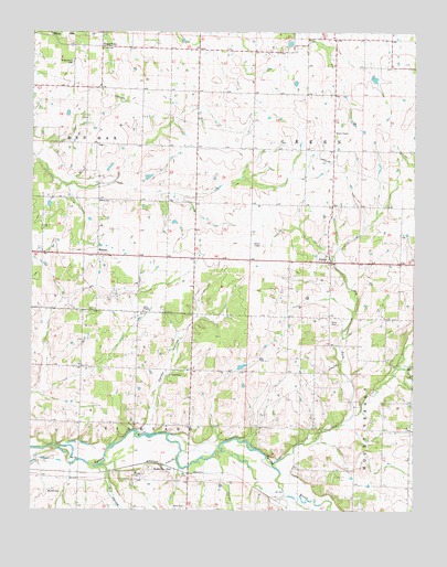
Rescue, MO USGS Topographic Map
Click on map above to begin viewing in our Map Viewer.

This topographic map contains these locations and features:
Feature Name Type Latitude Longitude GNIS ID View Map
Ash Grove School (historical)SchoolN37.1573°W93.9024°746382View Map
Beck CemeteryCemeteryN37.1262°W93.9496°713843View Map
Beck School (historical)SchoolN37.1259°W93.9483°746378View Map
Cole CemeteryCemeteryN37.1603°W93.9544°716097View Map
Colley HollowValleyN37.1462°W93.9630°716120View Map
Dry ForkStreamN37.1495°W93.8955°717098View Map
Dry HollowValleyN37.1337°W93.9760°717127View Map
Gaither (historical)Populated PlaceN37.1531°W93.8849°740065View Map
Goss CemeteryCemeteryN37.1743°W93.9023°718632View Map
Grays PointPopulated PlaceN37.2462°W93.9774°739990View Map
Grays Point CemeteryCemeteryN37.2420°W93.9869°718768View Map
Hodges CemeteryCemeteryN37.1341°W93.9667°719659View Map
Jackson School (historical)SchoolN37.1628°W93.9660°746377View Map
Kingsley AirfieldAirportN37.2318°W93.9287°2717173View Map
Northfield School (historical)SchoolN37.2196°W93.9013°746380View Map
PhelpsPopulated PlaceN37.1898°W93.9024°724278View Map
Phelps School (historical)SchoolN37.1914°W93.9030°746381View Map
RescuePopulated PlaceN37.1917°W93.9788°725227View Map
Scotts School (historical)SchoolN37.2487°W93.9010°746379View Map
Shaffer School (historical)SchoolN37.2064°W93.9785°746376View Map
Stahl CreekStreamN37.1370°W93.9213°729968View Map
Star School (historical)SchoolN37.1261°W93.9851°2710429View Map
Stone ChapelChurchN37.1770°W93.9635°727131View Map
Stotts CityLocaleN37.1359°W93.9533°727161View Map
Township of GreenCivilN37.2316°W93.9059°766881View Map
Township of VineyardCivilN37.1265°W93.9850°766891View Map
Unionjoy School (historical)SchoolN37.2345°W93.9555°746375View Map
West School (historical)SchoolN37.2059°W93.9780°728622View Map
Wilson CemeteryCemeteryN37.1303°W93.9944°728959View Map

Note: Coordinates in the location and feature list above are referenced to NAD83 datum.


Copyright (C) 2008-2024 Ryan Niemi / Sunset Dynamics ... All Rights Reserved