TopoQuest Logo
Do you find TopoQuest useful?
Help keep TopoQuest running and adding new maps/features by donating!
Bitcoin:  19c7KJd3qBynnjoSw5npx9KScwjBe4ifkT
Litecoin:  LXs6TkuXGGXo1vDsWCkWVdjQX94eUKd6ui
Home View Maps Find Maps Find Places Resources & Links


Masaryktown, Florida Topographic Map

USGS Map Title: Masaryktown, FL
USGS Map MRC: 28082D4
DRG (GeoTIFF) Download: o28082d4.tif


Neighboring USGS Topographic Map Quads:


  Weeki Wachee Spring, FL  
28082E5
 

  Brooksville, FL  
28082E4
 

  Brooksville SE, FL  
28082E3
 

  Port Richey NE, FL  
28082D5
 

  Masaryktown, FL  
28082D4
 

  Spring Lake, FL  
28082D3
 

  Fivay Junction, FL  
28082C5
 

  Ehren, FL  
28082C4
 

  San Antonio, FL  
28082C3


Map MRC Location:

N29°
W83°
N29°
W82°
H8 H7 H6 H5 H4 H3 H2 H1
G8 G7 G6 G5 G4 G3 G2 G1
F8 F7 F6 F5 F4 F3 F2 F1
E8 E7 E6 E5 E4 E3 E2 E1
D8 D7 D6 D5 D4 D3 D2 D1
C8 C7 C6 C5 C4 C3 C2 C1
B8 B7 B6 B5 B4 B3 B2 B1
A8 A7 A6 A5 A4 A3 A2 A1
N28°
W83°
N28°
W82°

Masaryktown, FL USGS 1:24K Topographic Map Preview:
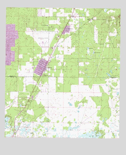
Masaryktown, FL USGS Topographic Map
Click on map above to begin viewing in our Map Viewer.

This topographic map contains these locations and features:
Feature Name Type Latitude Longitude GNIS ID View Map
Adelphi SchoolSchoolN28.4919°W82.4468°302764View Map
Aviation Post OfficePost OfficeN28.4802°W82.4626°2767977View Map
AyersPopulated PlaceN28.4633°W82.4437°295105View Map
Bayfront Medical Center Bayflite Station 4BuildingN28.4697°W82.4475°2661693View Map
Brooksville Army Air Field (historical)MilitaryN28.4694°W82.4592°2091738View Map
Brooksville-Tampa Bay Regional AirportAirportN28.4743°W82.4437°309294View Map
Chocachatti Elementary SchoolSchoolN28.4904°W82.4633°2504734View Map
Civil Air Patrol - Hernando CountyBuildingN28.4790°W82.4538°2131477View Map
Civil Air Patrol Hernando CountyBuildingN28.4784°W82.4533°2644664View Map
Cypress PondLakeN28.4618°W82.4101°281229View Map
Florida Highway Patrol - Land O'Lakes Troop CBuildingN28.4511°W82.4514°2756028View Map
Florida Hills Memorial GardensCemeteryN28.4763°W82.4838°298224View Map
Florida State Prison CampLocaleN28.4833°W82.4537°282622View Map
Garden GrovePopulated PlaceN28.4803°W82.4351°282923View Map
Garden Grove Census Designated PlaceCensusN28.4716°W82.4349°2583347View Map
Hernando Correctional InstitutionBuildingN28.4829°W82.4543°2753048View Map
Hernando County Fire Rescue Station 14BuildingN28.4744°W82.4398°2131705View Map
Hernando County Sheriff's Office Masaryktown SubstationBuildingN28.4416°W82.4571°2333572View Map
Jet Intensive Care UnitBuildingN28.4790°W82.4539°2661852View Map
LoycePopulated PlaceN28.3806°W82.4865°295421View Map
MasaryktownPopulated PlaceN28.4417°W82.4570°286497View Map
Masaryktown CemeteryCemeteryN28.4341°W82.4564°286498View Map
Masaryktown Census Designated PlaceCensusN28.4417°W82.4610°2403258View Map
McGeachy CemeteryCemeteryN28.4662°W82.3974°286614View Map
PowellLocaleN28.4897°W82.4068°294896View Map
PowellPopulated PlaceN28.4925°W82.4284°289274View Map
Seminole Presbyterian SchoolSchoolN28.4856°W82.4870°302768View Map
South MasaryktownPopulated PlaceN28.4283°W82.4604°300905View Map
Squirrel Prairie LakeLakeN28.4578°W82.4037°291593View Map
State of FloridaCivilN28.4771°W82.4664°294478View Map

Note: Coordinates in the location and feature list above are referenced to NAD83 datum.


Copyright (C) 2008-2024 Ryan Niemi / Sunset Dynamics ... All Rights Reserved