TopoQuest Logo
Do you find TopoQuest useful?
Help keep TopoQuest running and adding new maps/features by donating!
Bitcoin:  19c7KJd3qBynnjoSw5npx9KScwjBe4ifkT
Litecoin:  LXs6TkuXGGXo1vDsWCkWVdjQX94eUKd6ui
Home View Maps Find Maps Find Places Resources & Links


Heber City, Utah Topographic Map

USGS Map Title: Heber City, UT
USGS Map MRC: 40111E4
DRG (GeoTIFF) Download: o40111e4.tif


Neighboring USGS Topographic Map Quads:


  Park City West, UT  
40111F5
 

  Park City East, UT  
40111F4
 

  Kamas, UT  
40111F3
 

  Brighton, UT  
40111E5
 

  Heber City, UT  
40111E4
 

  Francis, UT  
40111E3
 

  Aspen Grove, UT  
40111D5
 

  Charleston, UT  
40111D4
 

  Center Creek, UT  
40111D3


Map MRC Location:

N41°
W112°
N41°
W111°
H8 H7 H6 H5 H4 H3 H2 H1
G8 G7 G6 G5 G4 G3 G2 G1
F8 F7 F6 F5 F4 F3 F2 F1
E8 E7 E6 E5 E4 E3 E2 E1
D8 D7 D6 D5 D4 D3 D2 D1
C8 C7 C6 C5 C4 C3 C2 C1
B8 B7 B6 B5 B4 B3 B2 B1
A8 A7 A6 A5 A4 A3 A2 A1
N40°
W112°
N40°
W111°

Heber City, UT USGS 1:24K Topographic Map Preview:
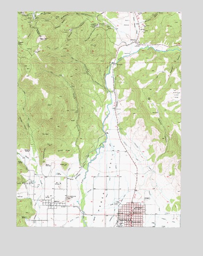
Heber City, UT USGS Topographic Map
Click on map above to begin viewing in our Map Viewer.

This topographic map contains these locations and features:
Feature Name Type Latitude Longitude GNIS ID View Map
Bald Eagle MountainSummitN40.6236°W111.4816°1425249View Map
Bald MountainSummitN40.6088°W111.4805°1425258View Map
Berkenshaw CreekStreamN40.5150°W111.4535°1425441View Map
Big Dutch Pete HollowValleyN40.6152°W111.4260°1425486View Map
Bone HollowValleyN40.6233°W111.4102°1425868View Map
Burgi HillSummitN40.5361°W111.4646°1426166View Map
Central Elementary SchoolSchoolN40.5030°W111.4127°1426510View Map
Charcoal CanyonValleyN40.6016°W111.3760°1426537View Map
City of HeberCivilN40.5072°W111.3983°2410731View Map
City of MidwayCivilN40.5183°W111.4754°2411101View Map
Cottonwood CanyonValleyN40.5777°W111.4316°1426903View Map
Coyote CanyonValleyN40.5347°W111.4041°1427034View Map
CranmerPopulated PlaceN40.6166°W111.4407°1437535View Map
Cunningham TunnelMineN40.6172°W111.4346°1427154View Map
Devils HoleBasinN40.5166°W111.4994°1440434View Map
Donkey RidgeRidgeN40.5441°W111.4652°1427448View Map
Drain Tunnel CreekStreamN40.6000°W111.4155°1427472View Map
Dutch HollowValleyN40.5355°W111.4519°1427636View Map
Epperson DitchCanalN40.5008°W111.4863°1427832View Map
First Baptist ChurchChurchN40.5238°W111.4099°1450593View Map
Flagstaff MountainSummitN40.6055°W111.4999°1427985View Map
Gerber SpringSpringN40.5375°W111.4968°1428182View Map
Glencoe CanyonValleyN40.6219°W111.4457°1428202View Map
Glencoe MineMineN40.6091°W111.4627°1428203View Map
HailstonePopulated PlaceN40.6083°W111.4102°1437577View Map
Harold P Fabian Visitor CenterBuildingN40.5330°W111.4899°1904551View Map
Hawkeye McHenryMineN40.6211°W111.4716°1428591View Map
Heber CityPopulated PlaceN40.5069°W111.4132°1455878View Map
Heber City CemeteryCemeteryN40.5166°W111.4010°1435664View Map
Heber City Police DepartmentBuildingN40.5033°W111.4126°2730402View Map
Heber City Post OfficePost OfficeN40.5093°W111.4112°1455314View Map
Heber Valley Baptist ChurchChurchN40.5238°W111.4096°1904560View Map
Heber Valley Railroad DepotBuildingN40.5025°W111.4257°1904561View Map
Homestead Crater Mineral DomeSummitN40.5238°W111.4852°1904552View Map
Indian SpringSpringN40.5052°W111.4928°1429018View Map
InterlakenPopulated PlaceN40.5417°W111.4730°2783908View Map
Island DitchCanalN40.5016°W111.4610°1429060View Map
J R Smith Elementary SchoolSchoolN40.5148°W111.4091°1435752View Map
JordanellePopulated PlaceN40.5944°W111.4274°1429249View Map
Jordanelle DamDamN40.5989°W111.4248°2746939View Map
Jordanelle ReservoirReservoirN40.6189°W111.4086°2746938View Map
Jordanelle State ParkParkN40.6204°W111.4117°2746940View Map
Keeler TunnelMineN40.6163°W111.4305°1429293View Map
KLVR-AM (Heber City)TowerN40.5005°W111.4494°1455744View Map
Lake CreekStreamN40.5033°W111.4007°1425012View Map
Lake FlatFlatN40.6219°W111.4885°1429425View Map
Lake SpringSpringN40.5305°W111.4702°1429442View Map
Mahogany SpringSpringN40.5437°W111.4910°1430047View Map
Mayflower MineMineN40.6163°W111.4416°1430154View Map
McHenry CanyonValleyN40.6080°W111.4155°1430182View Map
Memorial HillSummitN40.5169°W111.4613°1430222View Map
Middle DitchCanalN40.5300°W111.4296°1430269View Map
MidwayPopulated PlaceN40.5122°W111.4744°1430310View Map
Midway City CemeteryCemeteryN40.5027°W111.4868°1435946View Map
Midway Elementary SchoolSchoolN40.5084°W111.4694°1904555View Map
Midway Post OfficePost OfficeN40.5118°W111.4750°1455392View Map
Midway SchoolSchoolN40.5091°W111.4702°1435947View Map
Midway Town HallBuildingN40.5125°W111.4749°1904553View Map
Mound CityPopulated PlaceN40.5252°W111.4919°1437645View Map
Mound City CemeteryCemeteryN40.5260°W111.4938°1989289View Map
Mountain SpaPopulated PlaceN40.5250°W111.4674°1436005View Map
Mountain Valley Baptist ChapelChurchN40.5066°W111.4149°1450617View Map
Murdock HollowValleyN40.6180°W111.4080°1430605View Map
Murdock PowerhouseLocaleN40.6061°W111.4077°1454482View Map
NaildriverMineN40.6150°W111.4880°1430632View Map
New YorkMineN40.6152°W111.4896°1430702View Map
North Kindergarten SchoolSchoolN40.5108°W111.4107°1455074View Map
North Wasatch DivisionCivilN40.5900°W111.4159°2584787View Map
Ontario Number 1 ShaftMineN40.6238°W111.4980°1454492View Map
Ontario Shaft Number 2MineN40.6225°W111.4941°1454493View Map
Park City Fire District Station 34BuildingN40.6233°W111.4897°2767287View Map
Park Heber TunnelMineN40.5677°W111.4544°1431105View Map
Park Premier ShaftMineN40.6169°W111.4049°1431108View Map
Parkview Trailer CourtPopulated PlaceN40.5147°W111.4127°1436103View Map
Phosphate HillSummitN40.5477°W111.4757°1431212View Map
Pine CanyonValleyN40.6036°W111.4691°1431243View Map
Pine CreekStreamN40.5380°W111.4863°1444375View Map
Pocatello GulchValleyN40.6236°W111.4549°1431345View Map
Queen TunnelMineN40.6236°W111.3957°1431526View Map
River DitchCanalN40.5372°W111.4549°1431858View Map
Rock CreekStreamN40.5144°W111.4271°1431909View Map
Saint Lawrence Catholic ChurchChurchN40.5063°W111.4152°1450639View Map
Silver Lake Station Number 34BuildingN40.6236°W111.4874°1904550View Map
Springer HollowValleyN40.5550°W111.4919°1446056View Map
Star TunnelMineN40.6141°W111.4613°1432923View Map
The Church of Jesus Christ of Latter Day SaintsChurchN40.5144°W111.4074°1450763View Map
The Church of Jesus Christ of Latter Day SaintsChurchN40.5097°W111.4169°1450764View Map
The Church of Jesus Christ of Latter Day SaintsChurchN40.5022°W111.4091°1450765View Map
The Church of Jesus Christ of Latter Day SaintsChurchN40.5016°W111.4168°1450766View Map
The Church of Jesus Christ of Latter Day SaintsChurchN40.5088°W111.4669°1450821View Map
The Church of Jesus Christ of Latter Day SaintsChurchN40.5125°W111.4755°1450822View Map
The PeakSummitN40.5536°W111.4794°1433395View Map
Timpanogos CanalCanalN40.5397°W111.4019°1446608View Map
Town of InterlakenCivilN40.5411°W111.4752°2783907View Map
Valeo MineMineN40.5991°W111.4638°1433859View Map
WabashMineN40.6186°W111.4902°1433910View Map
Warm Ditch SpringSpringN40.5359°W111.4786°1433955View Map
WasatchMineN40.6197°W111.4796°1433974View Map
Wasatch CanalCanalN40.5333°W111.4091°1447001View Map
Wasatch County Emergency Medical ServicesBuildingN40.5067°W111.4149°2665421View Map
Wasatch County Fire District - Heber CityBuildingN40.5067°W111.4149°2627117View Map
Wasatch County Fire District MidwayBuildingN40.5127°W111.4740°2627214View Map
Wasatch County Hospital (historical)HospitalN40.5069°W111.4043°1436588View Map
Wasatch County Hospital HeliportAirportN40.5066°W111.4024°1436589View Map
Wasatch GulchValleyN40.6213°W111.4646°1433977View Map
West Bench DitchCanalN40.5211°W111.4927°1447111View Map
Westside DitchCanalN40.5258°W111.4419°1434131View Map
William Walter Wilson Burial SiteCemeteryN40.5450°W111.4933°2079457View Map

Note: Coordinates in the location and feature list above are referenced to NAD83 datum.


Copyright (C) 2008-2024 Ryan Niemi / Sunset Dynamics ... All Rights Reserved