TopoQuest Logo
Do you find TopoQuest useful?
Help keep TopoQuest running and adding new maps/features by donating!
Bitcoin:  19c7KJd3qBynnjoSw5npx9KScwjBe4ifkT
Litecoin:  LXs6TkuXGGXo1vDsWCkWVdjQX94eUKd6ui
Home View Maps Find Maps Find Places Resources & Links


Fort Blackmore, Virginia Topographic Map

USGS Map Title: Fort Blackmore, VA
USGS Map MRC: 36082G5
DRG (GeoTIFF) Download: o36082g5.tif


Neighboring USGS Topographic Map Quads:


  Norton, VA  
36082H6
 

  Wise, VA  
36082H5
 

  Coeburn, VA  
36082H4
 

  East Stone Gap, VA  
36082G6
 

  Fort Blackmore, VA  
36082G5
 

  Dungannon, VA  
36082G4
 

  Clinchport, VA  
36082F6
 

  Gate City, VA  
36082F5
 

  Hiltons, VA  
36082F4


Map MRC Location:

N37°
W83°
N37°
W82°
H8 H7 H6 H5 H4 H3 H2 H1
G8 G7 G6 G5 G4 G3 G2 G1
F8 F7 F6 F5 F4 F3 F2 F1
E8 E7 E6 E5 E4 E3 E2 E1
D8 D7 D6 D5 D4 D3 D2 D1
C8 C7 C6 C5 C4 C3 C2 C1
B8 B7 B6 B5 B4 B3 B2 B1
A8 A7 A6 A5 A4 A3 A2 A1
N36°
W83°
N36°
W82°

Fort Blackmore, VA USGS 1:24K Topographic Map Preview:
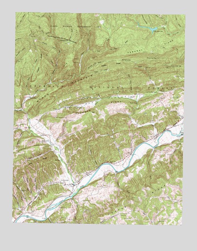
Fort Blackmore, VA USGS Topographic Map
Click on map above to begin viewing in our Map Viewer.

This topographic map contains these locations and features:
Feature Name Type Latitude Longitude GNIS ID View Map
Back ValleyValleyN36.8253°W82.5345°1481832View Map
Bagley CemeteryCemeteryN36.7797°W82.5714°1481395View Map
Baldwin CemeteryCemeteryN36.7953°W82.5893°1498027View Map
Baldwin HollowValleyN36.7629°W82.6102°1481437View Map
Ballard Gillenwater CemeteryCemeteryN36.7801°W82.5821°1498028View Map
Banner CemeteryCemeteryN36.7943°W82.5146°1481445View Map
Bark Camp DamDamN36.8673°W82.5205°1490835View Map
Bark Camp LakeReservoirN36.8668°W82.5262°1501990View Map
Bark CampgroundLocaleN36.8676°W82.5288°1488742View Map
Beard CemeteryCemeteryN36.7741°W82.5968°1481535View Map
Bearpen BranchStreamN36.8570°W82.5843°1481542View Map
Begley HollowValleyN36.7935°W82.5962°1481602View Map
Big BranchStreamN36.8426°W82.5940°1481702View Map
Big Flat TopSummitN36.8559°W82.5774°1494839View Map
Board Tree GapGapN36.8487°W82.5202°1481889View Map
Boatright CemeteryCemeteryN36.8021°W82.6006°1481892View Map
Brickey CemeteryCemeteryN36.7659°W82.5324°1481982View Map
Brickey CemeteryCemeteryN36.7957°W82.5980°1481983View Map
Brickey SpringSpringN36.7985°W82.5992°1481985View Map
Buckner RidgeRidgeN36.8209°W82.5574°1482138View Map
Buckner Ridge Lookout TowerTowerN36.8123°W82.5954°1491108View Map
Buffalo School (historical)SchoolN36.8237°W82.5615°1498044View Map
Carter CemeteryCemeteryN36.8084°W82.6154°1482345View Map
Carter ChapelChurchN36.8062°W82.6121°1482349View Map
Carter Chapel CemeteryCemeteryN36.8068°W82.6121°1498049View Map
Cassells ChapelChurchN36.8137°W82.5007°1482366View Map
Chestnut RidgeRidgeN36.7945°W82.6124°1482492View Map
Chimney RockSummitN36.8584°W82.5932°1494874View Map
Chimney Rock ForkStreamN36.8326°W82.5996°1482521View Map
Christ the King MissionChurchN36.8287°W82.5199°1482527View Map
Coalpit BranchStreamN36.8243°W82.6138°1482606View Map
Coalpit RidgeRidgeN36.8468°W82.6060°1482608View Map
Compton CemeteryCemeteryN36.7551°W82.5457°1482676View Map
Corder CemeteryCemeteryN36.8256°W82.5174°1482708View Map
Cornett BranchStreamN36.8237°W82.5613°1482717View Map
Cox CemeteryCemeteryN36.7721°W82.5598°1482767View Map
Cox CemeteryCemeteryN36.8154°W82.5027°1482770View Map
Cub CreekStreamN36.8065°W82.5010°1482868View Map
Davey Land BranchStreamN36.8670°W82.5146°1482925View Map
Davidson CemeteryCemeteryN36.7663°W82.5117°1482928View Map
Dingus BranchStreamN36.7954°W82.5218°1483017View Map
Dingus CemeteryCemeteryN36.7895°W82.5303°2766664View Map
Dingus CemeteryCemeteryN36.8086°W82.5081°1483019View Map
District 5CivilN36.7829°W82.6169°1927274View Map
Duncan CemeteryCemeteryN36.8257°W82.6133°1483161View Map
Flanary CemeteryCemeteryN36.7909°W82.5884°2766687View Map
Flanary CemeteryCemeteryN36.7957°W82.5364°2766688View Map
Ford BranchStreamN36.7520°W82.6079°1483474View Map
Fort BlackmorePopulated PlaceN36.7745°W82.5868°1494936View Map
Fort Blackmore CemeteryCemeteryN36.7730°W82.5864°1498069View Map
Fort Blackmore Methodist ChurchChurchN36.7729°W82.5865°1498071View Map
Fort Blackmore Post OfficePost OfficeN36.7741°W82.5880°2767215View Map
Fort Blackmore Primary SchoolSchoolN36.7753°W82.5768°1498070View Map
Fort Blackmore Volunteer Fire DepartmentBuildingN36.7754°W82.5761°2085970View Map
Fraysier CemeteryCemeteryN36.7536°W82.5844°1483531View Map
Frazier CemeteryCemeteryN36.7719°W82.5594°1483532View Map
George McConnell CemeteryCemeteryN36.7508°W82.5019°1498084View Map
Gillenwater Family CemeteryCemeteryN36.7534°W82.5372°1483627View Map
Glady ForkStreamN36.8534°W82.5704°1483661View Map
Glenn Carter Memorial BridgeBridgeN36.8107°W82.6132°1498087View Map
Gray BranchStreamN36.7959°W82.5038°1483772View Map
Gray CemeteryCemeteryN36.7920°W82.5113°1483774View Map
GraysPopulated PlaceN36.8001°W82.5024°1494963View Map
Grays FordPopulated PlaceN36.8037°W82.5046°1494964View Map
Grays IslandIslandN36.8057°W82.5007°1483777View Map
Grays School (historical)SchoolN36.8009°W82.5024°1498091View Map
Greear CemeteryCemeteryN36.7559°W82.6093°1483788View Map
Greens ChapelChurchN36.8248°W82.6129°1483823View Map
Greer CemeteryCemeteryN36.8190°W82.5752°1483833View Map
Hagan CemeteryCemeteryN36.8256°W82.5360°1483884View Map
Hagan HallLocaleN36.8273°W82.5324°1483885View Map
Hagan Spring BranchStreamN36.8248°W82.5393°1483886View Map
Henderson-Cox CemeteryCemeteryN36.7640°W82.5946°1498095View Map
Hickerson BranchStreamN36.7809°W82.5485°1484054View Map
Horne CemeteryCemeteryN36.7800°W82.5747°1484219View Map
Hunneycutt CemeteryCemeteryN36.8259°W82.5093°1484283View Map
Indian Grave GapGapN36.8443°W82.5054°1484327View Map
Ivy Patch BranchStreamN36.8532°W82.5582°1484375View Map
Joel BranchStreamN36.8670°W82.5021°1484455View Map
John Gay BranchStreamN36.8229°W82.5624°1484458View Map
John Wesley Lane CemeteryCemeteryN36.7943°W82.5799°1498102View Map
Johnson CemeteryCemeteryN36.7581°W82.6077°1484476View Map
KaLocaleN36.8109°W82.6129°1484518View Map
Kendrick CemeteryCemeteryN36.7520°W82.5177°1484548View Map
KernsPopulated PlaceN36.7573°W82.6179°1495014View Map
Kerns CemeteryCemeteryN36.7581°W82.6185°1498103View Map
Kerns HollowValleyN36.7580°W82.6200°1484563View Map
Kerns RidgeRidgeN36.7726°W82.6235°1484564View Map
Lane HollowValleyN36.7676°W82.6057°1484655View Map
Lane RidgeRidgeN36.7862°W82.6063°1484657View Map
Laney CemeteryCemeteryN36.8606°W82.6140°1484661View Map
LanoPopulated PlaceN36.7965°W82.5965°1495022View Map
Lick CreekStreamN36.7543°W82.6157°1484814View Map
Lick Creek ChurchChurchN36.7693°W82.6182°1484817View Map
Lick Creek School (historical)SchoolN36.7695°W82.6188°1498107View Map
Low Place BranchStreamN36.8709°W82.5982°1485111View Map
Mahogany GapGapN36.8470°W82.5465°1485156View Map
Mahogany Spring BranchStreamN36.8384°W82.5765°1485157View Map
Mann CemeteryCemeteryN36.7746°W82.5769°1485165View Map
Maple Spring BranchStreamN36.8629°W82.5974°1485176View Map
McConnell CemeteryCemeteryN36.7581°W82.5365°1485268View Map
McConnell CemeteryCemeteryN36.7592°W82.6157°1485269View Map
McGhee CreekStreamN36.8234°W82.5349°1485299View Map
Middle RidgeRidgeN36.8448°W82.5546°1485384View Map
Mill CreekStreamN36.8029°W82.5038°1485423View Map
Moore CemeteryCemeteryN36.7959°W82.5699°1485536View Map
Moore HollowValleyN36.7835°W82.5618°1485541View Map
Moping HollowValleyN36.8505°W82.5921°1485550View Map
Negro HollowValleyN36.8394°W82.5731°1485819View Map
New Buffalo ChurchChurchN36.8193°W82.5835°1485838View Map
Osborne CemeteryCemeteryN36.8309°W82.5076°1486000View Map
Osborne CemeteryCemeteryN36.8326°W82.5202°1498136View Map
Osborne RidgeRidgeN36.8568°W82.5157°1486003View Map
Pendleton CemeteryCemeteryN36.7593°W82.5904°1486126View Map
Pendleton IslandIslandN36.7593°W82.5952°1486129View Map
Peters CemeteryCemeteryN36.7578°W82.5710°1486162View Map
Pierson CemeteryCemeteryN36.7696°W82.6058°1486194View Map
Pine Grove ChurchChurchN36.7876°W82.5888°1486211View Map
Pine Grove School (historical)SchoolN36.8062°W82.6118°1498148View Map
Pine RidgeRidgeN36.8262°W82.5604°1486220View Map
Quillen CemeteryCemeteryN36.7637°W82.5710°1486468View Map
Quillen HollowValleyN36.8046°W82.6179°1486469View Map
Quillin CemeteryCemeteryN36.8184°W82.5757°1486471View Map
Redmond RidgeRidgeN36.7723°W82.6146°1486549View Map
Riner CemeteryCemeteryN36.8381°W82.5065°1486620View Map
Rocky BranchStreamN36.7657°W82.5810°1486731View Map
Sluss CemeteryCemeteryN36.7909°W82.5827°1498182View Map
Stacy BranchStreamN36.7834°W82.5427°1487500View Map
Stallard CemeteryCemeteryN36.7529°W82.5565°1487505View Map
Stallard CemeteryCemeteryN36.7654°W82.5035°1487507View Map
Stallard CemeteryCemeteryN36.8031°W82.5015°1487508View Map
Staunton CreekStreamN36.7987°W82.5188°1487543View Map
Stony CreekStreamN36.7698°W82.5765°1487615View Map
Straight ForkStreamN36.8168°W82.6185°1487654View Map
Suck BranchStreamN36.7529°W82.5988°1487680View Map
Sulphur SpringSpringN36.8221°W82.5343°1487714View Map
The SuckBendN36.7526°W82.5996°1487856View Map
Valaho (historical)Populated PlaceN36.8209°W82.5763°1498201View Map
Valley CreekStreamN36.8018°W82.6079°1488088View Map
Valley View ChurchChurchN36.8293°W82.5140°1488099View Map
WoodPopulated PlaceN36.7918°W82.5390°1488469View Map
Young CemeteryCemeteryN36.8254°W82.5371°1487127View Map

Note: Coordinates in the location and feature list above are referenced to NAD83 datum.


Copyright (C) 2008-2024 Ryan Niemi / Sunset Dynamics ... All Rights Reserved