TopoQuest Logo
Do you find TopoQuest useful?
Help keep TopoQuest running and adding new maps/features by donating!
Bitcoin:  19c7KJd3qBynnjoSw5npx9KScwjBe4ifkT
Litecoin:  LXs6TkuXGGXo1vDsWCkWVdjQX94eUKd6ui
Home View Maps Find Maps Find Places Resources & Links


Coeburn, Virginia Topographic Map

USGS Map Title: Coeburn, VA
USGS Map MRC: 36082H4
DRG (GeoTIFF) Download: o36082h4.tif


Neighboring USGS Topographic Map Quads:


  Pound, VA  
37082A5
 

  Caney Ridge, VA  
37082A4
 

  Nora, VA  
37082A3
 

  Wise, VA  
36082H5
 

  Coeburn, VA  
36082H4
 

  Saint Paul, VA  
36082H3
 

  Fort Blackmore, VA  
36082G5
 

  Dungannon, VA  
36082G4
 

  Moll Creek, VA  
36082G3


Map MRC Location:

N37°
W83°
N37°
W82°
H8 H7 H6 H5 H4 H3 H2 H1
G8 G7 G6 G5 G4 G3 G2 G1
F8 F7 F6 F5 F4 F3 F2 F1
E8 E7 E6 E5 E4 E3 E2 E1
D8 D7 D6 D5 D4 D3 D2 D1
C8 C7 C6 C5 C4 C3 C2 C1
B8 B7 B6 B5 B4 B3 B2 B1
A8 A7 A6 A5 A4 A3 A2 A1
N36°
W83°
N36°
W82°

Coeburn, VA USGS 1:24K Topographic Map Preview:
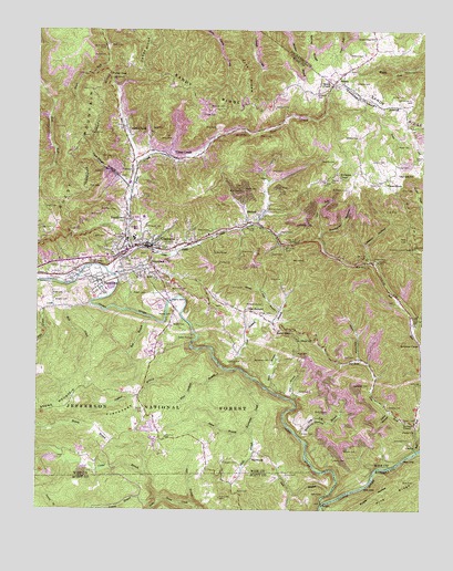
Coeburn, VA USGS Topographic Map
Click on map above to begin viewing in our Map Viewer.

This topographic map contains these locations and features:
Feature Name Type Latitude Longitude GNIS ID View Map
Adkins CemeteryCemeteryN36.9734°W82.4829°1481267View Map
Bad BranchStreamN36.9248°W82.4624°1481390View Map
Baker CemeteryCemeteryN36.8798°W82.4346°1481406View Map
BangorLocaleN36.8768°W82.4071°1481442View Map
BannerPopulated PlaceN36.9495°W82.4296°1481444View Map
Banner CemeteryCemeteryN36.9529°W82.4243°1481447View Map
Barker CemeteryCemeteryN36.9229°W82.4560°1481460View Map
Bethany ChurchChurchN36.8982°W82.3799°1481651View Map
Bond BranchStreamN36.9062°W82.4238°1481922View Map
Bond CemeteryCemeteryN36.9157°W82.4154°1481923View Map
Bond GapGapN36.9212°W82.4168°1481924View Map
BondtownPopulated PlaceN36.9507°W82.4707°1492607View Map
Bondtown CemeteryCemeteryN36.9529°W82.4740°1481925View Map
Bradley CemeteryCemeteryN36.9020°W82.3854°1481965View Map
Bruce CemeteryCemeteryN36.9382°W82.4888°1482048View Map
Buchanan CemeteryCemeteryN36.9143°W82.4238°1482097View Map
Buchanan CemeteryCemeteryN36.9326°W82.4563°1482099View Map
Buchanan HollowValleyN36.9479°W82.4079°1482104View Map
Bull Hill Lookout TowerTowerN36.9434°W82.3788°1491109View Map
Bull RunStreamN36.8904°W82.3765°1482158View Map
Bull Run ChurchChurchN36.9393°W82.3935°1482160View Map
Bull Run School (historical)SchoolN36.9387°W82.3993°1496593View Map
CarfaxPopulated PlaceN36.8907°W82.3776°1492714View Map
Carfax ChurchChurchN36.8954°W82.3765°1482321View Map
Carigo CemeteryCemeteryN36.9662°W82.3771°1482323View Map
CoeburnPopulated PlaceN36.9440°W82.4640°1482614View Map
Coeburn HeliportAirportN36.9598°W82.4702°1498638View Map
Coeburn LakeReservoirN36.9775°W82.4143°1496602View Map
Coeburn Middle SchoolSchoolN36.9510°W82.4677°2498412View Map
Coeburn Police DepartmentBuildingN36.9442°W82.4654°2766952View Map
Coeburn Police DepartmentBuildingN36.9429°W82.4692°2767086View Map
Coeburn Post OfficePost OfficeN36.9441°W82.4645°2767205View Map
Coeburn Primary SchoolSchoolN36.9483°W82.4685°2498451View Map
Coeburn Volunteer Fire DepartmentBuildingN36.9428°W82.4692°2085829View Map
Corder BranchStreamN36.8845°W82.4646°1482706View Map
Corder School (historical)SchoolN36.8909°W82.4904°1496604View Map
Crab OrchardPopulated PlaceN36.9270°W82.4321°1492814View Map
Crab Orchard BranchStreamN36.9115°W82.4357°1482783View Map
Crab Orchard School (historical)SchoolN36.9270°W82.4326°1496606View Map
Cranes NestPopulated PlaceN36.9740°W82.4724°1502783View Map
Dale Ridge HollowValleyN36.9600°W82.4710°1482900View Map
Davis CemeteryCemeteryN36.9059°W82.4146°1482936View Map
Dingus CemeteryCemeteryN36.9293°W82.4901°1483020View Map
District 4CivilN36.9271°W82.4701°1927255View Map
Dollarhide CemeteryCemeteryN36.9495°W82.4101°1483058View Map
Donahue CemeteryCemeteryN36.8873°W82.4388°1483060View Map
Dry ForkPopulated PlaceN36.9143°W82.3949°1492885View Map
Dry ForkStreamN36.8965°W82.3765°1483115View Map
Eastside High SchoolSchoolN36.9459°W82.4688°1496601View Map
Edwards CemeteryCemeteryN36.9659°W82.4029°1483245View Map
Edwards CemeteryCemeteryN36.9832°W82.4093°1483246View Map
Edwards CemeteryCemeteryN36.9865°W82.3968°1483247View Map
Fairview SchoolSchoolN36.9626°W82.3826°1483336View Map
First Baptist ChurchChurchN36.9432°W82.4607°1496611View Map
Flat BranchStreamN36.9034°W82.4165°1483434View Map
FlatwoodsWoodsN36.8993°W82.4724°1483453View Map
FlatwoodsPopulated PlaceN36.8907°W82.4288°1492943View Map
Flatwoods CampgroundLocaleN36.9123°W82.4618°1488727View Map
Flatwoods Job Corps CampLocaleN36.8918°W82.4607°1488738View Map
Fork RidgeRidgeN36.9957°W82.4349°1487045View Map
FrancoPopulated PlaceN36.9765°W82.4207°1496613View Map
Fuller GapGapN36.9887°W82.4763°1483560View Map
Gibson School (historical)SchoolN36.9820°W82.4335°1496615View Map
Grace HouseBuildingN36.9601°W82.3863°1483733View Map
Greear CemeteryCemeteryN36.8840°W82.4188°1483789View Map
Greear CemeteryCemeteryN36.8957°W82.4124°1483790View Map
Greear CemeteryCemeteryN36.9262°W82.4235°1483791View Map
Greenwood CemeteryCemeteryN36.9495°W82.4654°1483829View Map
Greenwood SchoolSchoolN36.9979°W82.3907°1483831View Map
Guest MountainSummitN36.9518°W82.4963°1493046View Map
Guest RiverStreamN36.9093°W82.4299°1483858View Map
Hall CemeteryCemeteryN36.9151°W82.3965°1483899View Map
Hall CemeteryCemeteryN36.9482°W82.4954°1483900View Map
Hall HollowValleyN36.9145°W82.3956°1483905View Map
Hamm CemeteryCemeteryN36.8982°W82.3774°1483918View Map
Hamm CemeteryCemeteryN36.9476°W82.4204°1483919View Map
Hayes CemeteryCemeteryN36.9607°W82.3888°1483983View Map
Hayes CemeteryCemeteryN36.9643°W82.3801°1483984View Map
Hayes CemeteryCemeteryN36.9701°W82.3790°1483985View Map
HeraldPopulated PlaceN36.9879°W82.4021°1493073View Map
Holbrook CemeteryCemeteryN36.9073°W82.3921°1484152View Map
Holbrook CemeteryCemeteryN36.9237°W82.3771°1484153View Map
Holbrook ChapelChurchN36.9184°W82.3754°1484154View Map
Hurricane CreekStreamN36.9093°W82.4299°1484296View Map
Ingle CemeteryCemeteryN36.8795°W82.4104°1484340View Map
Jackson CemeteryCemeteryN36.9798°W82.4221°1484386View Map
Jaybird BranchStreamN36.9168°W82.4474°1484402View Map
Kennedy CemeteryCemeteryN36.9801°W82.4438°1484550View Map
Kilgore CemeteryCemeteryN36.9482°W82.4435°1484590View Map
Kilgore CemeteryCemeteryN36.9620°W82.4035°1484591View Map
Kise CemeteryCemeteryN36.9315°W82.4943°1484619View Map
Lane HollowValleyN36.9006°W82.3853°1484656View Map
Laurel BranchStreamN36.8784°W82.4610°1484684View Map
Laurel Grove School (historical)SchoolN36.9054°W82.4151°1496625View Map
Lawson CemeteryCemeteryN36.9137°W82.4329°1484736View Map
Lawson CemeteryCemeteryN36.9404°W82.3907°1484737View Map
Lawson CemeteryCemeteryN36.9657°W82.3876°1484738View Map
Lawson CemeteryCemeteryN36.9723°W82.3957°1484739View Map
Lawson HollowValleyN36.9441°W82.3934°1484741View Map
Lick BranchStreamN36.8790°W82.4054°1484803View Map
Lick Log BranchStreamN36.8945°W82.4151°1484822View Map
LifeCare Ambulance Service CoeburnBuildingN36.9437°W82.4628°2721172View Map
Little Tom TunnelTunnelN36.9445°W82.4163°1484989View Map
Little Toms CreekStreamN36.9426°W82.4690°1484990View Map
Marshall School (historical)SchoolN36.9859°W82.4157°1496629View Map
Marty 1 HeliportAirportN36.9401°W82.4815°1498637View Map
MaytownPopulated PlaceN36.9379°W82.4621°1493263View Map
McClellan CemeteryCemeteryN36.9587°W82.3990°1485257View Map
McClellan ChapelChurchN36.9615°W82.4015°1485258View Map
McCoy CemeteryCemeteryN36.9826°W82.3851°1485276View Map
McReynolds CemeteryCemeteryN36.9282°W82.4313°1485318View Map
Meade ChapelChurchN36.9857°W82.4049°1485321View Map
Mill CreekStreamN36.9276°W82.4902°1485411View Map
Mount Olivet ChurchChurchN36.9198°W82.4151°1485617View Map
Pine (historical)Populated PlaceN36.9459°W82.4082°1496637View Map
Pine Camp CreekStreamN36.9287°W82.4824°1486207View Map
Pine Orchard BranchStreamN36.9118°W82.4385°1486219View Map
Pine RidgeRidgeN36.8823°W82.3768°1487071View Map
Possum HollowValleyN36.8950°W82.4145°1486377View Map
Powers CemeteryCemeteryN36.9312°W82.4643°1486414View Map
Ramey BranchStreamN36.8773°W82.4602°1486492View Map
Ramey CemeteryCemeteryN36.9259°W82.4563°1486495View Map
Reed CemeteryCemeteryN36.9537°W82.4976°1486552View Map
Ringley CemeteryCemeteryN36.9609°W82.4071°1486622View Map
RiverviewPopulated PlaceN36.9354°W82.4818°1493495View Map
Riverview Census Designated PlaceCensusN36.9327°W82.4845°2629844View Map
Robinette CemeteryCemeteryN36.8934°W82.3788°1486680View Map
Rose CemeteryCemeteryN36.9220°W82.4193°1486767View Map
Sandy Ridge Volunteer Fire DepartmentBuildingN36.9998°W82.3915°2086313View Map
Sandy Ridge Volunteer Rescue SquadBuildingN36.9953°W82.3905°2086314View Map
Selcer BranchStreamN36.8957°W82.4299°1486994View Map
Shade BranchStreamN36.8957°W82.4301°1487015View Map
Spruce Pine BranchStreamN36.9268°W82.4207°1487486View Map
Stallard CemeteryCemeteryN36.8904°W82.3957°1487509View Map
Stallard CemeteryCemeteryN36.9001°W82.4049°1487510View Map
Stallard CemeteryCemeteryN36.9943°W82.3943°1487511View Map
Star BranchStreamN36.8770°W82.4493°1487525View Map
Swede TunnelTunnelN36.9201°W82.4493°1487752View Map
Toms CreekPopulated PlaceN36.9668°W82.4546°1493714View Map
Toms CreekStreamN36.9365°W82.4757°1487949View Map
Toms Creek DamDamN36.9768°W82.4165°1491043View Map
Town of CoeburnCivilN36.9451°W82.4690°2390808View Map
Trail of the Lonesome PineTrailN36.9398°W82.4010°1487086View Map
Vane (historical)Populated PlaceN36.9515°W82.4324°1496652View Map
ViccoPopulated PlaceN36.9604°W82.4243°1493738View Map
Wise Correctional UnitBuildingN36.9164°W82.4625°2767197View Map
Wolfe CemeteryCemeteryN36.8882°W82.4029°1488459View Map
WZQK-FM (Coeburn)TowerN36.9457°W82.4971°1502621View Map

Note: Coordinates in the location and feature list above are referenced to NAD83 datum.


Copyright (C) 2008-2024 Ryan Niemi / Sunset Dynamics ... All Rights Reserved