TopoQuest Logo
Do you find TopoQuest useful?
Help keep TopoQuest running and adding new maps/features by donating!
Bitcoin:  19c7KJd3qBynnjoSw5npx9KScwjBe4ifkT
Litecoin:  LXs6TkuXGGXo1vDsWCkWVdjQX94eUKd6ui
Home View Maps Find Maps Find Places Resources & Links


Clinton, Arkansas Topographic Map

USGS Map Title: Clinton, AR
USGS Map MRC: 35092E4
DRG (GeoTIFF) Download: o35092e4.tif


Neighboring USGS Topographic Map Quads:


  Botkinburg, AR  
35092F5
 

  Old Lexington, AR  
35092F4
 

  Shirley, AR  
35092F3
 

  Scotland, AR  
35092E5
 

  Clinton, AR  
35092E4
 

  Fairfield Bay, AR  
35092E3
 

  Formosa, AR  
35092D5
 

  Bee Branch, AR  
35092D4
 

  Morganton, AR  
35092D3


Map MRC Location:

N36°
W93°
N36°
W92°
H8 H7 H6 H5 H4 H3 H2 H1
G8 G7 G6 G5 G4 G3 G2 G1
F8 F7 F6 F5 F4 F3 F2 F1
E8 E7 E6 E5 E4 E3 E2 E1
D8 D7 D6 D5 D4 D3 D2 D1
C8 C7 C6 C5 C4 C3 C2 C1
B8 B7 B6 B5 B4 B3 B2 B1
A8 A7 A6 A5 A4 A3 A2 A1
N35°
W93°
N35°
W92°

Clinton, AR USGS 1:24K Topographic Map Preview:
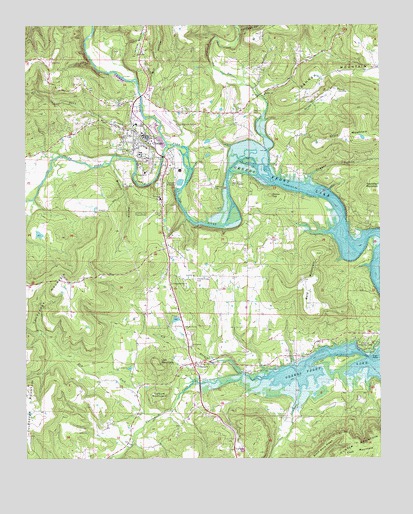
Clinton, AR USGS Topographic Map
Click on map above to begin viewing in our Map Viewer.

This topographic map contains these locations and features:
Feature Name Type Latitude Longitude GNIS ID View Map
Archey CreekStreamN35.5906°W92.4479°70390View Map
Bald MountainSummitN35.5456°W92.3999°46047View Map
Banner (historical)Populated PlaceN35.6115°W92.3896°68643View Map
Big BranchStreamN35.5242°W92.4235°46514View Map
Branch HollowValleyN35.5862°W92.4693°46914View Map
Burnt Ridge Volunteer Fire DepartmentBuildingN35.5859°W92.4110°2116206View Map
Camp KaetzellLocaleN35.5795°W92.4260°47323View Map
ChoctawPopulated PlaceN35.5276°W92.4399°57548View Map
Choctaw Church of ChristChurchN35.5281°W92.4385°68651View Map
Choctaw Fire DepartmentBuildingN35.5259°W92.4409°2116272View Map
Choctaw High School (historical)SchoolN35.5342°W92.4093°70214View Map
Choctaw LakeReservoirN35.5484°W92.4485°79628View Map
Choctaw Lake DamDamN35.5484°W92.4485°79627View Map
Choctaw Post OfficePost OfficeN35.5279°W92.4400°84430View Map
Choctaw Recreation AreaParkN35.5329°W92.3804°76609View Map
Christadelphian ChurchChurchN35.5506°W92.4488°47766View Map
City of ClintonCivilN35.5801°W92.4541°2404076View Map
ClintonPopulated PlaceN35.5915°W92.4604°47856View Map
Clinton Elementary SchoolSchoolN35.5837°W92.4598°68658View Map
Clinton High SchoolSchoolN35.5875°W92.4599°68655View Map
Clinton Intermediate SchoolSchoolN35.5591°W92.4528°2093354View Map
Clinton Junior High SchoolSchoolN35.5874°W92.4585°68657View Map
Clinton LakeReservoirN35.5916°W92.4359°79624View Map
Clinton Lake DamDamN35.5917°W92.4352°79623View Map
Clinton Municipal AirportAirportN35.5984°W92.4508°83662View Map
Clinton Police DepartmentBuildingN35.5912°W92.4569°2118836View Map
Clinton Post OfficePost OfficeN35.5651°W92.4525°2781870View Map
Clinton Volunteer Fire Department Station 1BuildingN35.5936°W92.4597°2116283View Map
Clinton Volunteer Fire Department Station 2BuildingN35.5578°W92.4582°2116284View Map
Clinton Volunteer Fire Department Station 3BuildingN35.5999°W92.4305°2116285View Map
Cove CreekStreamN35.5187°W92.4035°48105View Map
Cullum MountainSummitN35.5187°W92.4535°48252View Map
Dry Fork Choctaw CreekStreamN35.5126°W92.4532°48662View Map
Duggan HollowValleyN35.5815°W92.4002°48686View Map
Green TreePopulated PlaceN35.5167°W92.3835°68668View Map
Griggs CreekStreamN35.5984°W92.4174°46963View Map
Huie ChurchChurchN35.5529°W92.4413°50401View Map
Hunter-Hill CemeteryCemeteryN35.5520°W92.4404°50416View Map
Jim Cates HollowValleyN35.6240°W92.4243°50647View Map
Johnson CemeteryCemeteryN35.5784°W92.4340°50680View Map
KGFL-AM (Clinton)TowerN35.5584°W92.4590°85060View Map
Lick MountainSummitN35.5276°W92.4543°51156View Map
Mill HollowValleyN35.6045°W92.4593°52041View Map
Ozark Health Medical CenterHospitalN35.5592°W92.4527°68707View Map
Pee DeePopulated PlaceN35.6051°W92.4168°68686View Map
Pee Dee Baptist ChurchChurchN35.6051°W92.4160°77970View Map
Pee Dee CemeteryCemeteryN35.6001°W92.4202°53260View Map
Pee Dee CreekStreamN35.5815°W92.4132°77971View Map
Round TopSummitN35.5762°W92.4140°54251View Map
Shake Rag (historical)Populated PlaceN35.5726°W92.4896°68698View Map
South Fork Little Red RiverStreamN35.5656°W92.3752°73649View Map
Southern Paramedic Service ClintonBuildingN35.5753°W92.4540°2119148View Map
Standley MountainSummitN35.5779°W92.3774°55153View Map
Story MountainSummitN35.5917°W92.3796°55256View Map
Town BranchStreamN35.5912°W92.4510°55617View Map
Township of ChoctawCivilN35.5148°W92.4122°69764View Map
Township of CulpepperCivilN35.5423°W92.4987°69766View Map
Township of East GriggsCivilN35.5908°W92.4135°1986408View Map
Township of Griggs (historical)CivilN35.6167°W92.4571°69768View Map
Township of West GriggsCivilN35.6130°W92.4953°1986411View Map
Van Buren County CourthouseBuildingN35.5929°W92.4574°68706View Map
Van Buren County Memorial Hospital HeliportAirportN35.5759°W92.4535°83663View Map
Van Buren County Sheriff's OfficeBuildingN35.5702°W92.4495°2118753View Map
Vital Link, Incorporated - Clinton (Ambulance Services)BuildingN35.5912°W92.4569°2119147View Map

Note: Coordinates in the location and feature list above are referenced to NAD83 datum.


Copyright (C) 2008-2024 Ryan Niemi / Sunset Dynamics ... All Rights Reserved