TopoQuest Logo
Do you find TopoQuest useful?
Help keep TopoQuest running and adding new maps/features by donating!
Bitcoin:  19c7KJd3qBynnjoSw5npx9KScwjBe4ifkT
Litecoin:  LXs6TkuXGGXo1vDsWCkWVdjQX94eUKd6ui
Home View Maps Find Maps Find Places Resources & Links


Botkinburg, Arkansas Topographic Map

USGS Map Title: Botkinburg, AR
USGS Map MRC: 35092F5
DRG (GeoTIFF) Download: o35092f5.tif


Neighboring USGS Topographic Map Quads:


  Canaan, AR  
35092G6
 

  Leslie, AR  
35092G5
 

  Oxley, AR  
35092G4
 

  Alread, AR  
35092F6
 

  Botkinburg, AR  
35092F5
 

  Old Lexington, AR  
35092F4
 

  Rex, AR  
35092E6
 

  Scotland, AR  
35092E5
 

  Clinton, AR  
35092E4


Map MRC Location:

N36°
W93°
N36°
W92°
H8 H7 H6 H5 H4 H3 H2 H1
G8 G7 G6 G5 G4 G3 G2 G1
F8 F7 F6 F5 F4 F3 F2 F1
E8 E7 E6 E5 E4 E3 E2 E1
D8 D7 D6 D5 D4 D3 D2 D1
C8 C7 C6 C5 C4 C3 C2 C1
B8 B7 B6 B5 B4 B3 B2 B1
A8 A7 A6 A5 A4 A3 A2 A1
N35°
W93°
N35°
W92°

Botkinburg, AR USGS 1:24K Topographic Map Preview:
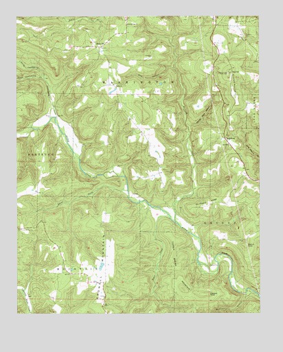
Botkinburg, AR USGS Topographic Map
Click on map above to begin viewing in our Map Viewer.

This topographic map contains these locations and features:
Feature Name Type Latitude Longitude GNIS ID View Map
Akins CreekStreamN35.6770°W92.5677°76155View Map
Alread - Community Volunteer Fire Department Station 2BuildingN35.6416°W92.5890°2116078View Map
Archey (historical)Populated PlaceN35.6484°W92.5260°68641View Map
Arnhart CemeteryCemeteryN35.6998°W92.6229°45929View Map
Bluffton CemeteryCemeteryN35.6449°W92.5249°46779View Map
BotkinburgPopulated PlaceN35.6990°W92.5171°57414View Map
Boyce CreekStreamN35.6654°W92.5460°46865View Map
Castleberry CreekStreamN35.7062°W92.6049°47518View Map
Chinkapin RidgeRidgeN35.6720°W92.5265°47751View Map
Copper Spring MountainSummitN35.6356°W92.5396°57583View Map
Coppers KnobSummitN35.6331°W92.5285°57584View Map
Crabtree ChurchChurchN35.6326°W92.5793°48132View Map
Dennard Census Designated PlaceCensusN35.7498°W92.5394°2612125View Map
Evening Shade ChurchChurchN35.7470°W92.5668°48938View Map
George Main HollowValleyN35.7034°W92.5354°49374View Map
Hartsugg CreekStreamN35.6626°W92.5415°49926View Map
Hurricane BranchStreamN35.6326°W92.5007°50433View Map
Jackson LakeReservoirN35.6451°W92.5802°79872View Map
Jackson Lake DamDamN35.6451°W92.5802°79871View Map
KHPQ-FM (Clinton)TowerN35.6790°W92.5085°85165View Map
Lunceford CemeteryCemeteryN35.7330°W92.5555°51513View Map
North Castleberry CreekStreamN35.7234°W92.6102°52810View Map
Red HillSummitN35.7265°W92.5160°53946View Map
Red Hill ChurchChurchN35.6962°W92.5157°53949View Map
Rocky HillPopulated PlaceN35.7373°W92.5818°68692View Map
Rocky HillSummitN35.7376°W92.5813°54138View Map
Salem CemeteryCemeteryN35.7212°W92.5738°68693View Map
Salem Missionary Baptist ChurchChurchN35.7209°W92.5732°78281View Map
South Castleberry CreekStreamN35.7234°W92.6107°55014View Map
Township of Cleveland (historical)CivilN35.6959°W92.5502°68654View Map
Township of MountainCivilN35.6484°W92.6089°69774View Map
Township of WashingtonCivilN35.7335°W92.5563°69777View Map
Walnut KnobSummitN35.6540°W92.5074°58822View Map
Woolum CemeteryCemeteryN35.7084°W92.6068°56544View Map
Zack HollowValleyN35.7284°W92.5438°56621View Map

Note: Coordinates in the location and feature list above are referenced to NAD83 datum.


Copyright (C) 2008-2024 Ryan Niemi / Sunset Dynamics ... All Rights Reserved