TopoQuest Logo
Do you find TopoQuest useful?
Help keep TopoQuest running and adding new maps/features by donating!
Bitcoin:  19c7KJd3qBynnjoSw5npx9KScwjBe4ifkT
Litecoin:  LXs6TkuXGGXo1vDsWCkWVdjQX94eUKd6ui
Home View Maps Find Maps Find Places Resources & Links


Cedarville, Missouri Topographic Map

USGS Map Title: Cedarville, MO
USGS Map MRC: 37093E8
DRG (GeoTIFF) Download: o37093e8.tif


Neighboring USGS Topographic Map Quads:


  Montevallo, MO  
37094F1
 

  Wagoner, MO  
37093F8
 

  Stockton, MO  
37093F7
 

  Jerico Springs, MO  
37094E1
 

  Cedarville, MO  
37093E8
 

  Crisp, MO  
37093E7
 

  Golden City, MO  
37094D1
 

  Lockwood, MO  
37093D8
 

  Greenfield, MO  
37093D7


Map MRC Location:

N38°
W94°
N38°
W93°
H8 H7 H6 H5 H4 H3 H2 H1
G8 G7 G6 G5 G4 G3 G2 G1
F8 F7 F6 F5 F4 F3 F2 F1
E8 E7 E6 E5 E4 E3 E2 E1
D8 D7 D6 D5 D4 D3 D2 D1
C8 C7 C6 C5 C4 C3 C2 C1
B8 B7 B6 B5 B4 B3 B2 B1
A8 A7 A6 A5 A4 A3 A2 A1
N37°
W94°
N37°
W93°

Cedarville, MO USGS 1:24K Topographic Map Preview:
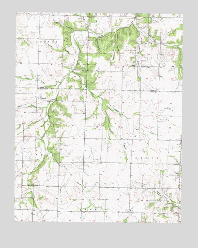
Cedarville, MO USGS Topographic Map
Click on map above to begin viewing in our Map Viewer.

This topographic map contains these locations and features:
Feature Name Type Latitude Longitude GNIS ID View Map
Amos CemeteryCemeteryN37.5223°W93.9880°713268View Map
ArcolaPopulated PlaceN37.5492°W93.8752°729837View Map
Arcola Fire DepartmentBuildingN37.5488°W93.8788°2621687View Map
Boggy Springs School (historical)SchoolN37.5064°W93.9099°746257View Map
Boston BranchStreamN37.6003°W93.9535°714547View Map
Brown FordLocaleN37.6131°W93.9463°714775View Map
Carlo HollowValleyN37.6150°W93.9260°715400View Map
Cedar Hall School (historical)SchoolN37.6106°W93.9697°746238View Map
CedarvillePopulated PlaceN37.5745°W93.9844°758424View Map
Cedarville CemeteryCemeteryN37.5667°W93.9797°2711407View Map
Cedarville School (historical)SchoolN37.5698°W93.9838°746259View Map
Central School (historical)SchoolN37.5284°W93.9663°746258View Map
Conner BranchStreamN37.6195°W93.9130°716199View Map
Flowing Springs School (historical)SchoolN37.6237°W93.9288°746239View Map
Ford BranchStreamN37.6137°W93.9472°718064View Map
Goose CreekStreamN37.5903°W93.9588°718583View Map
Hickory Grove CemeteryCemeteryN37.5286°W93.8783°719454View Map
Horse Creek Post OfficePost OfficeN37.5745°W93.9844°765602View Map
Keller BranchStreamN37.5434°W93.9777°720494View Map
Marshall BranchStreamN37.5714°W93.9344°721901View Map
Maybee BranchStreamN37.5681°W93.9769°722001View Map
Mount Olive School (historical)SchoolN37.6225°W93.8860°746240View Map
Noffsinger BridgeBridgeN37.6223°W93.9116°755345View Map
Noffsinger CemeteryCemeteryN37.6228°W93.8960°723399View Map
OmerLocaleN37.5934°W93.9105°729940View Map
Omer BranchStreamN37.6134°W93.9072°723818View Map
Omer CemeteryCemeteryN37.5967°W93.9063°723819View Map
Omer School (historical)SchoolN37.5939°W93.9102°746241View Map
Pyle BranchStreamN37.5828°W93.9663°725014View Map
Spring HollowValleyN37.6139°W93.9566°726941View Map
Township of NorthCivilN37.5355°W93.8864°766555View Map
Village of ArcolaCivilN37.5493°W93.8760°2397980View Map
Whitley HollowValleyN37.6112°W93.9397°728796View Map

Note: Coordinates in the location and feature list above are referenced to NAD83 datum.


Copyright (C) 2008-2024 Ryan Niemi / Sunset Dynamics ... All Rights Reserved