TopoQuest Logo
Do you find TopoQuest useful?
Help keep TopoQuest running and adding new maps/features by donating!
Bitcoin:  19c7KJd3qBynnjoSw5npx9KScwjBe4ifkT
Litecoin:  LXs6TkuXGGXo1vDsWCkWVdjQX94eUKd6ui
Home View Maps Find Maps Find Places Resources & Links


Waterloo, Oregon Topographic Map

USGS Map Title: Waterloo, OR
USGS Map MRC: 44122D7
DRG (GeoTIFF) Download: o44122d7.tif


Neighboring USGS Topographic Map Quads:


  Lebanon, OR  
44122E8
 

  Onehorse Slough, OR  
44122E7
 

  Lacomb, OR  
44122E6
 

  Brownsville, OR  
44122D8
 

  Waterloo, OR  
44122D7
 

  Sweet Home, OR  
44122D6
 

  Union Point, OR  
44122C8
 

  Crawfordsville, OR  
44122C7
 

  Chandler Mountain, OR  
44122C6


Map MRC Location:

N45°
W123°
N45°
W122°
H8 H7 H6 H5 H4 H3 H2 H1
G8 G7 G6 G5 G4 G3 G2 G1
F8 F7 F6 F5 F4 F3 F2 F1
E8 E7 E6 E5 E4 E3 E2 E1
D8 D7 D6 D5 D4 D3 D2 D1
C8 C7 C6 C5 C4 C3 C2 C1
B8 B7 B6 B5 B4 B3 B2 B1
A8 A7 A6 A5 A4 A3 A2 A1
N44°
W123°
N44°
W122°

Waterloo, OR USGS 1:24K Topographic Map Preview:
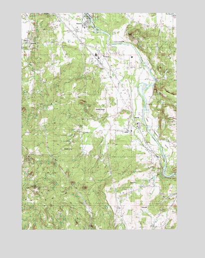
Waterloo, OR USGS Topographic Map
Click on map above to begin viewing in our Map Viewer.

This topographic map contains these locations and features:
Feature Name Type Latitude Longitude GNIS ID View Map
Antique Apple OrchardLocaleN44.4147°W122.7633°2663937View Map
Bauman Lumber CompanyLocaleN44.4757°W122.8187°1637800View Map
Benjo Milling Company (historical)LocaleN44.4340°W122.7829°1637806View Map
Berlin Union ChurchChurchN44.4918°W122.7573°1117549View Map
Beulahland School (historical)SchoolN44.4329°W122.7676°1117570View Map
Bigbee CreekStreamN44.4582°W122.7706°1130635View Map
Binegar ButteSummitN44.4868°W122.7840°1138130View Map
Boise Cascade PlywoodLocaleN44.4176°W122.7684°1637827View Map
City of SodavilleCivilN44.4830°W122.8691°2411922View Map
Durlam ReservoirReservoirN44.4792°W122.8744°1130628View Map
FairviewPopulated PlaceN44.4748°W122.8220°1130641View Map
Fairview School (historical)SchoolN44.4751°W122.8106°1120579View Map
G and G Lumber Company (historical)LocaleN44.4671°W122.8054°1637803View Map
Gabriel CreekStreamN44.4235°W122.7651°1130633View Map
Gas Heat (historical)LocaleN44.4687°W122.8101°1637802View Map
Grass Ridge Post Office (historical)Post OfficeN44.4240°W122.8006°1164387View Map
GreenvillePopulated PlaceN44.3868°W122.7795°1136344View Map
Hills PondReservoirN44.4346°W122.8269°1130637View Map
J H Baxter Company (historical)LocaleN44.4310°W122.7801°1637807View Map
Kell Lumber Company (historical)LocaleN44.4421°W122.7865°1637805View Map
Kenshaws-Bauman Sales Incorporated (historical)LocaleN44.4779°W122.8220°1637799View Map
Klum CemeteryCemeteryN44.4803°W122.8416°1122806View Map
Lebanon Fire District Station 33BuildingN44.4805°W122.8212°2576960View Map
LibertyPopulated PlaceN44.4332°W122.7915°1130636View Map
Liberty CemeteryCemeteryN44.4137°W122.7728°1123067View Map
Liberty School (historical)SchoolN44.4319°W122.7875°1123069View Map
Linn Memorial CemeteryCemeteryN44.4671°W122.8109°1160862View Map
Little CreekStreamN44.4235°W122.7804°1130634View Map
Lower Pleasant ValleyValleyN44.4579°W122.7740°1123581View Map
M B Christianson (historical)LocaleN44.4712°W122.8129°1637801View Map
McDowell CreekStreamN44.4607°W122.7679°1123945View Map
Mid Plywood Incorporated (historical)LocaleN44.4160°W122.7668°1637808View Map
Mountain HomeLocaleN44.4212°W122.8440°1124421View Map
NarrowsLocaleN44.4390°W122.7862°1136562View Map
Noble CreekStreamN44.4818°W122.8068°1130638View Map
Nye (historical)LocaleN44.4679°W122.7956°1130639View Map
Rickmans PondReservoirN44.4389°W122.7683°1130632View Map
Roaring CreekStreamN44.4082°W122.7623°1130631View Map
Sand Ridge Charter SchoolSchoolN44.4802°W122.8699°2466069View Map
Santiam Post Office (historical)Post OfficeN44.4423°W122.7779°1164663View Map
Santiam TerracePopulated PlaceN44.4429°W122.8112°1136730View Map
Scott MountainSummitN44.3987°W122.8640°1117188View Map
Soda Springs Post Office (historical)Post OfficeN44.4704°W122.8706°1164693View Map
SodavillePopulated PlaceN44.4846°W122.8718°1136764View Map
Sodaville City HallBuildingN44.4833°W122.8697°2699826View Map
Sodaville Mineral SpringsSpringN44.4846°W122.8679°1162201View Map
Sodaville Post Office (historical)Post OfficeN44.4846°W122.8718°1165963View Map
Sodaville Springs ParkParkN44.4846°W122.8706°1130640View Map
Timber Owners Incorporated (historical)LocaleN44.4457°W122.7873°1637804View Map
Town of WaterlooCivilN44.4947°W122.8243°2413454View Map
WaterlooPopulated PlaceN44.4940°W122.8254°1136880View Map
Waterloo City HallBuildingN44.4968°W122.8225°2699933View Map
Waterloo County ParkParkN44.4915°W122.8206°1162199View Map
Waterloo County Park Claude Cox Addition Lower Boat RampLocaleN44.4977°W122.8219°2699934View Map
Waterloo County Park Upper Boat RampLocaleN44.4940°W122.8207°2699935View Map
Waterloo Post Office (historical)Post OfficeN44.4940°W122.8254°1166133View Map
Waterville School (historical)SchoolN44.4860°W122.8234°1162200View Map

Note: Coordinates in the location and feature list above are referenced to NAD83 datum.


Copyright (C) 2008-2024 Ryan Niemi / Sunset Dynamics ... All Rights Reserved