TopoQuest Logo
Do you find TopoQuest useful?
Help keep TopoQuest running and adding new maps/features by donating!
Bitcoin:  19c7KJd3qBynnjoSw5npx9KScwjBe4ifkT
Litecoin:  LXs6TkuXGGXo1vDsWCkWVdjQX94eUKd6ui
Home View Maps Find Maps Find Places Resources & Links


McKinley, Wisconsin Topographic Map

USGS Map Title: McKinley, WI
USGS Map MRC: 45092E2
DRG (GeoTIFF) Download: o45092e2.tif


Neighboring USGS Topographic Map Quads:


  Clam Falls, WI  
45092F3
 

  Indian Creek, WI  
45092F2
 

  Timberland, WI  
45092F1
 

  Big Round Lake, WI  
45092E3
 

  McKinley, WI  
45092E2
 

  Cumberland, WI  
45092E1
 

  Range, WI  
45092D3
 

  Turtle Lake, WI  
45092D2
 

  Almena, WI  
45092D1


Map MRC Location:

N46°
W93°
N46°
W92°
H8 H7 H6 H5 H4 H3 H2 H1
G8 G7 G6 G5 G4 G3 G2 G1
F8 F7 F6 F5 F4 F3 F2 F1
E8 E7 E6 E5 E4 E3 E2 E1
D8 D7 D6 D5 D4 D3 D2 D1
C8 C7 C6 C5 C4 C3 C2 C1
B8 B7 B6 B5 B4 B3 B2 B1
A8 A7 A6 A5 A4 A3 A2 A1
N45°
W93°
N45°
W92°

McKinley, WI USGS 1:24K Topographic Map Preview:
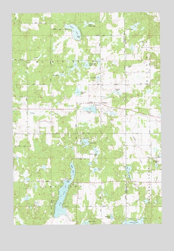
McKinley, WI USGS Topographic Map
Click on map above to begin viewing in our Map Viewer.

This topographic map contains these locations and features:
Feature Name Type Latitude Longitude GNIS ID View Map
Bergman SchoolSchoolN45.5888°W92.1363°1561597View Map
Black Bear LakeLakeN45.5961°W92.1771°1569961View Map
Blueberry LakeLakeN45.5343°W92.1294°1581546View Map
Deer LakeLakeN45.5862°W92.1777°1563841View Map
Ember LakeLakeN45.5886°W92.2083°1564609View Map
Emerson SchoolSchoolN45.5616°W92.1360°1564619View Map
Grenquist LakeLakeN45.5680°W92.1843°1565850View Map
Grenquist ParkParkN45.5702°W92.1813°1831815View Map
Grouse LakeLakeN45.5939°W92.1975°1565921View Map
Highland LakeLakeN45.5040°W92.1673°1566394View Map
Johnson LakeLakeN45.5783°W92.1952°1567234View Map
Kelleys LakeLakeN45.6158°W92.1475°1567381View Map
Lake of the WoodsLakeN45.5314°W92.1527°1561247View Map
Largon LakeLakeN45.6141°W92.1974°1567846View Map
Largon SchoolSchoolN45.6144°W92.1782°1567847View Map
Little Largon LakeLakeN45.6184°W92.1855°1568304View Map
Martel LakeLakeN45.5484°W92.1894°1569088View Map
McKinleyPopulated PlaceN45.5713°W92.1766°1568637View Map
McKinley SchoolSchoolN45.5716°W92.1874°1569257View Map
McKinley TownhallBuildingN45.5722°W92.1866°1831828View Map
Miller Camp LakeLakeN45.5426°W92.1797°1569507View Map
Mort's LandingAirportN45.5051°W92.1432°1581926View Map
Mud LakeLakeN45.5320°W92.1812°1569958View Map
North Pipe LakeLakeN45.5316°W92.2001°1570480View Map
Pipe LakeLakeN45.5151°W92.2093°1571552View Map
Pipe Lake SchoolSchoolN45.5005°W92.1980°1571553View Map
Round LakeLakeN45.5009°W92.1889°1572674View Map
Snowshoe LakeLakeN45.5776°W92.1619°1574352View Map
Staples CreekStreamN45.5775°W92.1366°1574797View Map
Town of JohnstownCivilN45.5108°W92.2198°1583457View Map
Town of McKinleyCivilN45.5968°W92.2193°1583621View Map
Wintergreen LakeLakeN45.5944°W92.1879°1576891View Map
Woodside SchoolSchoolN45.5244°W92.1346°1577035View Map

Note: Coordinates in the location and feature list above are referenced to NAD83 datum.


Copyright (C) 2008-2024 Ryan Niemi / Sunset Dynamics ... All Rights Reserved