TopoQuest Logo
Do you find TopoQuest useful?
Help keep TopoQuest running and adding new maps/features by donating!
Bitcoin:  19c7KJd3qBynnjoSw5npx9KScwjBe4ifkT
Litecoin:  LXs6TkuXGGXo1vDsWCkWVdjQX94eUKd6ui
Home View Maps Find Maps Find Places Resources & Links


Timberland, Wisconsin Topographic Map

USGS Map Title: Timberland, WI
USGS Map MRC: 45092F1
DRG (GeoTIFF) Download: o45092f1.tif


Neighboring USGS Topographic Map Quads:


  Hertel, WI  
45092G2
 

  Poquettes Lake, WI  
45092G1
 

  Spooner, WI  
45091G8
 

  Indian Creek, WI  
45092F2
 

  Timberland, WI  
45092F1
 

  Shell Lake, WI  
45091F8
 

  McKinley, WI  
45092E2
 

  Cumberland, WI  
45092E1
 

  Lower Vermillion Lake, WI  
45091E8


Map MRC Location:

N46°
W93°
N46°
W92°
H8 H7 H6 H5 H4 H3 H2 H1
G8 G7 G6 G5 G4 G3 G2 G1
F8 F7 F6 F5 F4 F3 F2 F1
E8 E7 E6 E5 E4 E3 E2 E1
D8 D7 D6 D5 D4 D3 D2 D1
C8 C7 C6 C5 C4 C3 C2 C1
B8 B7 B6 B5 B4 B3 B2 B1
A8 A7 A6 A5 A4 A3 A2 A1
N45°
W93°
N45°
W92°

Timberland, WI USGS 1:24K Topographic Map Preview:
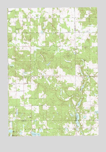
Timberland, WI USGS Topographic Map
Click on map above to begin viewing in our Map Viewer.

This topographic map contains these locations and features:
Feature Name Type Latitude Longitude GNIS ID View Map
Buck LakeLakeN45.6951°W92.0686°1562326View Map
Chain LakeLakeN45.6478°W92.0016°1562928View Map
Church of GodChurchN45.7258°W92.0513°1843104View Map
Clam River CemeteryCemeteryN45.7258°W92.0268°1563106View Map
Clam River State Fishery AreaParkN45.7052°W92.0777°1843105View Map
Horseshoe LakeLakeN45.6261°W92.0871°1566747View Map
Kinny LakeLakeN45.6824°W92.0140°1567526View Map
Lake Thirty TwoLakeN45.6480°W92.1128°1575422View Map
Leach LakeLakeN45.6722°W92.0215°1567909View Map
Offers LakeLakeN45.6564°W92.0265°1570754View Map
Peacock LakeLakeN45.6941°W92.1195°1571119View Map
Places LakeLakeN45.6867°W92.1009°1571571View Map
Roosevelt SchoolSchoolN45.6758°W92.1199°1572587View Map
Roosevelt TownhallBuildingN45.6758°W92.1171°1843168View Map
Severson LakeLakeN45.6982°W92.0211°1573930View Map
Shallow LakeLakeN45.6406°W92.0291°1573950View Map
South Dewey Community ChurchChurchN45.7258°W92.0416°1843187View Map
South Dewey SchoolSchoolN45.7258°W92.0535°1581572View Map
South Fork Clam RiverStreamN45.7108°W92.0857°1574443View Map
Spring LakeLakeN45.7052°W92.0324°1843192View Map
TimberlandPopulated PlaceN45.6761°W92.1060°1577853View Map
Timberland ChurchChurchN45.6694°W92.1066°1575463View Map
Town of RooseveltCivilN45.6828°W92.0933°1584061View Map
Upper Waterman LakeLakeN45.6300°W92.1224°1576001View Map

Note: Coordinates in the location and feature list above are referenced to NAD83 datum.


Copyright (C) 2008-2024 Ryan Niemi / Sunset Dynamics ... All Rights Reserved