TopoQuest Logo
Do you find TopoQuest useful?
Help keep TopoQuest running and adding new maps/features by donating!
Bitcoin:  19c7KJd3qBynnjoSw5npx9KScwjBe4ifkT
Litecoin:  LXs6TkuXGGXo1vDsWCkWVdjQX94eUKd6ui
Home View Maps Find Maps Find Places Resources & Links


Range, Wisconsin Topographic Map

USGS Map Title: Range, WI
USGS Map MRC: 45092D3
DRG (GeoTIFF) Download: o45092d3.tif


Neighboring USGS Topographic Map Quads:


  Luck, WI  
45092E4
 

  Big Round Lake, WI  
45092E3
 

  McKinley, WI  
45092E2
 

  Balsam Lake, WI  
45092D4
 

  Range, WI  
45092D3
 

  Turtle Lake, WI  
45092D2
 

  Wapogasset Lake, WI  
45092C4
 

  Amery, WI  
45092C3
 

  Clayton, WI  
45092C2


Map MRC Location:

N46°
W93°
N46°
W92°
H8 H7 H6 H5 H4 H3 H2 H1
G8 G7 G6 G5 G4 G3 G2 G1
F8 F7 F6 F5 F4 F3 F2 F1
E8 E7 E6 E5 E4 E3 E2 E1
D8 D7 D6 D5 D4 D3 D2 D1
C8 C7 C6 C5 C4 C3 C2 C1
B8 B7 B6 B5 B4 B3 B2 B1
A8 A7 A6 A5 A4 A3 A2 A1
N45°
W93°
N45°
W92°

Range, WI USGS 1:24K Topographic Map Preview:
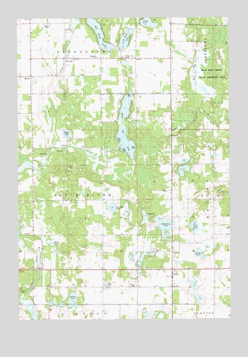
Range, WI USGS Topographic Map
Click on map above to begin viewing in our Map Viewer.

This topographic map contains these locations and features:
Feature Name Type Latitude Longitude GNIS ID View Map
Apple River TownhallBuildingN45.3883°W92.3241°1831791View Map
Apple River Township Fire DepartmentBuildingN45.3953°W92.2865°2696799View Map
Apple River Valley School (historical)SchoolN45.3891°W92.3619°1831792View Map
Beautiful LakeLakeN45.4213°W92.3194°1561417View Map
Big Blake LakeLakeN45.4965°W92.3296°1561687View Map
Blake School (historical)SchoolN45.4827°W92.3057°1831799View Map
BunyanPopulated PlaceN45.4761°W92.3671°1577533View Map
Camp LakeLakeN45.4176°W92.3004°1562623View Map
Chelstrom LakeLakeN45.4132°W92.2713°1562972View Map
Clara LakeLakeN45.4978°W92.2977°1563109View Map
Deedon LakeLakeN45.4018°W92.2681°1563806View Map
Deedon Lake Natural OrchardLocaleN45.4053°W92.2722°2611789View Map
Elim CemeteryCemeteryN45.3886°W92.2852°1564509View Map
Elim ChurchChurchN45.3927°W92.2852°1564510View Map
Fox CreekPopulated PlaceN45.4836°W92.3455°1577604View Map
Fox CreekStreamN45.4466°W92.3544°1565206View Map
Georgetown CemeteryCemeteryN45.4836°W92.3283°1565471View Map
Georgetown ChurchChurchN45.4838°W92.3419°1565472View Map
Georgetown TownhallBuildingN45.4827°W92.3057°1831813View Map
Gibson LakeLakeN45.3839°W92.3436°1565509View Map
Happy Hollow School (historical)SchoolN45.4486°W92.2849°1831817View Map
Holy Rosary ChurchChurchN45.4836°W92.3110°1566623View Map
Little Blake LakeLakeN45.4911°W92.3111°1568203View Map
Markee CreekStreamN45.3822°W92.3735°1569049View Map
RangePopulated PlaceN45.3955°W92.2846°1572071View Map
Rice Bed CreekStreamN45.4627°W92.2702°1572243View Map
Rice Bed Creek State Wildlife AreaParkN45.4766°W92.2605°1572244View Map
Ridler DamDamN45.3966°W92.3635°1791992View Map
Saint Marys CemeteryCemeteryN45.3886°W92.3063°1573304View Map
Saint Marys ChurchChurchN45.3886°W92.3055°1831844View Map
School Number 1 (historical)SchoolN45.4086°W92.2605°1831846View Map
Shiloh Flowage 151ReservoirN45.3966°W92.3635°1791993View Map
Shiloh LakeLakeN45.4059°W92.3557°1574047View Map
Square LakeLakeN45.4523°W92.3463°1574749View Map
Town of Apple RiverCivilN45.4249°W92.3459°1582702View Map
Townline LakeLakeN45.4135°W92.2891°1575548View Map
Twin LakesLakeN45.3993°W92.3030°1575800View Map
White Ash LakeLakeN45.4481°W92.3112°1576622View Map

Note: Coordinates in the location and feature list above are referenced to NAD83 datum.


Copyright (C) 2008-2024 Ryan Niemi / Sunset Dynamics ... All Rights Reserved