TopoQuest Logo
Do you find TopoQuest useful?
Help keep TopoQuest running and adding new maps/features by donating!
Bitcoin:  19c7KJd3qBynnjoSw5npx9KScwjBe4ifkT
Litecoin:  LXs6TkuXGGXo1vDsWCkWVdjQX94eUKd6ui
Home View Maps Find Maps Find Places Resources & Links


Wapogasset Lake, Wisconsin Topographic Map

USGS Map Title: Wapogasset Lake, WI
USGS Map MRC: 45092C4
DRG (GeoTIFF) Download: o45092c4.tif


Neighboring USGS Topographic Map Quads:


  Centuria, WI  
45092D5
 

  Balsam Lake, WI  
45092D4
 

  Range, WI  
45092D3
 

  Nye, WI  
45092C5
 

  Wapogasset Lake, WI  
45092C4
 

  Amery, WI  
45092C3
 

  New Richmond North, WI  
45092B5
 

  Deer Park, WI  
45092B4
 

  Forest, WI  
45092B3


Map MRC Location:

N46°
W93°
N46°
W92°
H8 H7 H6 H5 H4 H3 H2 H1
G8 G7 G6 G5 G4 G3 G2 G1
F8 F7 F6 F5 F4 F3 F2 F1
E8 E7 E6 E5 E4 E3 E2 E1
D8 D7 D6 D5 D4 D3 D2 D1
C8 C7 C6 C5 C4 C3 C2 C1
B8 B7 B6 B5 B4 B3 B2 B1
A8 A7 A6 A5 A4 A3 A2 A1
N45°
W93°
N45°
W92°

Wapogasset Lake, WI USGS 1:24K Topographic Map Preview:
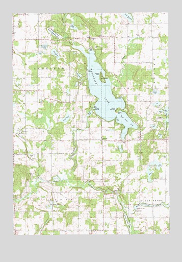
Wapogasset Lake, WI USGS Topographic Map
Click on map above to begin viewing in our Map Viewer.

This topographic map contains these locations and features:
Feature Name Type Latitude Longitude GNIS ID View Map
Amery Airport (historical)AirportN45.3550°W92.3905°1831790View Map
Balsam BranchStreamN45.3550°W92.4474°1561136View Map
Balsam Branch State Wildlife AreaParkN45.3622°W92.4663°1561137View Map
Basswood LakeLakeN45.3564°W92.4745°1561296View Map
Bear Lake School (historical)SchoolN45.3675°W92.4996°1831793View Map
Bear Trap LakeLakeN45.3128°W92.4102°1561397View Map
Big Horseshoe LakeLakeN45.3232°W92.4991°1831797View Map
Black Brook County ParkParkN45.2633°W92.4027°1561844View Map
Black Brook FlowageReservoirN45.2666°W92.3952°1561845View Map
Black Brook WP-66 DamDamN45.2641°W92.4030°1791756View Map
Camp IcaghowanLocaleN45.3369°W92.4283°1562616View Map
DerondaPopulated PlaceN45.3036°W92.4283°1563913View Map
Dresser - Osceola - Garfield Fire Association Garfield StationBuildingN45.3081°W92.4948°2696748View Map
Friday CreekStreamN45.3358°W92.4210°1565324View Map
Goose LakeLakeN45.3155°W92.4576°1565655View Map
Hickory PointCapeN45.3177°W92.4160°1566361View Map
High Bridge School (historical)SchoolN45.2814°W92.4699°1831818View Map
Joe LakeLakeN45.3396°W92.4470°1567191View Map
King LakeLakeN45.2892°W92.3852°1567499View Map
Kinney LakeLakeN45.2983°W92.4140°1567519View Map
Lake KenabeeLakeN45.3726°W92.4073°1567402View Map
Lincoln CemeteryCemeteryN45.3468°W92.3886°1568070View Map
Little FallsPopulated PlaceN45.2739°W92.4188°1568259View Map
Lutheran Bible CampLocaleN45.3200°W92.4171°1568815View Map
Mud LakeLakeN45.3181°W92.4386°1569949View Map
Mustard Seed Faith AcademySchoolN45.3024°W92.3945°2713253View Map
Oak Grove School (historical)SchoolN45.3394°W92.4552°1831832View Map
Ox LakeLakeN45.3673°W92.4514°1570972View Map
Park LakeLakeN45.3300°W92.3856°1571041View Map
Parker CreekStreamN45.2683°W92.4141°1571048View Map
Parker Creek State Public Fishing AreaParkN45.2575°W92.4085°1571049View Map
Peabody CreekStreamN45.2805°W92.4819°1571108View Map
Pine LakeLakeN45.3520°W92.4658°1571492View Map
Pleasant View School (historical)SchoolN45.2630°W92.3891°1831838View Map
Polk County HomeBuildingN45.3694°W92.4035°1831840View Map
Smith LakeLakeN45.2667°W92.4701°1574302View Map
Sucker Lake School (historical)SchoolN45.3619°W92.4288°1831851View Map
Summerfield LakeLakeN45.3235°W92.3847°1575052View Map
Town of GarfieldCivilN45.3388°W92.4896°1583258View Map
Travelers Rest CemeteryCemeteryN45.3608°W92.3877°1581574View Map
Trident LakeLakeN45.2839°W92.3911°1577409View Map
Trinity ChurchChurchN45.3314°W92.4860°1575633View Map
Volga School (historical)SchoolN45.3613°W92.3877°1831855View Map
Wallace IslandIslandN45.3389°W92.4277°1576165View Map
WanderoosPopulated PlaceN45.3086°W92.4944°1576192View Map
Wapogasset BranchStreamN45.2814°W92.4594°1576200View Map
Wapogasset LakeReservoirN45.3316°W92.4288°1576201View Map
Youngs Landing Strip (historical)AirportN45.3150°W92.3821°1831860View Map

Note: Coordinates in the location and feature list above are referenced to NAD83 datum.


Copyright (C) 2008-2024 Ryan Niemi / Sunset Dynamics ... All Rights Reserved