TopoQuest Logo
Do you find TopoQuest useful?
Help keep TopoQuest running and adding new maps/features by donating!
Bitcoin:  19c7KJd3qBynnjoSw5npx9KScwjBe4ifkT
Litecoin:  LXs6TkuXGGXo1vDsWCkWVdjQX94eUKd6ui
Home View Maps Find Maps Find Places Resources & Links


Burton, Texas Topographic Map

USGS Map Title: Burton, TX
USGS Map MRC: 30096B5
DRG (GeoTIFF) Download: o30096b5.tif


Neighboring USGS Topographic Map Quads:


  Flag Pond, TX  
30096C6
 

  Somerville, TX  
30096C5
 

  Gay Hill, TX  
30096C4
 

  Carmine, TX  
30096B6
 

  Burton, TX  
30096B5
 

  Brenham, TX  
30096B4
 

  Round Top, TX  
30096A6
 

  Greenvine, TX  
30096A5
 

  Welcome, TX  
30096A4


Map MRC Location:

N31°
W97°
N31°
W96°
H8 H7 H6 H5 H4 H3 H2 H1
G8 G7 G6 G5 G4 G3 G2 G1
F8 F7 F6 F5 F4 F3 F2 F1
E8 E7 E6 E5 E4 E3 E2 E1
D8 D7 D6 D5 D4 D3 D2 D1
C8 C7 C6 C5 C4 C3 C2 C1
B8 B7 B6 B5 B4 B3 B2 B1
A8 A7 A6 A5 A4 A3 A2 A1
N30°
W97°
N30°
W96°

Burton, TX USGS 1:24K Topographic Map Preview:
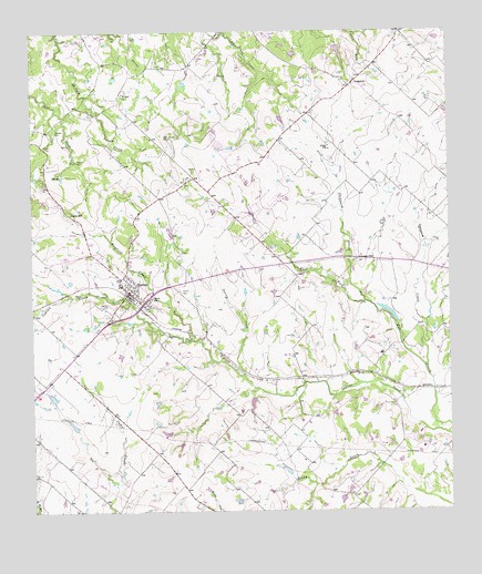
Burton, TX USGS Topographic Map
Click on map above to begin viewing in our Map Viewer.

This topographic map contains these locations and features:
Feature Name Type Latitude Longitude GNIS ID View Map
Artesian ParkLocaleN30.1905°W96.5266°1329780View Map
Bethany CemeteryCemeteryN30.2242°W96.6176°1330470View Map
Broesche CemeteryCemeteryN30.2166°W96.6108°1331298View Map
BurtonPopulated PlaceN30.1822°W96.5955°1331727View Map
Burton CemeteryCemeteryN30.1827°W96.5800°1331728View Map
Burton Commercial Historic DistrictLocaleN30.1835°W96.5961°2031985View Map
Burton DivisionCivilN30.1771°W96.6100°1938585View Map
Burton Farmers GinLocaleN30.1780°W96.5941°2032187View Map
Burton Fire DeptBuildingN30.1830°W96.5952°2552348View Map
Burton High SchoolSchoolN30.1841°W96.5983°2031888View Map
Burton Police DepartmentBuildingN30.1816°W96.5965°2739228View Map
Burton Post OfficePost OfficeN30.1815°W96.5963°2731124View Map
Carver SchoolSchoolN30.1808°W96.5889°1332252View Map
City of BurtonCivilN30.1812°W96.5999°2411748View Map
Doctor Charles Laas HouseBuildingN30.1847°W96.5958°2031316View Map
Gantt-Jones HouseBuildingN30.2055°W96.6180°2031164View Map
Hall CemeteryCemeteryN30.2138°W96.5758°1337247View Map
Herbert Nienstedt HouseBuildingN30.1833°W96.5955°2031045View Map
Hodde DrugstoreBuildingN30.1808°W96.5936°2031061View Map
Kneip-Bredthauer HouseBuildingN30.1849°W96.5958°2030837View Map
Lee LakeReservoirN30.2453°W96.5331°1854350View Map
Lee Lake DamDamN30.2469°W96.5336°1854349View Map
LongpointPopulated PlaceN30.2366°W96.5280°1378608View Map
Mayfield CreekStreamN30.1713°W96.5775°1341112View Map
Mitchell LakeReservoirN30.2273°W96.5501°1865428View Map
Mitchell Lake DamDamN30.2285°W96.5502°1865427View Map
Nelms LakeReservoirN30.1775°W96.5190°1854348View Map
Nelms Lake DamDamN30.1735°W96.5152°1854347View Map
Oak Hill CemeteryCemeteryN30.1788°W96.6041°1342987View Map
Opossum CreekStreamN30.1624°W96.5077°1343296View Map
Saint Paul ChurchChurchN30.2341°W96.5969°1346070View Map
Section CreekStreamN30.1605°W96.5616°1346869View Map
Sheppard CreekStreamN30.1797°W96.5250°1376091View Map
Union HillPopulated PlaceN30.2030°W96.6136°1379193View Map
Washington County Constable's Office Precinct 4BuildingN30.1805°W96.5944°2739451View Map
Wehring Shoe Shop and ResidenceBuildingN30.1799°W96.5936°2032446View Map
William Edward Sanders HouseBuildingN30.1766°W96.5914°2032426View Map
William Neumann HouseBuildingN30.1780°W96.6039°2032436View Map
William Nienstedt HouseBuildingN30.1824°W96.5944°2032437View Map
Zuehlke LakeReservoirN30.1550°W96.6196°1865426View Map
Zuehlke Lake DamDamN30.1552°W96.6186°1865425View Map

Note: Coordinates in the location and feature list above are referenced to NAD83 datum.


Copyright (C) 2008-2024 Ryan Niemi / Sunset Dynamics ... All Rights Reserved