TopoQuest Logo
Do you find TopoQuest useful?
Help keep TopoQuest running and adding new maps/features by donating!
Bitcoin:  19c7KJd3qBynnjoSw5npx9KScwjBe4ifkT
Litecoin:  LXs6TkuXGGXo1vDsWCkWVdjQX94eUKd6ui
Home View Maps Find Maps Find Places Resources & Links


Flag Pond, Texas Topographic Map

USGS Map Title: Flag Pond, TX
USGS Map MRC: 30096C6
DRG (GeoTIFF) Download: o30096c6.tif


Neighboring USGS Topographic Map Quads:


  Deanville, TX  
30096D7
 

  Frenstat, TX  
30096D6
 

  Lyons, TX  
30096D5
 

  Dime Box, TX  
30096C7
 

  Flag Pond, TX  
30096C6
 

  Somerville, TX  
30096C5
 

  Ledbetter, TX  
30096B7
 

  Carmine, TX  
30096B6
 

  Burton, TX  
30096B5


Map MRC Location:

N31°
W97°
N31°
W96°
H8 H7 H6 H5 H4 H3 H2 H1
G8 G7 G6 G5 G4 G3 G2 G1
F8 F7 F6 F5 F4 F3 F2 F1
E8 E7 E6 E5 E4 E3 E2 E1
D8 D7 D6 D5 D4 D3 D2 D1
C8 C7 C6 C5 C4 C3 C2 C1
B8 B7 B6 B5 B4 B3 B2 B1
A8 A7 A6 A5 A4 A3 A2 A1
N30°
W97°
N30°
W96°

Flag Pond, TX USGS 1:24K Topographic Map Preview:
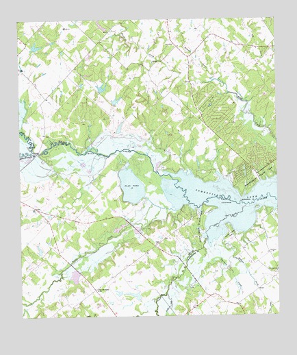
Flag Pond, TX USGS Topographic Map
Click on map above to begin viewing in our Map Viewer.

This topographic map contains these locations and features:
Feature Name Type Latitude Longitude GNIS ID View Map
Alum CreekStreamN30.2599°W96.6797°1329474View Map
Birch CemeteryCemeteryN30.3649°W96.6736°1330694View Map
Birch Creek Area Volunteer Fire DepartmentBuildingN30.3166°W96.6366°2552424View Map
Birch Creek State ParkParkN30.3085°W96.6350°1330696View Map
Bredthauer LakeReservoirN30.2589°W96.6943°1859509View Map
Bredthauer Lake DamDamN30.2569°W96.6936°1859508View Map
Cedar CreekStreamN30.2969°W96.6405°1332406View Map
East Yegua CreekStreamN30.3191°W96.7425°1372149View Map
Edwards LakeReservoirN30.3463°W96.7098°1854378View Map
Edwards Lake DamDamN30.3452°W96.7103°1854377View Map
Flag PondLakeN30.3049°W96.6961°1335879View Map
Flat Prairie CemeteryCemeteryN30.2683°W96.6286°1335908View Map
Flat Prairie ChurchChurchN30.2766°W96.6289°1335909View Map
Fourmile CreekStreamN30.2791°W96.6578°1336116View Map
Gerdes Lake Number 2ReservoirN30.2781°W96.7409°1859511View Map
Gerdes Lake Number 2 DamDamN30.2769°W96.7403°1859510View Map
Gerland LakeReservoirN30.3408°W96.7031°1854380View Map
Gerland Lake DamDamN30.3419°W96.7036°1854379View Map
Hickory CreekStreamN30.3497°W96.6547°1374052View Map
Kerr CreekStreamN30.2558°W96.6300°1339054View Map
Lake Somerville State ParkParkN30.3102°W96.6289°2028983View Map
Lake Somerville TrailwayTrailN30.3049°W96.6394°2033493View Map
Lamb LakeReservoirN30.3294°W96.7014°1865337View Map
Lamb Lake DamDamN30.3269°W96.7019°1865336View Map
McCain CreekStreamN30.2838°W96.6522°1341138View Map
McCain Creek ParkParkN30.2830°W96.6472°1341139View Map
Middle Yegua CreekStreamN30.3197°W96.7422°1374921View Map
Nails CreekStreamN30.2949°W96.6741°1342360View Map
Nails Creek State ParkParkN30.2880°W96.6644°1342361View Map
Newman Lake DamDamN30.3285°W96.7003°1854381View Map
Post Oak SchoolSchoolN30.2616°W96.7136°1344414View Map
Saint Mary ChurchChurchN30.2808°W96.6839°1346018View Map
Schindler Lake DamDamN30.3702°W96.7069°1865330View Map
Schlindler LakeReservoirN30.3724°W96.7096°1865331View Map
Ward LakeReservoirN30.3624°W96.7441°1854384View Map
Ward Lake DamDamN30.3619°W96.7436°1854383View Map

Note: Coordinates in the location and feature list above are referenced to NAD83 datum.


Copyright (C) 2008-2024 Ryan Niemi / Sunset Dynamics ... All Rights Reserved