TopoQuest Logo
Do you find TopoQuest useful?
Help keep TopoQuest running and adding new maps/features by donating!
Bitcoin:  19c7KJd3qBynnjoSw5npx9KScwjBe4ifkT
Litecoin:  LXs6TkuXGGXo1vDsWCkWVdjQX94eUKd6ui
Home View Maps Find Maps Find Places Resources & Links


Brenham, Texas Topographic Map

USGS Map Title: Brenham, TX
USGS Map MRC: 30096B4
DRG (GeoTIFF) Download: o30096b4.tif


Neighboring USGS Topographic Map Quads:


  Somerville, TX  
30096C5
 

  Gay Hill, TX  
30096C4
 

  Independence, TX  
30096C3
 

  Burton, TX  
30096B5
 

  Brenham, TX  
30096B4
 

  Chappell Hill, TX  
30096B3
 

  Greenvine, TX  
30096A5
 

  Welcome, TX  
30096A4
 

  Kenney, TX  
30096A3


Map MRC Location:

N31°
W97°
N31°
W96°
H8 H7 H6 H5 H4 H3 H2 H1
G8 G7 G6 G5 G4 G3 G2 G1
F8 F7 F6 F5 F4 F3 F2 F1
E8 E7 E6 E5 E4 E3 E2 E1
D8 D7 D6 D5 D4 D3 D2 D1
C8 C7 C6 C5 C4 C3 C2 C1
B8 B7 B6 B5 B4 B3 B2 B1
A8 A7 A6 A5 A4 A3 A2 A1
N30°
W97°
N30°
W96°

Brenham, TX USGS 1:24K Topographic Map Preview:
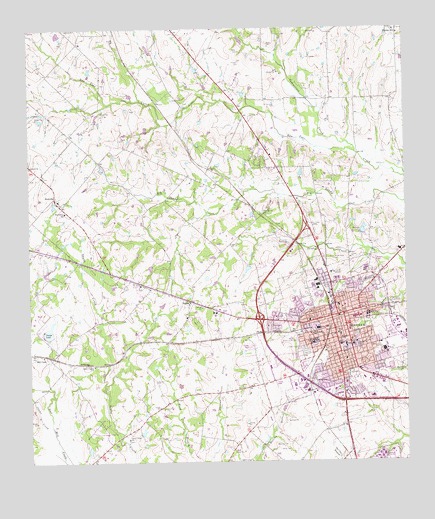
Brenham, TX USGS Topographic Map
Click on map above to begin viewing in our Map Viewer.

This topographic map contains these locations and features:
Feature Name Type Latitude Longitude GNIS ID View Map
Affleck CemeteryCemeteryN30.2469°W96.4705°1329241View Map
Alamo SchoolSchoolN30.1608°W96.3964°1329306View Map
Allcorn-Kokemoor FarmsteadBuildingN30.2244°W96.3822°2031558View Map
Almot Schlenker HouseBuildingN30.1602°W96.3902°2031562View Map
Alton Elementary SchoolSchoolN30.1683°W96.3883°2009602View Map
Bassett and Bassett Banking HouseBuildingN30.1677°W96.3964°2031527View Map
Baylor Scott And White Medical Center BrenhamHospitalN30.1458°W96.3992°2015698View Map
Becker-Hildebrandt HouseBuildingN30.1563°W96.3966°2031503View Map
BerlinPopulated PlaceN30.1713°W96.4458°1377995View Map
Berlin Volunteer Fire DepartmentBuildingN30.1764°W96.4645°2552446View Map
Blue Bell Creameries ComplexBuildingN30.1666°W96.3902°2031480View Map
BrenhamPopulated PlaceN30.1669°W96.3977°1331223View Map
Brenham Alternative SchoolSchoolN30.1585°W96.3939°2009603View Map
Brenham City HallBuildingN30.1681°W96.3997°2753202View Map
Brenham DivisionCivilN30.1643°W96.4068°1938562View Map
Brenham Elementary SchoolSchoolN30.1588°W96.3952°2009604View Map
Brenham Fire DepartmentBuildingN30.1693°W96.3909°2552346View Map
Brenham High School GymnasiumBuildingN30.1594°W96.3922°2031496View Map
Brenham Junior High SchoolSchoolN30.1574°W96.3833°2009548View Map
Brenham Police DepartmentBuildingN30.1487°W96.4151°2739211View Map
Brenham Post OfficePost OfficeN30.1696°W96.3974°2032518View Map
Brenham SchoolSchoolN30.1674°W96.3936°2031887View Map
Brenham Sports ComplexParkN30.1847°W96.4036°2027485View Map
Brenham Water WorksLocaleN30.1591°W96.3977°2032183View Map
Brockschmidt-Miller HouseBuildingN30.1605°W96.4002°2031466View Map
Calvary CemeteryCemeteryN30.1580°W96.4108°1331909View Map
Camptown CemeteryCemeteryN30.1675°W96.3869°1332052View Map
City of BrenhamCivilN30.1584°W96.3962°2409901View Map
Clear Spring CemeteryCemeteryN30.1963°W96.4214°1332957View Map
Doctor Robert Lenert HouseBuildingN30.1635°W96.3955°2031295View Map
East Brenham Historict DistrictLocaleN30.1730°W96.3980°2031864View Map
Edgar Matchett HouseBuildingN30.1660°W96.4030°2031268View Map
Edmund Holle HouseBuildingN30.1591°W96.4002°2031269View Map
Eichholt CemeteryCemeteryN30.2405°W96.4283°1335138View Map
F W Schuerenberg HouseBuildingN30.1655°W96.4030°2031235View Map
Firemans ParkParkN30.1716°W96.4030°2028351View Map
Giddings-Stone MansionBuildingN30.1658°W96.4152°2031113View Map
Giddings-Wilkin HouseBuildingN30.1738°W96.3916°2031114View Map
Giddings-Wilkin House MuseumBuildingN30.1738°W96.3927°2014371View Map
Harrisburg SchoolSchoolN30.1972°W96.4880°1337405View Map
Hattie Powers ParkParkN30.1688°W96.4086°2029189View Map
Heisic CemeteryCemeteryN30.2434°W96.4294°1337567View Map
HIC CemeteryCemeteryN30.1577°W96.4097°1337167View Map
Indian CreekStreamN30.1333°W96.4922°1374209View Map
Jackson ParkParkN30.1544°W96.4030°2029106View Map
KTTX-AM (Brenham)TowerN30.1683°W96.4225°1385514View Map
KULF-FM (Brenham)TowerN30.1422°W96.4169°1385784View Map
KWHI-FM (Brenham)TowerN30.1683°W96.4227°1385785View Map
Lange DamDamN30.1602°W96.4919°1854358View Map
Lange LakeLakeN30.1602°W96.4919°1339617View Map
Lehmann CemeteryCemeteryN30.1486°W96.4586°1339801View Map
Live Oak Ranch AirportAirportN30.1856°W96.4461°2675930View Map
McNees LakeReservoirN30.1338°W96.4630°1854357View Map
McNees Lake DamDamN30.1336°W96.4636°1854356View Map
Meyer CemeteryCemeteryN30.2455°W96.4194°1341454View Map
Mill CreekPopulated PlaceN30.1555°W96.4933°1378682View Map
Milroy HospitalHospitalN30.1660°W96.4069°1341698View Map
Mount Pilgrim ChurchChurchN30.1530°W96.4789°1342087View Map
Mount Zion Methodist ChurchChurchN30.1622°W96.4072°2032277View Map
North End ParkFlatN30.1758°W96.3975°1342719View Map
Pampell-Day HouseBuildingN30.1655°W96.4027°2031755View Map
Pickard High SchoolSchoolN30.1674°W96.3875°1343959View Map
Prairie HillPopulated PlaceN30.2488°W96.3772°1378904View Map
Prairie Lea CemeteryCemeteryN30.1566°W96.4083°1344515View Map
R A Schuerenberg HouseBuildingN30.1624°W96.3947°2031717View Map
Railroad LakeReservoirN30.2102°W96.4219°1857909View Map
Railroad Lake DamDamN30.2102°W96.4219°1857908View Map
Reichardt-Low HouseBuildingN30.1627°W96.3986°2031701View Map
Saint Johns ChurchChurchN30.2494°W96.3783°1345947View Map
Saint Jude HospitalHospitalN30.1797°W96.3994°1345982View Map
Saint Marys Catholic ChurchChurchN30.1619°W96.3972°2032194View Map
Saint Marys SchoolSchoolN30.1572°W96.3825°1346039View Map
Sandy Creek ChurchChurchN30.1319°W96.4675°1346597View Map
Santa Fe Railway Company Freight DepotLocaleN30.1655°W96.4002°2032027View Map
Schlenker-Kolwes HouseBuildingN30.1574°W96.3939°2032634View Map
Schmidt HouseBuildingN30.1577°W96.4072°2032636View Map
Seekeks LakeLakeN30.1915°W96.3894°1346874View Map
Southern Pacific Railroad Freight DepotLocaleN30.1660°W96.3964°2032033View Map
Struckmeyer CemeteryCemeteryN30.2277°W96.4169°1348013View Map
Synagogue B'nai AbrahamChurchN30.1683°W96.3983°2032204View Map
Thomas CreekStreamN30.2422°W96.4166°1348481View Map
Tommelson CreekStreamN30.2141°W96.3911°1348636View Map
W E Seelhorst HouseBuildingN30.1658°W96.3914°2032482View Map
Washington CountyCivilN30.2145°W96.4034°1384024View Map
Washington County Emergency Medical ServicesBuildingN30.1780°W96.3908°2655839View Map
Washington County JailBuildingN30.1809°W96.3867°2738756View Map
Washington County Sheriff's OfficeBuildingN30.1794°W96.3887°2739245View Map
Weiss CemeteryCemeteryN30.1288°W96.4172°1349615View Map
West End SchoolSchoolN30.1619°W96.4058°1349707View Map
Willow Grove CemeteryCemeteryN30.1599°W96.4114°1350194View Map
Wood-Hughes HouseBuildingN30.1622°W96.3991°2032389View Map
Yellow Fever CemeteryCemeteryN30.1838°W96.3997°1350674View Map
ZionvillePopulated PlaceN30.2019°W96.4914°1379304View Map

Note: Coordinates in the location and feature list above are referenced to NAD83 datum.


Copyright (C) 2008-2024 Ryan Niemi / Sunset Dynamics ... All Rights Reserved