TopoQuest Logo
Do you find TopoQuest useful?
Help keep TopoQuest running and adding new maps/features by donating!
Bitcoin:  19c7KJd3qBynnjoSw5npx9KScwjBe4ifkT
Litecoin:  LXs6TkuXGGXo1vDsWCkWVdjQX94eUKd6ui
Home View Maps Find Maps Find Places Resources & Links


Brownsburg, Virginia Topographic Map

USGS Map Title: Brownsburg, VA
USGS Map MRC: 37079H3
DRG (GeoTIFF) Download: o37079h3.tif


Neighboring USGS Topographic Map Quads:


  Craigsville, VA  
38079A4
 

  Augusta Springs, VA  
38079A3
 

  Greenville, VA  
38079A2
 

  Goshen, VA  
37079H4
 

  Brownsburg, VA  
37079H3
 

  Vesuvius, VA  
37079H2
 

  Lexington, VA  
37079G4
 

  Cornwall, VA  
37079G3
 

  Montebello, VA  
37079G2


Map MRC Location:

N38°
W80°
N38°
W79°
H8 H7 H6 H5 H4 H3 H2 H1
G8 G7 G6 G5 G4 G3 G2 G1
F8 F7 F6 F5 F4 F3 F2 F1
E8 E7 E6 E5 E4 E3 E2 E1
D8 D7 D6 D5 D4 D3 D2 D1
C8 C7 C6 C5 C4 C3 C2 C1
B8 B7 B6 B5 B4 B3 B2 B1
A8 A7 A6 A5 A4 A3 A2 A1
N37°
W80°
N37°
W79°

Brownsburg, VA USGS 1:24K Topographic Map Preview:
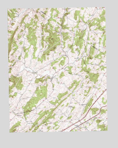
Brownsburg, VA USGS Topographic Map
Click on map above to begin viewing in our Map Viewer.

This topographic map contains these locations and features:
Feature Name Type Latitude Longitude GNIS ID View Map
Big HillSummitN37.9532°W79.3250°1463356View Map
Big HillSummitN37.9751°W79.3636°1463357View Map
BrownsburgPopulated PlaceN37.9285°W79.3192°1492643View Map
Brownsburg Historic DistrictParkN37.9279°W79.3198°1779353View Map
Brownsburg Post OfficePost OfficeN37.9291°W79.3190°2766345View Map
Burnt HillSummitN37.9765°W79.2500°1492680View Map
BustleburgPopulated PlaceN37.8921°W79.3645°1492686View Map
Cedar CreekStreamN37.8951°W79.3570°1464596View Map
DavisPopulated PlaceN37.9187°W79.2636°1477251View Map
DecaturPopulated PlaceN37.8765°W79.3356°1492848View Map
Dixon HillSummitN37.8793°W79.3678°1465837View Map
FairfieldPopulated PlaceN37.8793°W79.2895°1492923View Map
Fairfield CemeteryCemeteryN37.8779°W79.2923°1805978View Map
Fairfield Elementary SchoolSchoolN37.8771°W79.2936°1779358View Map
Fairfield Post OfficePost OfficeN37.8798°W79.2883°2766200View Map
Fairfield Presbyterian ChurchChurchN37.8785°W79.2911°1779359View Map
Fairfield Rescue Squad Rescue 7BuildingN37.8846°W79.2792°2086011View Map
Fairfield United Methodist ChurchChurchN37.8801°W79.2873°1779360View Map
Fairfield Volunteer Rescue SquadBuildingN37.8797°W79.2883°2075624View Map
Gibbs FallsFallsN37.9482°W79.2689°1467059View Map
Goose CreekStreamN37.9376°W79.3034°1467250View Map
Hackett HillSummitN37.8849°W79.2611°1493050View Map
Immanuel CemeteryCemeteryN37.9923°W79.3625°1805990View Map
Immanuel Presbyterian ChurchChurchN37.9924°W79.3620°1805991View Map
Interchange 200CrossingN37.8915°W79.2770°1779376View Map
JonestownPopulated PlaceN37.8893°W79.2673°1493152View Map
Laurel HillSummitN37.9935°W79.2998°1493181View Map
Lawson ChapelChurchN37.8865°W79.2661°1469213View Map
Lunsford HillSummitN37.9346°W79.2720°1469937View Map
Lusk HillSummitN37.9065°W79.2698°1469938View Map
McClung MillPopulated PlaceN37.9354°W79.3434°1493266View Map
McElwee ChapelChurchN37.8976°W79.3684°1470252View Map
McNutt (historical)Populated PlaceN37.9976°W79.2561°1739636View Map
Miller HillSummitN37.9765°W79.2909°1493292View Map
Moffatts CreekStreamN37.9440°W79.2928°1485509View Map
Mount Olive ChurchChurchN37.9037°W79.2973°1470977View Map
Mountain ViewPopulated PlaceN37.9012°W79.2834°1493324View Map
Mulberry GroveBuildingN37.9232°W79.3061°1779385View Map
New Providence ChurchChurchN37.9518°W79.3023°1471489View Map
New Providence Presbyterian Church CemeteryCemeteryN37.9514°W79.3027°1806003View Map
Newport HillSummitN37.9987°W79.2981°1493346View Map
Oak Hill School (historical)SchoolN37.8968°W79.3703°1806004View Map
Otts CreekStreamN37.9440°W79.2928°1486015View Map
Pisgah BranchStreamN37.9365°W79.3445°1472440View Map
Pisgah Chapel (historical)ChurchN37.9710°W79.3317°1779388View Map
Pisgah HillSummitN37.9685°W79.3203°1472443View Map
Poor CreekStreamN37.9476°W79.2848°1486338View Map
Rockbridge Middle SchoolSchoolN37.8891°W79.3012°2498636View Map
Roundtop HillSummitN37.9596°W79.3175°1473598View Map
South River District Volunteer Fire and Rescue Company 7BuildingN37.8829°W79.2799°2075622View Map
Stony RunPopulated PlaceN37.9746°W79.2645°1739671View Map
Wades MillPopulated PlaceN37.9490°W79.2861°1493748View Map
Walkers Creek Volunteer Fire DepartmentBuildingN37.9950°W79.3580°2075618View Map
White HillSummitN37.9610°W79.3517°1493792View Map
ZackPopulated PlaceN37.9929°W79.3609°1493567View Map

Note: Coordinates in the location and feature list above are referenced to NAD83 datum.


Copyright (C) 2008-2024 Ryan Niemi / Sunset Dynamics ... All Rights Reserved