TopoQuest Logo
Do you find TopoQuest useful?
Help keep TopoQuest running and adding new maps/features by donating!
Bitcoin:  19c7KJd3qBynnjoSw5npx9KScwjBe4ifkT
Litecoin:  LXs6TkuXGGXo1vDsWCkWVdjQX94eUKd6ui
Home View Maps Find Maps Find Places Resources & Links


Greenville, Virginia Topographic Map

USGS Map Title: Greenville, VA
USGS Map MRC: 38079A2
DRG (GeoTIFF) Download: o38079a2.tif


Neighboring USGS Topographic Map Quads:


  Elliott Knob, VA  
38079B3
 

  Churchville, VA  
38079B2
 

  Staunton, VA  
38079B1
 

  Augusta Springs, VA  
38079A3
 

  Greenville, VA  
38079A2
 

  Stuarts Draft, VA  
38079A1
 

  Brownsburg, VA  
37079H3
 

  Vesuvius, VA  
37079H2
 

  Big Levels, VA  
37079H1


Map MRC Location:

N39°
W80°
N39°
W79°
H8 H7 H6 H5 H4 H3 H2 H1
G8 G7 G6 G5 G4 G3 G2 G1
F8 F7 F6 F5 F4 F3 F2 F1
E8 E7 E6 E5 E4 E3 E2 E1
D8 D7 D6 D5 D4 D3 D2 D1
C8 C7 C6 C5 C4 C3 C2 C1
B8 B7 B6 B5 B4 B3 B2 B1
A8 A7 A6 A5 A4 A3 A2 A1
N38°
W80°
N38°
W79°

Greenville, VA USGS 1:24K Topographic Map Preview:
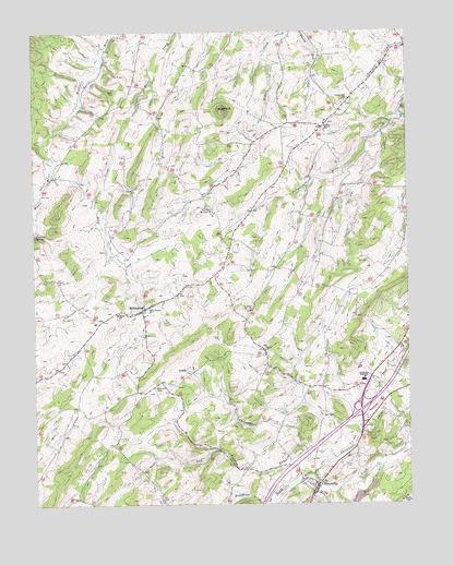
Greenville, VA USGS Topographic Map
Click on map above to begin viewing in our Map Viewer.

This topographic map contains these locations and features:
Feature Name Type Latitude Longitude GNIS ID View Map
Allen MineMineN38.0149°W79.2273°1739577View Map
Arbor HillPopulated PlaceN38.0999°W79.1525°1495197View Map
Arbor Hill ChurchChurchN38.1068°W79.1448°1462541View Map
Bethel ChurchChurchN38.0421°W79.1723°1463195View Map
Bridgewater CollegeSchoolN38.0012°W79.1714°1481990View Map
Broadhead CreekStreamN38.0001°W79.1864°1482017View Map
Cockran SpringSpringN38.0729°W79.2489°1465044View Map
Glebe CemeteryCemeteryN38.1096°W79.2217°1467141View Map
GreenvillePopulated PlaceN38.0035°W79.1559°1495616View Map
Greenville Baptist ChurchChurchN38.0057°W79.1584°1739609View Map
Greenville CemeteryCemeteryN38.0021°W79.1567°1739686View Map
Greenville Census Designated PlaceCensusN38.0036°W79.1523°2389883View Map
Greenville Post OfficePost OfficeN38.0023°W79.1586°2766369View Map
Greenville United Methodist ChurchChurchN38.0021°W79.1573°1739687View Map
Harris MineMineN38.0140°W79.2250°1739611View Map
Holy Trinity ChurchChurchN38.0524°W79.2109°1468192View Map
Interchange 213CrossingN38.0249°W79.1411°1739621View Map
Lower Wallace DamDamN38.0085°W79.1348°1489210View Map
MiddlebrookPopulated PlaceN38.0512°W79.2139°1470421View Map
Middlebrook Census Designated PlaceCensusN38.0552°W79.2182°2584881View Map
Middlebrook High School (historical)SchoolN38.0501°W79.2128°1739637View Map
Middlebrook Historic DistrictParkN38.0521°W79.2128°1739638View Map
Middlebrook Post OfficePost OfficeN38.0516°W79.2133°2766250View Map
Middlebrook Volunteer Fire Department Company 3BuildingN38.0498°W79.2129°2075601View Map
Mount Airey ChurchChurchN38.0512°W79.2211°1470795View Map
Mount Tabor ChurchChurchN38.0785°W79.1903°1471081View Map
Oak Hill CemeteryCemeteryN38.0312°W79.2092°1471751View Map
Poor CreekStreamN38.0115°W79.1339°1486339View Map
Riverheads DistrictCivilN38.0184°W79.1761°1927465View Map
Riverheads Elementary SchoolSchoolN38.0359°W79.1411°1739660View Map
Riverheads High SchoolSchoolN38.0328°W79.1401°1473267View Map
Riverheads Volunteer Fire Department Company 25BuildingN38.0420°W79.1253°2766743View Map
Roaring RunStreamN38.0160°W79.1603°1473306View Map
Saint Johns ChurchChurchN38.0512°W79.1770°1473779View Map
Sinking Springs FarmLocaleN38.0233°W79.2319°2647240View Map
Stony HillSummitN38.1165°W79.1978°1739670View Map
SugarloafSummitN38.1040°W79.1850°1475295View Map
Upper Wallace DamDamN38.0018°W79.1398°1489194View Map
Walace LakeReservoirN38.0045°W79.1374°1489195View Map
Wrenn's Turkey FarmLocaleN38.0325°W79.2258°2647241View Map

Note: Coordinates in the location and feature list above are referenced to NAD83 datum.


Copyright (C) 2008-2024 Ryan Niemi / Sunset Dynamics ... All Rights Reserved