TopoQuest Logo
Do you find TopoQuest useful?
Help keep TopoQuest running and adding new maps/features by donating!
Bitcoin:  19c7KJd3qBynnjoSw5npx9KScwjBe4ifkT
Litecoin:  LXs6TkuXGGXo1vDsWCkWVdjQX94eUKd6ui
Home View Maps Find Maps Find Places Resources & Links


Montebello, Virginia Topographic Map

USGS Map Title: Montebello, VA
USGS Map MRC: 37079G2
DRG (GeoTIFF) Download: o37079g2.tif


Neighboring USGS Topographic Map Quads:


  Brownsburg, VA  
37079H3
 

  Vesuvius, VA  
37079H2
 

  Big Levels, VA  
37079H1
 

  Cornwall, VA  
37079G3
 

  Montebello, VA  
37079G2
 

  Massies Mill, VA  
37079G1
 

  Buena Vista, VA  
37079F3
 

  Forks of Buffalo, VA  
37079F2
 

  Piney River, VA  
37079F1


Map MRC Location:

N38°
W80°
N38°
W79°
H8 H7 H6 H5 H4 H3 H2 H1
G8 G7 G6 G5 G4 G3 G2 G1
F8 F7 F6 F5 F4 F3 F2 F1
E8 E7 E6 E5 E4 E3 E2 E1
D8 D7 D6 D5 D4 D3 D2 D1
C8 C7 C6 C5 C4 C3 C2 C1
B8 B7 B6 B5 B4 B3 B2 B1
A8 A7 A6 A5 A4 A3 A2 A1
N37°
W80°
N37°
W79°

Montebello, VA USGS 1:24K Topographic Map Preview:
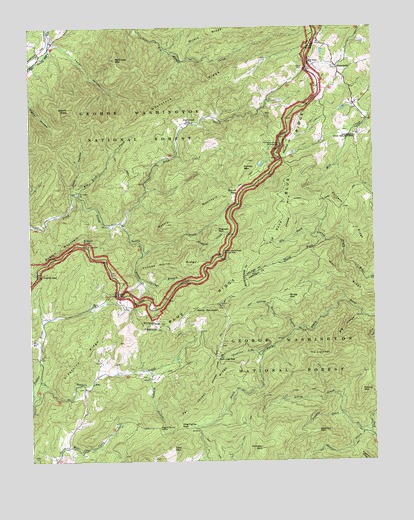
Montebello, VA USGS Topographic Map
Click on map above to begin viewing in our Map Viewer.

This topographic map contains these locations and features:
Feature Name Type Latitude Longitude GNIS ID View Map
Adams PeakSummitN37.8518°W79.2353°1481262View Map
AltoPopulated PlaceN37.7721°W79.2278°1495191View Map
Big Bend CreekStreamN37.8271°W79.2342°1481695View Map
Big BranchStreamN37.7843°W79.2475°1481713View Map
Big HollowValleyN37.7919°W79.1286°1481732View Map
Boston KnobSummitN37.8129°W79.2309°1495287View Map
Boston MountainSummitN37.8129°W79.2309°1495288View Map
Brush MountainSummitN37.7968°W79.1567°1495317View Map
Childress BranchStreamN37.7812°W79.1650°1482513View Map
Clark Mountain Mission (historical)ChurchN37.7921°W79.2464°1707573View Map
Clarks GapGapN37.8040°W79.2475°1482549View Map
Cole MountainSummitN37.7535°W79.1989°1495408View Map
Dark HollowValleyN37.8277°W79.2341°1482918View Map
Dismal MountainSummitN37.7690°W79.1298°1483027View Map
Doefoot MountainSummitN37.7585°W79.1459°1495471View Map
Elk Pond BranchStreamN37.8132°W79.1420°1483277View Map
Elk Pond MountainSummitN37.8124°W79.1648°1483278View Map
Georges CreekStreamN37.7590°W79.1292°1483605View Map
Grant CemeteryCemeteryN37.8635°W79.1497°1483744View Map
Grapevine RidgeRidgeN37.7807°W79.2281°1483747View Map
Greasy Spring BranchStreamN37.7874°W79.1534°1483783View Map
Hog Camp GapGapN37.7604°W79.1956°1484133View Map
Irish CreekPopulated PlaceN37.8476°W79.1911°1484352View Map
Irish Creek CemeteryCemeteryN37.8271°W79.2328°1484354View Map
Irish Creek MineMineN37.8499°W79.1639°1779378View Map
Irish Creek MissionChurchN37.8187°W79.2200°1779379View Map
Irish GapGapN37.7985°W79.2184°1484355View Map
King CreekStreamN37.7585°W79.1264°1484603View Map
Lovingston SpringsSpringN37.8029°W79.1734°1488508View Map
McClung MountainSummitN37.8657°W79.2184°1485262View Map
Mill CreekStreamN37.8490°W79.1267°1481249View Map
MontebelloPopulated PlaceN37.8637°W79.1378°1485520View Map
Montebello Post OfficePost OfficeN37.8526°W79.1313°2780812View Map
Montebello State Fish HatcheryLocaleN37.8440°W79.1303°1488510View Map
Montebello Volunteer Fire Department and Rescue SquadBuildingN37.8533°W79.1298°2086120View Map
Mount Paran ChurchChurchN37.8651°W79.1473°1485625View Map
Mount Pleasant Special Management AreaParkN37.7554°W79.1742°1496450View Map
Myers SchoolSchoolN37.7946°W79.2278°1485786View Map
Nettle CreekStreamN37.8190°W79.2170°1485828View Map
Nettle MountainSummitN37.8224°W79.1848°1485830View Map
Nettle Spring BranchStreamN37.8101°W79.2084°1485832View Map
Norvell FlatsLocaleN37.8276°W79.1739°1485926View Map
Painter MountainSummitN37.8337°W79.1723°1496057View Map
Pompey CreekStreamN37.7635°W79.1361°1486320View Map
Pompey MountainSummitN37.7537°W79.1666°2791101View Map
Porters RidgeRidgeN37.8199°W79.1345°1486374View Map
Rocky MountainSummitN37.7940°W79.1895°1486744View Map
Salt Log GapGapN37.7801°W79.1820°1486901View Map
Seeley Woodworth Trail ShelterLocaleN37.8187°W79.1542°1488509View Map
Statons CreekStreamN37.7735°W79.2481°1487541View Map
Statons Creek FallsFallsN37.7687°W79.2470°1488517View Map
Stillhouse Hollow Parking AreaLocaleN37.8410°W79.1584°1487583View Map
Tar Jacket RidgeRidgeN37.7685°W79.1867°1487776View Map
Taylor HollowValleyN37.8698°W79.2414°1487795View Map
The CardinalSummitN37.7801°W79.1445°1496302View Map
Twin SpringsSpringN37.8232°W79.1545°1488511View Map
Wheelers RunStreamN37.7701°W79.2492°1488274View Map
Whetstone RidgeRidgeN37.8554°W79.1945°1481244View Map
Wiggins BranchStreamN37.7760°W79.2078°1488357View Map
Wiggins Spring ShelterLocaleN37.7599°W79.2034°1488358View Map
Wigwam CreekStreamN37.8146°W79.1906°1488359View Map
Wigwam MountainSummitN37.8162°W79.1820°1496416View Map
Wilkie RidgeRidgeN37.8737°W79.1848°1488385View Map
Wolf RidgeRidgeN37.8024°W79.1356°1488452View Map
WREL-FM (Buena Vista)TowerN37.7771°W79.2048°1502610View Map
Yankee Horse RidgeRidgeN37.8071°W79.1956°1487108View Map
Yankee Horse Ridge Parking AreaLocaleN37.8099°W79.1795°1487109View Map

Note: Coordinates in the location and feature list above are referenced to NAD83 datum.


Copyright (C) 2008-2024 Ryan Niemi / Sunset Dynamics ... All Rights Reserved