TopoQuest Logo
Do you find TopoQuest useful?
Help keep TopoQuest running and adding new maps/features by donating!
Bitcoin:  19c7KJd3qBynnjoSw5npx9KScwjBe4ifkT
Litecoin:  LXs6TkuXGGXo1vDsWCkWVdjQX94eUKd6ui
Home View Maps Find Maps Find Places Resources & Links


Wilson Bay, Minnesota Topographic Map

USGS Map Title: Wilson Bay, MN
USGS Map MRC: 46094D4
DRG (GeoTIFF) Download: o46094d4.tif


Neighboring USGS Topographic Map Quads:


  Graff, MN  
46094E5
 

  Pine River SW, MN  
46094E4
 

  Nisswa, MN  
46094E3
 

  Casino, MN  
46094D5
 

  Wilson Bay, MN  
46094D4
 

  Gull Lake, MN  
46094D3
 

  Motley SE, MN  
46094C5
 

  Pillager, MN  
46094C4
 

  Baxter, MN  
46094C3


Map MRC Location:

N47°
W95°
N47°
W94°
H8 H7 H6 H5 H4 H3 H2 H1
G8 G7 G6 G5 G4 G3 G2 G1
F8 F7 F6 F5 F4 F3 F2 F1
E8 E7 E6 E5 E4 E3 E2 E1
D8 D7 D6 D5 D4 D3 D2 D1
C8 C7 C6 C5 C4 C3 C2 C1
B8 B7 B6 B5 B4 B3 B2 B1
A8 A7 A6 A5 A4 A3 A2 A1
N46°
W95°
N46°
W94°

Wilson Bay, MN USGS 1:24K Topographic Map Preview:
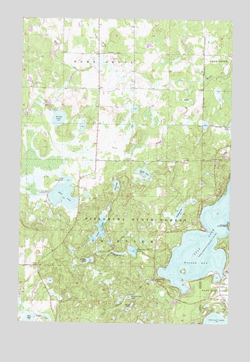
Wilson Bay, MN USGS Topographic Map
Click on map above to begin viewing in our Map Viewer.

This topographic map contains these locations and features:
Feature Name Type Latitude Longitude GNIS ID View Map
Bass LakeLakeN46.4314°W94.4432°639684View Map
Beauty LakeLakeN46.4008°W94.4579°639807View Map
Burned Camp LakeLakeN46.3857°W94.4349°640661View Map
Cory BrookStreamN46.4816°W94.4519°641517View Map
Dead Horse LakeLakeN46.4040°W94.4428°642677View Map
Duffney LakeLakeN46.4205°W94.4052°642967View Map
Green Bass LakeLakeN46.4049°W94.4327°644408View Map
Gull Lake Lookout TowerTowerN46.4430°W94.3772°659847View Map
Hardy LakeLakeN46.4588°W94.4779°644669View Map
KAWB-TV (Brainerd)TowerN46.4225°W94.4617°663145View Map
KBPR-FM (Brainerd)TowerN46.4225°W94.4617°663018View Map
Little Long LakeLakeN46.4334°W94.4717°646844View Map
Long LakeLakeN46.4137°W94.4525°647085View Map
Madden's Pine Beach East Golf CourseLocaleN46.3903°W94.3819°2074411View Map
Madden's Pine Beach West Golf CourseLocaleN46.3903°W94.3819°2074409View Map
Madden's Social Nine Golf CourseLocaleN46.3903°W94.3819°2074412View Map
Pillager Area Fire and Rescue Station 2BuildingN46.4348°W94.3848°2666238View Map
Pillsbury State ForestForestN46.4194°W94.4350°649434View Map
Rock LakeLakeN46.4266°W94.4745°650197View Map
Rock Lake CampgroundLocaleN46.4291°W94.4831°650202View Map
Rush BrookStreamN46.4661°W94.4019°650390View Map
Rush Brook Post Office (historical)Post OfficeN46.4306°W94.4639°2071268View Map
Saint Thomas of the Pines ChurchChurchN46.3916°W94.3811°651066View Map
Shafer LakeLakeN46.4363°W94.4263°651893View Map
Stump LakeLakeN46.3812°W94.4339°652743View Map
Township of FairviewCivilN46.4194°W94.4338°664135View Map
Wilson BayBayN46.4000°W94.3961°654218View Map
WJJY-FM (Brainerd)TowerN46.4433°W94.3831°663019View Map

Note: Coordinates in the location and feature list above are referenced to NAD83 datum.


Copyright (C) 2008-2024 Ryan Niemi / Sunset Dynamics ... All Rights Reserved