TopoQuest Logo
Do you find TopoQuest useful?
Help keep TopoQuest running and adding new maps/features by donating!
Bitcoin:  19c7KJd3qBynnjoSw5npx9KScwjBe4ifkT
Litecoin:  LXs6TkuXGGXo1vDsWCkWVdjQX94eUKd6ui
Home View Maps Find Maps Find Places Resources & Links


Pillager, Minnesota Topographic Map

USGS Map Title: Pillager, MN
USGS Map MRC: 46094C4
DRG (GeoTIFF) Download: o46094c4.tif


Neighboring USGS Topographic Map Quads:


  Casino, MN  
46094D5
 

  Wilson Bay, MN  
46094D4
 

  Gull Lake, MN  
46094D3
 

  Motley SE, MN  
46094C5
 

  Pillager, MN  
46094C4
 

  Baxter, MN  
46094C3
 

  Cushing, MN  
46094B5
 

  Belle Prairie NW, MN  
46094B4
 

  Fort Ripley, MN  
46094B3


Map MRC Location:

N47°
W95°
N47°
W94°
H8 H7 H6 H5 H4 H3 H2 H1
G8 G7 G6 G5 G4 G3 G2 G1
F8 F7 F6 F5 F4 F3 F2 F1
E8 E7 E6 E5 E4 E3 E2 E1
D8 D7 D6 D5 D4 D3 D2 D1
C8 C7 C6 C5 C4 C3 C2 C1
B8 B7 B6 B5 B4 B3 B2 B1
A8 A7 A6 A5 A4 A3 A2 A1
N46°
W95°
N46°
W94°

Pillager, MN USGS 1:24K Topographic Map Preview:
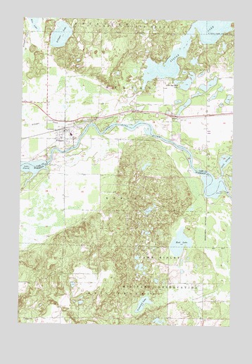
Pillager, MN USGS Topographic Map
Click on map above to begin viewing in our Map Viewer.

This topographic map contains these locations and features:
Feature Name Type Latitude Longitude GNIS ID View Map
Cass County Sheriff's Office PillagerBuildingN46.3275°W94.4778°2758514View Map
City of PillagerCivilN46.3297°W94.4797°2396203View Map
Crow Wing River CemeteryCemeteryN46.3007°W94.3887°2068619View Map
Crow Wing River DamDamN46.3150°W94.4853°1776846View Map
First Baptist ChurchChurchN46.3300°W94.4739°2071119View Map
First Lutheran ChurchChurchN46.3350°W94.4069°2071113View Map
Franzen Family CemeteryCemeteryN46.3180°W94.4430°2068617View Map
Franzon SchoolLocaleN46.3114°W94.4445°643897View Map
Gilgal ChurchChurchN46.2519°W94.4964°644141View Map
Gull RiverStreamN46.3105°W94.3822°644528View Map
Little Red Sand LakeLakeN46.3477°W94.4044°646899View Map
Mrs Albert Schultz GraveCemeteryN46.2972°W94.4194°2068618View Map
Mud LakeLakeN46.2839°W94.4053°648291View Map
Peaks Charter SchoolSchoolN46.3389°W94.4917°2071118View Map
PillagerPopulated PlaceN46.3300°W94.4742°649426View Map
PillagerLocaleN46.3294°W94.4750°2071114View Map
Pillager Area Fire and Rescue Station 1BuildingN46.3291°W94.4728°2071116View Map
Pillager Assemblies of God ChurchChurchN46.3300°W94.4739°2071117View Map
Pillager CemeteryCemeteryN46.3172°W94.4947°649427View Map
Pillager CreekStreamN46.3322°W94.4589°649428View Map
Pillager DamDamN46.3155°W94.4845°649429View Map
Pillager Elementary SchoolSchoolN46.3272°W94.4699°2071120View Map
Pillager LakeLakeN46.3681°W94.4779°649430View Map
Pillager Post OfficePost OfficeN46.3297°W94.4736°2071115View Map
Rail Prairie Union CemeteryCemeteryN46.2517°W94.4967°2068621View Map
Rice LakeLakeN46.3749°W94.4934°650038View Map
School Number 107LocaleN46.2677°W94.4847°651338View Map
SylvanLocaleN46.3350°W94.4064°2071112View Map
SylvanPopulated PlaceN46.3350°W94.4067°654970View Map
Sylvan CemeteryCemeteryN46.3335°W94.4117°2071085View Map
Sylvan DamDamN46.3000°W94.3786°1776836View Map
Sylvan DamDamN46.3047°W94.3781°652961View Map
Sylvan LakeLakeN46.3707°W94.4007°652965View Map
Sylvan Post Office (historical)Post OfficeN46.3350°W94.4064°2071378View Map
Tamarack LakeLakeN46.2587°W94.4266°653006View Map
Township of RosingCivilN46.3016°W94.4391°665472View Map
Township of SylvanCivilN46.3393°W94.4114°665757View Map
Wildwood CemeteryCemeteryN46.3311°W94.4631°654147View Map

Note: Coordinates in the location and feature list above are referenced to NAD83 datum.


Copyright (C) 2008-2024 Ryan Niemi / Sunset Dynamics ... All Rights Reserved