TopoQuest Logo
Do you find TopoQuest useful?
Help keep TopoQuest running and adding new maps/features by donating!
Bitcoin:  19c7KJd3qBynnjoSw5npx9KScwjBe4ifkT
Litecoin:  LXs6TkuXGGXo1vDsWCkWVdjQX94eUKd6ui
Home View Maps Find Maps Find Places Resources & Links


Whispering Pines, California Topographic Map

USGS Map Title: Whispering Pines, CA
USGS Map MRC: 38122G6
DRG (GeoTIFF) Download: o38122g6.tif


Neighboring USGS Topographic Map Quads:


  Kelseyville, CA  
38122H7
 

  Clearlake Highlands, CA  
38122H6
 

  Lower Lake, CA  
38122H5
 

  The Geysers, CA  
38122G7
 

  Whispering Pines, CA  
38122G6
 

  Middletown, CA  
38122G5
 

  Jimtown, CA  
38122F7
 

  Mount Saint Helena, CA  
38122F6
 

  Detert Reservoir, CA  
38122F5


Map MRC Location:

N39°
W123°
N39°
W122°
H8 H7 H6 H5 H4 H3 H2 H1
G8 G7 G6 G5 G4 G3 G2 G1
F8 F7 F6 F5 F4 F3 F2 F1
E8 E7 E6 E5 E4 E3 E2 E1
D8 D7 D6 D5 D4 D3 D2 D1
C8 C7 C6 C5 C4 C3 C2 C1
B8 B7 B6 B5 B4 B3 B2 B1
A8 A7 A6 A5 A4 A3 A2 A1
N38°
W123°
N38°
W122°

Whispering Pines, CA USGS 1:24K Topographic Map Preview:
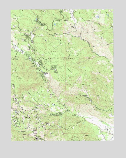
Whispering Pines, CA USGS Topographic Map
Click on map above to begin viewing in our Map Viewer.

This topographic map contains these locations and features:
Feature Name Type Latitude Longitude GNIS ID View Map
AdamsPopulated PlaceN38.8563°W122.7197°1657887View Map
Adams Post Office (historical)Post OfficeN38.8563°W122.7197°2026834View Map
Adams Springs Golf CourseLocaleN38.8493°W122.7247°1766158View Map
Anderson CreekStreamN38.7743°W122.6889°218250View Map
Anderson SpringsSpringN38.7749°W122.6930°218270View Map
Anderson-Bull SpringSpringN38.7974°W122.7308°2037832View Map
Bad CreekStreamN38.8485°W122.6667°218510View Map
Bear Canyon CreekStreamN38.7771°W122.6805°218796View Map
Big Chief MineMineN38.7707°W122.7042°219160View Map
Big Injun MineMineN38.7627°W122.7111°219203View Map
Boggs MountainSummitN38.8155°W122.6828°1658097View Map
Boggs Mountain State ForestForestN38.8324°W122.6936°219586View Map
Bonanza SpringsPopulated PlaceN38.8643°W122.6869°1658105View Map
Brookside Farm (historical)LocaleN38.8180°W122.7164°1766162View Map
Castle Rock SpringsPopulated PlaceN38.7702°W122.7167°1658235View Map
Childers PeakSummitN38.8424°W122.6300°220986View Map
CobbPopulated PlaceN38.8221°W122.7230°1658293View Map
Cobb Census Designated PlaceCensusN38.8356°W122.7229°2407643View Map
Cobb MountainSummitN38.8074°W122.7405°1658294View Map
Cobb Mountain Elementary SchoolSchoolN38.8300°W122.7215°1766166View Map
Cobb Post OfficePost OfficeN38.8210°W122.7203°1766167View Map
Cobb ValleyValleyN38.8432°W122.7494°221281View Map
Cobb Valley SchoolSchoolN38.8321°W122.7350°221282View Map
Collayomi ValleyValleyN38.7599°W122.6344°240781View Map
Department of Forestry and Fire Protection South Lake County Fire Protection District Station 62BuildingN38.8220°W122.7206°2622151View Map
Department of Forestry and Fire Protection South Lake County Fire Protection District Station 64BuildingN38.8630°W122.7179°2622194View Map
Ettawa SpringsPopulated PlaceN38.8510°W122.6961°1658513View Map
Ford FlatFlatN38.7955°W122.7175°223665View Map
Forest LakePopulated PlaceN38.8180°W122.7178°1658561View Map
Grouse SpringSpringN38.8471°W122.7125°224673View Map
Gunning CreekStreamN38.7810°W122.7100°224743View Map
Harbin MountainSummitN38.7918°W122.6464°224914View Map
Harbin SpringsPopulated PlaceN38.7877°W122.6555°1658709View Map
Harbin Springs AnnexPopulated PlaceN38.7921°W122.6614°1658710View Map
Harrington FlatFlatN38.8660°W122.7444°224958View Map
Harris CreekStreamN38.8585°W122.6272°224962View Map
HobergsPopulated PlaceN38.8435°W122.7244°225376View Map
Hobergs Post Office (historical)Post OfficeN38.8435°W122.7244°1940064View Map
Hobergs-Forest Lake Golf CourseLocaleN38.8232°W122.7203°1766169View Map
Houghton CreekStreamN38.8241°W122.7217°225685View Map
Howard SpringsPopulated PlaceN38.8582°W122.6747°1658789View Map
Jones CreekStreamN38.8210°W122.7178°226332View Map
Lincoln RockPillarN38.7810°W122.7178°227125View Map
Loch LomondPopulated PlaceN38.8632°W122.7194°1658991View Map
Malo CreekStreamN38.8316°W122.6447°227987View Map
Meadow Springs Shopping CenterLocaleN38.8255°W122.7219°1766174View Map
Mill CreekStreamN38.8505°W122.7005°228668View Map
Nutmeg SpringSpringN38.8274°W122.7427°229817View Map
Paul Hoberg Airport (historical)AirportN38.8696°W122.6762°1653614View Map
Pine GrovePopulated PlaceN38.8282°W122.7311°1659392View Map
Rush CreekStreamN38.8374°W122.7419°232020View Map
Seigler MountainSummitN38.8741°W122.7105°232795View Map
Seigler SpringsPopulated PlaceN38.8743°W122.6886°1659622View Map
Snows LakeLakeN38.8671°W122.6442°234785View Map
Spikenard CreekStreamN38.8496°W122.6753°235198View Map
SugarloafSummitN38.7549°W122.6622°1659901View Map
Sweet Springs CreekStreamN38.8560°W122.6339°235890View Map
Thorne MineMineN38.7641°W122.7042°236289View Map
Wardlow RockPillarN38.7663°W122.7214°237234View Map
Whispering PinesPopulated PlaceN38.8135°W122.7125°1660164View Map

Note: Coordinates in the location and feature list above are referenced to NAD83 datum.


Copyright (C) 2008-2024 Ryan Niemi / Sunset Dynamics ... All Rights Reserved