TopoQuest Logo
Do you find TopoQuest useful?
Help keep TopoQuest running and adding new maps/features by donating!
Bitcoin:  19c7KJd3qBynnjoSw5npx9KScwjBe4ifkT
Litecoin:  LXs6TkuXGGXo1vDsWCkWVdjQX94eUKd6ui
Home View Maps Find Maps Find Places Resources & Links


Kelseyville, California Topographic Map

USGS Map Title: Kelseyville, CA
USGS Map MRC: 38122H7
DRG (GeoTIFF) Download: o38122h7.tif


Neighboring USGS Topographic Map Quads:


  Lakeport, CA  
39122A8
 

  Lucerne, CA  
39122A7
 

  Clearlake Oaks, CA  
39122A6
 

  Highland Springs, CA  
38122H8
 

  Kelseyville, CA  
38122H7
 

  Clearlake Highlands, CA  
38122H6
 

  Asti, CA  
38122G8
 

  The Geysers, CA  
38122G7
 

  Whispering Pines, CA  
38122G6


Map MRC Location:

N39°
W123°
N39°
W122°
H8 H7 H6 H5 H4 H3 H2 H1
G8 G7 G6 G5 G4 G3 G2 G1
F8 F7 F6 F5 F4 F3 F2 F1
E8 E7 E6 E5 E4 E3 E2 E1
D8 D7 D6 D5 D4 D3 D2 D1
C8 C7 C6 C5 C4 C3 C2 C1
B8 B7 B6 B5 B4 B3 B2 B1
A8 A7 A6 A5 A4 A3 A2 A1
N38°
W123°
N38°
W122°

Kelseyville, CA USGS 1:24K Topographic Map Preview:
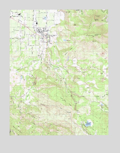
Kelseyville, CA USGS Topographic Map
Click on map above to begin viewing in our Map Viewer.

This topographic map contains these locations and features:
Feature Name Type Latitude Longitude GNIS ID View Map
Allen 394 DamDamN38.9332°W122.8611°1663857View Map
Bell MineMineN38.9566°W122.7583°218986View Map
Benson RidgeRidgeN38.9585°W122.7992°219057View Map
Big ValleyAreaN38.9905°W122.8422°257037View Map
Boggs LakeLakeN38.8860°W122.7769°219585View Map
Boggs Lake PreserveParkN38.8866°W122.7767°1657214View Map
Buckingham BluffsCliffN38.9932°W122.7622°220066View Map
Buckingham PeakSummitN38.9896°W122.7689°254669View Map
California Highway Patrol Northern Division - Clear LakeBuildingN38.9716°W122.8325°2751095View Map
Camel Back RidgeRidgeN38.9057°W122.8058°220427View Map
Carlsbad SpringSpringN38.9180°W122.7992°220602View Map
Clark PeakSummitN38.9841°W122.7955°1658283View Map
Cold Creek RanchLocaleN38.9043°W122.7592°1724025View Map
Fifield RanchLocaleN38.9091°W122.8686°1724027View Map
Gard Street Elementary SchoolSchoolN38.9799°W122.8393°1766100View Map
GlenviewPopulated PlaceN38.8999°W122.7592°1658622View Map
Grace Evangelical Free ChurchChurchN38.9610°W122.8325°1766102View Map
Helenthal RanchLocaleN38.9060°W122.7753°1724029View Map
Hill CreekStreamN38.9927°W122.8622°225316View Map
Howard PeakSummitN38.9738°W122.7711°225701View Map
Intermountain High SchoolSchoolN38.9744°W122.8300°2516069View Map
Kelsey - Cobb Fire StationBuildingN38.9123°W122.7659°2622297View Map
Kelsey Creek PitMineN38.9997°W122.8447°2678042View Map
Kelsey-Cobb Fire StationLocaleN38.9127°W122.7658°226486View Map
KelseyvillePopulated PlaceN38.9780°W122.8394°277532View Map
Kelseyville CemeteryCemeteryN38.9740°W122.8487°2755393View Map
Kelseyville Census Designated PlaceCensusN38.9705°W122.8328°2408468View Map
Kelseyville Community Day High SchoolSchoolN38.9742°W122.8287°2516037View Map
Kelseyville Elementary SchoolSchoolN38.9739°W122.8199°1766110View Map
Kelseyville Fire Protection District Station 55BuildingN38.9780°W122.8371°2621807View Map
Kelseyville High SchoolSchoolN38.9742°W122.8296°1766108View Map
Kelseyville Post OfficePost OfficeN38.9813°W122.8354°1766109View Map
Konoti WineryLocaleN38.9930°W122.8744°1766113View Map
M-Square FarmsLocaleN38.9761°W122.8539°2677485View Map
Mahnke RanchLocaleN38.8810°W122.8536°1724030View Map
McIntire CreekStreamN38.9427°W122.8164°228380View Map
McIntire RanchLocaleN38.9249°W122.7775°1724032View Map
Mount KonoctiSummitN38.9749°W122.7664°254859View Map
Mount OliveSummitN38.9318°W122.7925°230010View Map
Mountain SchoolSchoolN38.9116°W122.7658°229199View Map
Mountain Vista Middle SchoolSchoolN38.9717°W122.8184°1766136View Map
Poison Smith SpringSpringN38.8975°W122.7985°230890View Map
Presbyterian Church of KelseyvilleChurchN38.9768°W122.8361°1766142View Map
S - Bar - S QuarryMineN38.9297°W122.7567°2708148View Map
Saint Peter Roman Catholic ChurchChurchN38.9774°W122.8364°1766149View Map
Shaul ValleyBasinN38.9477°W122.7950°232881View Map
South PeakSummitN38.9691°W122.7719°1659827View Map
Storm CanyonValleyN38.8963°W122.8555°235554View Map
SugarloafSummitN38.9405°W122.7508°1656339View Map
Sweetwater CreekStreamN38.9052°W122.8528°235896View Map
Sweetwater RanchLocaleN38.9066°W122.8508°1724033View Map
Widow CreekStreamN38.9082°W122.8578°237728View Map
Wright PeakSummitN38.9746°W122.7661°255245View Map

Note: Coordinates in the location and feature list above are referenced to NAD83 datum.


Copyright (C) 2008-2024 Ryan Niemi / Sunset Dynamics ... All Rights Reserved