TopoQuest Logo
Do you find TopoQuest useful?
Help keep TopoQuest running and adding new maps/features by donating!
Bitcoin:  19c7KJd3qBynnjoSw5npx9KScwjBe4ifkT
Litecoin:  LXs6TkuXGGXo1vDsWCkWVdjQX94eUKd6ui
Home View Maps Find Maps Find Places Resources & Links


Wheeler, Illinois Topographic Map

USGS Map Title: Wheeler, IL
USGS Map MRC: 39088A3
DRG (GeoTIFF) Download: o39088a3.tif


Neighboring USGS Topographic Map Quads:


  Teutopolis, IL  
39088B4
 

  Woodbury, IL  
39088B3
 

  Greenup, IL  
39088B2
 

  Dieterich, IL  
39088A4
 

  Wheeler, IL  
39088A3
 

  Rose Hill, IL  
39088A2
 

  Eberle, IL  
38088H4
 

  Latona, IL  
38088H3
 

  Newton, IL  
38088H2


Map MRC Location:

N40°
W89°
N40°
W88°
H8 H7 H6 H5 H4 H3 H2 H1
G8 G7 G6 G5 G4 G3 G2 G1
F8 F7 F6 F5 F4 F3 F2 F1
E8 E7 E6 E5 E4 E3 E2 E1
D8 D7 D6 D5 D4 D3 D2 D1
C8 C7 C6 C5 C4 C3 C2 C1
B8 B7 B6 B5 B4 B3 B2 B1
A8 A7 A6 A5 A4 A3 A2 A1
N39°
W89°
N39°
W88°

Wheeler, IL USGS 1:24K Topographic Map Preview:
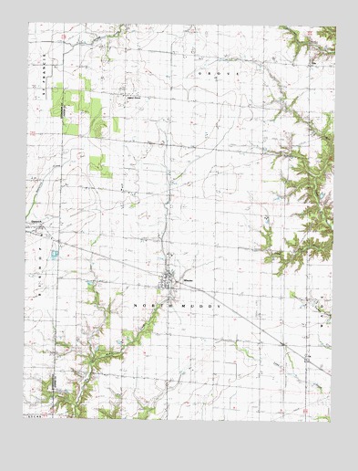
Wheeler, IL USGS Topographic Map
Click on map above to begin viewing in our Map Viewer.

This topographic map contains these locations and features:
Feature Name Type Latitude Longitude GNIS ID View Map
Bierman Grain FarmLocaleN39.0775°W88.3339°2724526View Map
Bierman Grain FarmLocaleN39.0775°W88.3336°2705579View Map
Brewer CemeteryCemeteryN39.1009°W88.3348°1923082View Map
Cohorst Dairy FarmLocaleN39.1006°W88.3258°2705580View Map
Fairfield CemeteryCemeteryN39.0928°W88.2600°1923105View Map
Fairfield Church (historical)ChurchN39.0928°W88.2595°408163View Map
GilaPopulated PlaceN39.1128°W88.2603°408995View Map
Green FarmsLocaleN39.0408°W88.2867°2724527View Map
Green FarmsLocaleN39.0406°W88.2867°2705581View Map
Grove Elementary SchoolSchoolN39.1150°W88.2756°409542View Map
Hetzer FarmsLocaleN39.0586°W88.2992°2724528View Map
Hetzer FarmsLocaleN39.0583°W88.2989°2705582View Map
Immaculate Conception CemeteryCemeteryN39.0589°W88.3709°1810506View Map
Island GrovePopulated PlaceN39.1025°W88.3353°1725219View Map
Island Grove ChurchChurchN39.1025°W88.3359°410961View Map
Isley Airport (historical)AirportN39.0875°W88.2889°427916View Map
Lidy Dairy and Hog FarmLocaleN39.0981°W88.2972°2724530View Map
Lidy Dairy and Hog FarmLocaleN39.0925°W88.2969°2705599View Map
Lidy FarmLocaleN39.0475°W88.2992°2680991View Map
Linder Post Office (historical)Post OfficeN39.0392°W88.3164°1815651View Map
LisPopulated PlaceN39.0200°W88.2603°412260View Map
Maple Lawn Herford FarmLocaleN39.0522°W88.3153°2705600View Map
Niemerg FarmsLocaleN39.0842°W88.3594°2724531View Map
Probstland DairyLocaleN39.0881°W88.3197°2705601View Map
Probstland Dairy FarmLocaleN39.0881°W88.3197°2724524View Map
Rocky Ford Sportsman Club South LakeReservoirN39.0761°W88.3725°1692207View Map
Satinfield Church (historical)ChurchN39.0564°W88.2695°418027View Map
Schumacher FarmLocaleN39.0636°W88.2772°2724525View Map
Slate Point FarmsLocaleN39.0636°W88.2769°2705602View Map
Township of North MuddyCivilN39.0185°W88.3114°429461View Map
Village of WheelerCivilN39.0430°W88.3188°2400160View Map
WheelerPopulated PlaceN39.0467°W88.3164°420989View Map
Wheeler CemeteryCemeteryN39.0411°W88.3139°1923591View Map
Wheeler Post OfficePost OfficeN39.0453°W88.3164°1815660View Map

Note: Coordinates in the location and feature list above are referenced to NAD83 datum.


Copyright (C) 2008-2024 Ryan Niemi / Sunset Dynamics ... All Rights Reserved