TopoQuest Logo
Do you find TopoQuest useful?
Help keep TopoQuest running and adding new maps/features by donating!
Bitcoin:  19c7KJd3qBynnjoSw5npx9KScwjBe4ifkT
Litecoin:  LXs6TkuXGGXo1vDsWCkWVdjQX94eUKd6ui
Home View Maps Find Maps Find Places Resources & Links


Eberle, Illinois Topographic Map

USGS Map Title: Eberle, IL
USGS Map MRC: 38088H4
DRG (GeoTIFF) Download: o38088h4.tif


Neighboring USGS Topographic Map Quads:


  Effingham South, IL  
39088A5
 

  Dieterich, IL  
39088A4
 

  Wheeler, IL  
39088A3
 

  Hord, IL  
38088H5
 

  Eberle, IL  
38088H4
 

  Latona, IL  
38088H3
 

  Louisville West, IL  
38088G5
 

  Louisville East, IL  
38088G4
 

  Sailor Springs, IL  
38088G3


Map MRC Location:

N39°
W89°
N39°
W88°
H8 H7 H6 H5 H4 H3 H2 H1
G8 G7 G6 G5 G4 G3 G2 G1
F8 F7 F6 F5 F4 F3 F2 F1
E8 E7 E6 E5 E4 E3 E2 E1
D8 D7 D6 D5 D4 D3 D2 D1
C8 C7 C6 C5 C4 C3 C2 C1
B8 B7 B6 B5 B4 B3 B2 B1
A8 A7 A6 A5 A4 A3 A2 A1
N38°
W89°
N38°
W88°

Eberle, IL USGS 1:24K Topographic Map Preview:
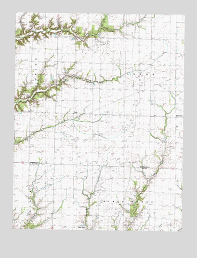
Eberle, IL USGS Topographic Map
Click on map above to begin viewing in our Map Viewer.

This topographic map contains these locations and features:
Feature Name Type Latitude Longitude GNIS ID View Map
Bethsaida CemeteryCemeteryN38.9465°W88.4834°404349View Map
Bethsaida ChurchChurchN38.9420°W88.4887°404350View Map
EberlePopulated PlaceN38.9425°W88.4570°407753View Map
Eberle Post Office (historical)Post OfficeN38.9423°W88.4887°1810485View Map
Eberle School (historical)SchoolN38.9356°W88.4556°407754View Map
German CemeteryCemeteryN38.8988°W88.4548°408966View Map
Holste Brothers FarmLocaleN38.9403°W88.3850°2705564View Map
Joergens FarmLocaleN38.9400°W88.4303°2705565View Map
Merry CemeteryCemeteryN38.9600°W88.4439°413446View Map
Morris CemeteryCemeteryN38.9650°W88.4634°413796View Map
Mount Zion CemeteryCemeteryN38.9639°W88.4564°1810525View Map
Mount Zion ChurchChurchN38.9648°W88.4559°414130View Map
Nadler School (historical)SchoolN38.8989°W88.4464°414280View Map
Poe CemeteryCemeteryN38.9870°W88.4775°415968View Map
Saint John CemeteryCemeteryN38.9136°W88.4753°1810538View Map
Saint Johns School (historical)SchoolN38.9137°W88.4759°417412View Map
Saint Matthew Lutheran CemeteryCemeteryN38.9409°W88.4220°1810541View Map
Saint Matthews ChurchChurchN38.9417°W88.4228°417631View Map
Saint Paul CemeteryCemeteryN38.9120°W88.4350°1821637View Map
Saint Pauls ChurchChurchN38.9120°W88.4364°417719View Map
Scott CemeteryCemeteryN38.9539°W88.3809°418139View Map
Township of LucasCivilN38.9563°W88.4156°429289View Map
Webster School (historical)SchoolN38.8925°W88.4006°420697View Map
WinterrowdPopulated PlaceN38.9409°W88.3750°421348View Map
Zimdars FarmLocaleN38.9722°W88.3897°2705568View Map

Note: Coordinates in the location and feature list above are referenced to NAD83 datum.


Copyright (C) 2008-2024 Ryan Niemi / Sunset Dynamics ... All Rights Reserved