TopoQuest Logo
Do you find TopoQuest useful?
Help keep TopoQuest running and adding new maps/features by donating!
Bitcoin:  19c7KJd3qBynnjoSw5npx9KScwjBe4ifkT
Litecoin:  LXs6TkuXGGXo1vDsWCkWVdjQX94eUKd6ui
Home View Maps Find Maps Find Places Resources & Links


Greenup, Illinois Topographic Map

USGS Map Title: Greenup, IL
USGS Map MRC: 39088B2
DRG (GeoTIFF) Download: o39088b2.tif


Neighboring USGS Topographic Map Quads:


  Johnstown, IL  
39088C3
 

  Toledo, IL  
39088C2
 

  Union Center, IL  
39088C1
 

  Woodbury, IL  
39088B3
 

  Greenup, IL  
39088B2
 

  Hazel Dell, IL  
39088B1
 

  Wheeler, IL  
39088A3
 

  Rose Hill, IL  
39088A2
 

  Yale, IL  
39088A1


Map MRC Location:

N40°
W89°
N40°
W88°
H8 H7 H6 H5 H4 H3 H2 H1
G8 G7 G6 G5 G4 G3 G2 G1
F8 F7 F6 F5 F4 F3 F2 F1
E8 E7 E6 E5 E4 E3 E2 E1
D8 D7 D6 D5 D4 D3 D2 D1
C8 C7 C6 C5 C4 C3 C2 C1
B8 B7 B6 B5 B4 B3 B2 B1
A8 A7 A6 A5 A4 A3 A2 A1
N39°
W89°
N39°
W88°

Greenup, IL USGS 1:24K Topographic Map Preview:
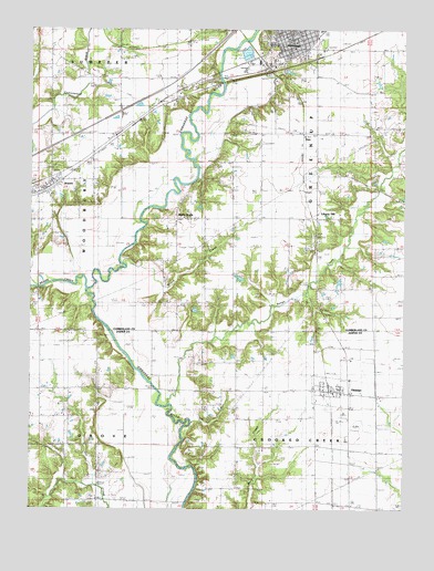
Greenup, IL USGS Topographic Map
Click on map above to begin viewing in our Map Viewer.

This topographic map contains these locations and features:
Feature Name Type Latitude Longitude GNIS ID View Map
Bruce CreekStreamN39.1895°W88.2198°404999View Map
Cherwood FordCrossingN39.2020°W88.2134°422544View Map
Chezem CemeteryCemeteryN39.1781°W88.2442°1922809View Map
Coad School (historical)SchoolN39.1270°W88.1700°406276View Map
Crooked Creek Fire Protection DistrictBuildingN39.1556°W88.1486°2682339View Map
DeesPopulated PlaceN39.2231°W88.1592°422612View Map
Dewey School (historical)SchoolN39.1839°W88.1495°407168View Map
Excelsior School (historical)SchoolN39.1284°W88.2281°408137View Map
First Presbyterian ChurchChurchN39.2467°W88.1620°1837338View Map
Frazier School (historical)SchoolN39.1562°W88.2373°408707View Map
GreenupPopulated PlaceN39.2478°W88.1634°409442View Map
Greenup Area Ambulance ServiceBuildingN39.2470°W88.1637°2673801View Map
Greenup CemeteryCemeteryN39.2459°W88.1725°1820725View Map
Greenup Commercial Historic DistrictParkN39.2464°W88.1648°1773387View Map
Greenup Fire DepartmentBuildingN39.2470°W88.1637°2682349View Map
Greenup Police DepartmentBuildingN39.2470°W88.1636°2759007View Map
Greenup Post OfficePost OfficeN39.2474°W88.1633°1773388View Map
Greenup Township Carnegie LibraryBuildingN39.2470°W88.1659°1773389View Map
Hamilton School (historical)SchoolN39.2261°W88.2189°409697View Map
Hayes CemeteryCemeteryN39.1525°W88.1853°1923116View Map
Hayes Chapel (historical)ChurchN39.1564°W88.1862°409960View Map
Hickory School (historical)SchoolN39.1892°W88.2059°410182View Map
HidalgoPopulated PlaceN39.1559°W88.1470°410196View Map
Hidalgo CemeteryCemeteryN39.1706°W88.1545°410197View Map
Hidalgo Elementary SchoolSchoolN39.1553°W88.1486°1815647View Map
Hidalgo Post OfficePost OfficeN39.1561°W88.1490°1815648View Map
Hutson School (historical)SchoolN39.1553°W88.1814°410734View Map
JewettPopulated PlaceN39.2078°W88.2459°411110View Map
Jewett Community ChurchChurchN39.2100°W88.2439°1820731View Map
Jewett Post OfficePost OfficeN39.2080°W88.2457°1773395View Map
Layman's Seed FarmLocaleN39.1644°W88.1422°2724535View Map
Liberty HillPopulated PlaceN39.2012°W88.1542°1725681View Map
Liberty Hill CemeteryCemeteryN39.2009°W88.1514°1820732View Map
Liberty Hill School (historical)SchoolN39.2012°W88.1542°412006View Map
Liberty Hill United Methodist ChurchChurchN39.2009°W88.1523°1820733View Map
Muddy CreekStreamN39.1823°W88.2309°414211View Map
Range CreekStreamN39.1525°W88.2037°416384View Map
Salem CemeteryCemeteryN39.2384°W88.2253°1820742View Map
Salem ChurchChurchN39.2384°W88.2262°417874View Map
Scotch Chapel School (historical)SchoolN39.2234°W88.1720°418134View Map
Shull School (historical)SchoolN39.1928°W88.1831°418482View Map
Spannagel FarmsLocaleN39.1639°W88.1825°2724533View Map
Swick School (historical)SchoolN39.1398°W88.1317°419484View Map
Township of GreenupCivilN39.2295°W88.1528°429080View Map
Village of GreenupCivilN39.2483°W88.1599°2398204View Map
Village of HidalgoCivilN39.1559°W88.1491°2398501View Map
Village of JewettCivilN39.2077°W88.2431°2398303View Map
Walla WallaPopulated PlaceN39.2009°W88.1923°423281View Map
Ward CemeteryCemeteryN39.1270°W88.1720°1923588View Map
Weatherholt School (historical)SchoolN39.2220°W88.1409°420671View Map

Note: Coordinates in the location and feature list above are referenced to NAD83 datum.


Copyright (C) 2008-2024 Ryan Niemi / Sunset Dynamics ... All Rights Reserved