TopoQuest Logo
Do you find TopoQuest useful?
Help keep TopoQuest running and adding new maps/features by donating!
Bitcoin:  19c7KJd3qBynnjoSw5npx9KScwjBe4ifkT
Litecoin:  LXs6TkuXGGXo1vDsWCkWVdjQX94eUKd6ui
Home View Maps Find Maps Find Places Resources & Links


Tarsney Lakes, Missouri Topographic Map

USGS Map Title: Tarsney Lakes, MO
USGS Map MRC: 38094H2
DRG (GeoTIFF) Download: o38094h2.tif


Neighboring USGS Topographic Map Quads:


  Blue Springs, MO  
39094A3
 

  Oak Grove, MO  
39094A2
 

  Bates City, MO  
39094A1
 

  Lake Jacomo, MO  
38094H3
 

  Tarsney Lakes, MO  
38094H2
 

  Chapel Hill, MO  
38094H1
 

  Pleasant Hill, MO  
38094G3
 

  Strasburg, MO  
38094G2
 

  Elm, MO  
38094G1


Map MRC Location:

N39°
W95°
N39°
W94°
H8 H7 H6 H5 H4 H3 H2 H1
G8 G7 G6 G5 G4 G3 G2 G1
F8 F7 F6 F5 F4 F3 F2 F1
E8 E7 E6 E5 E4 E3 E2 E1
D8 D7 D6 D5 D4 D3 D2 D1
C8 C7 C6 C5 C4 C3 C2 C1
B8 B7 B6 B5 B4 B3 B2 B1
A8 A7 A6 A5 A4 A3 A2 A1
N38°
W95°
N38°
W94°

Tarsney Lakes, MO USGS 1:24K Topographic Map Preview:
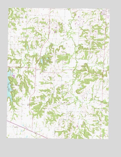
Tarsney Lakes, MO USGS Topographic Map
Click on map above to begin viewing in our Map Viewer.

This topographic map contains these locations and features:
Feature Name Type Latitude Longitude GNIS ID View Map
Adams CemeteryCemeteryN38.9069°W94.2233°713144View Map
Alley CemeteryCemeteryN38.9261°W94.2252°713230View Map
Aylward LakeReservoirN38.9248°W94.1585°763009View Map
Aylward Lake DamDamN38.9250°W94.1602°763008View Map
Briggs Lake DamDamN38.8917°W94.1386°763146View Map
Brown CemeteryCemeteryN38.9898°W94.1619°714767View Map
CockrellPopulated PlaceN38.8856°W94.2377°716060View Map
Corn CemeteryCemeteryN38.9353°W94.1747°716323View Map
Corn CemeteryCemeteryN38.9614°W94.1352°716324View Map
George CemeteryCemeteryN38.9844°W94.1483°718395View Map
Gosney CemeteryCemeteryN38.9333°W94.1930°718630View Map
Grain Valley Middle SchoolSchoolN38.9901°W94.2121°2545103View Map
Hillside School (historical)SchoolN38.9867°W94.1427°734953View Map
Koger CemeteryCemeteryN38.9494°W94.1916°720685View Map
Lake LotawanaPopulated PlaceN38.9231°W94.2441°720753View Map
Lake Lotawana DamDamN38.9350°W94.2469°762881View Map
Lambs FieldAirportN38.8752°W94.1434°2679356View Map
Lone Jack Elementary SchoolSchoolN38.8800°W94.1720°2545175View Map
Lone Jack Lake Conservation AreaParkN38.8944°W94.1986°2093251View Map
Lotawana ChurchChurchN38.9428°W94.2466°721602View Map
Michael Farm AirportAirportN38.8992°W94.2284°758793View Map
Mononame 83 DamDamN38.9600°W94.2269°763006View Map
Mononame 83 LakeReservoirN38.9593°W94.2266°763007View Map
Moreland School (historical)SchoolN38.9872°W94.2499°734951View Map
Morris Lake DamDamN38.9767°W94.1936°763332View Map
New Liberty ChurchChurchN38.9395°W94.2066°723277View Map
Oak Grove CemeteryCemeteryN38.9886°W94.1369°723568View Map
Oak Grove Police DepartmentBuildingN38.9957°W94.1287°2752152View Map
Oak Grove Post OfficePost OfficeN38.9988°W94.1300°2779451View Map
Oak Hill School (historical)SchoolN38.9853°W94.1893°734446View Map
Perdue CemeteryCemeteryN38.9342°W94.2027°724225View Map
Powell School (historical)SchoolN38.8854°W94.2185°734455View Map
Powis AirportAirportN38.9455°W94.1610°2679374View Map
Pueblo School (historical)SchoolN38.9389°W94.1928°734952View Map
Purdee Chapel CemeteryCemeteryN38.9903°W94.2311°725004View Map
Rattlesnake HillSummitN38.9439°W94.1538°725117View Map
Sni MillLocaleN38.9414°W94.1674°734955View Map
Sni MillsPopulated PlaceN38.9408°W94.1324°726660View Map
Sni Mills ChurchChurchN38.9367°W94.1374°726661View Map
Sni Valley Fire Protection District Main StationBuildingN38.9998°W94.1289°2621222View Map
Stony Point Elementary SchoolSchoolN38.9900°W94.2155°2545086View Map
Stony Point School (historical)SchoolN38.9856°W94.2163°2745345View Map
TarsneyPopulated PlaceN38.9414°W94.2158°727469View Map
Tarsney LakeReservoirN38.9491°W94.2084°758352View Map
Tarsney Lake DamDamN38.9517°W94.2086°763005View Map
Tarsney LakesPopulated PlaceN38.9497°W94.2038°727470View Map
Tarsney School (historical)SchoolN38.9383°W94.2160°2745346View Map
Thomas AirportAirportN38.9487°W94.1265°758833View Map
Township of Van BurenCivilN38.8988°W94.1905°766805View Map
West Fork Sni-A-Bar CreekStreamN38.9725°W94.1730°728578View Map
Wide Awake School (historical)SchoolN38.9661°W94.1552°734954View Map
Wood LakeReservoirN38.9515°W94.2013°758365View Map
Wood Lake DamDamN38.9517°W94.2019°763004View Map

Note: Coordinates in the location and feature list above are referenced to NAD83 datum.


Copyright (C) 2008-2024 Ryan Niemi / Sunset Dynamics ... All Rights Reserved