TopoQuest Logo
Do you find TopoQuest useful?
Help keep TopoQuest running and adding new maps/features by donating!
Bitcoin:  19c7KJd3qBynnjoSw5npx9KScwjBe4ifkT
Litecoin:  LXs6TkuXGGXo1vDsWCkWVdjQX94eUKd6ui
Home View Maps Find Maps Find Places Resources & Links


Pleasant Hill, Missouri Topographic Map

USGS Map Title: Pleasant Hill, MO
USGS Map MRC: 38094G3
DRG (GeoTIFF) Download: o38094g3.tif


Neighboring USGS Topographic Map Quads:


  Lees Summit, MO  
38094H4
 

  Lake Jacomo, MO  
38094H3
 

  Tarsney Lakes, MO  
38094H2
 

  Raymore, MO  
38094G4
 

  Pleasant Hill, MO  
38094G3
 

  Strasburg, MO  
38094G2
 

  Peculiar, MO  
38094F4
 

  Harrisonville, MO  
38094F3
 

  East Lynne, MO  
38094F2


Map MRC Location:

N39°
W95°
N39°
W94°
H8 H7 H6 H5 H4 H3 H2 H1
G8 G7 G6 G5 G4 G3 G2 G1
F8 F7 F6 F5 F4 F3 F2 F1
E8 E7 E6 E5 E4 E3 E2 E1
D8 D7 D6 D5 D4 D3 D2 D1
C8 C7 C6 C5 C4 C3 C2 C1
B8 B7 B6 B5 B4 B3 B2 B1
A8 A7 A6 A5 A4 A3 A2 A1
N38°
W95°
N38°
W94°

Pleasant Hill, MO USGS 1:24K Topographic Map Preview:
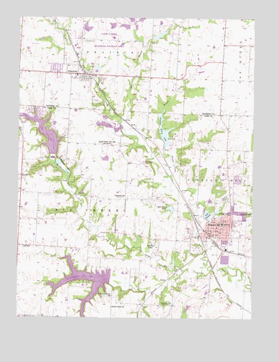
Pleasant Hill, MO USGS Topographic Map
Click on map above to begin viewing in our Map Viewer.

This topographic map contains these locations and features:
Feature Name Type Latitude Longitude GNIS ID View Map
Allendale DamDamN38.8167°W94.3536°763232View Map
Allendale LakeReservoirN38.8167°W94.3536°763233View Map
Allendale LakesReservoirN38.8142°W94.3538°713226View Map
AvonPopulated PlaceN38.8303°W94.3158°740645View Map
Bluestem Lake DamDamN38.8717°W94.3252°762857View Map
Bodarc Lake DamDamN38.8717°W94.3152°762862View Map
Brush College Number 2 School (historical)SchoolN38.8225°W94.3255°755014View Map
City of GreenwoodCivilN38.8508°W94.3378°2394246View Map
City of Lake WinnebagoCivilN38.8234°W94.3612°2395607View Map
City of Pleasant HillCivilN38.8061°W94.2655°2396231View Map
Coot LakeReservoirN38.8708°W94.3391°762867View Map
Crossroads SchoolSchoolN38.8000°W94.3202°740783View Map
Dogwood Energy FacilityLocaleN38.7931°W94.3011°2477721View Map
East BranchStreamN38.8320°W94.3194°717253View Map
Elmo School (historical)SchoolN38.8092°W94.3741°729881View Map
Fairview Farms Lake DamDamN38.8667°W94.3036°762941View Map
Franklin LakesReservoirN38.7803°W94.3016°718166View Map
Gopher Lake DamDamN38.8733°W94.3152°762864View Map
GowdyPopulated PlaceN38.7656°W94.2972°740880View Map
GreenwoodPopulated PlaceN38.8517°W94.3438°718834View Map
Greenwood CemeteryCemeteryN38.8653°W94.3408°718837View Map
Greenwood Elementary SchoolSchoolN38.8509°W94.3443°2477847View Map
Greenwood Police DepartmentBuildingN38.8512°W94.3435°2752445View Map
Greenwood Post OfficePost OfficeN38.8507°W94.3419°2477763View Map
Haake LakeReservoirN38.7546°W94.2844°763273View Map
Haake Lake DamDamN38.7550°W94.2819°763272View Map
Harrisonville City LakeReservoirN38.7674°W94.3426°719167View Map
Harrisonville City Lake DamDamN38.7650°W94.3269°762930View Map
Hickory Grove ChurchChurchN38.7550°W94.3255°719465View Map
Hickory Grove School (historical)SchoolN38.7595°W94.3247°719474View Map
Inter-State AirportAirportN38.7738°W94.3335°758868View Map
Judy School (historical)SchoolN38.7800°W94.3722°720451View Map
Kellogg LakeReservoirN38.7947°W94.2699°720509View Map
Lake WinnebagoPopulated PlaceN38.8314°W94.3586°1669601View Map
Lake WinnebagoReservoirN38.8272°W94.3621°729008View Map
Lake Winnebago DamDamN38.8183°W94.3569°763224View Map
Lake Winnebago Municipal Airport (historical)AirportN38.8142°W94.3088°758774View Map
Loch LeonardReservoirN38.7933°W94.2739°758303View Map
Loch Leonard DamDamN38.7917°W94.2752°763220View Map
Lone Star School (historical)SchoolN38.7556°W94.2924°721484View Map
Maple Grove School (historical)SchoolN38.8522°W94.3749°746665View Map
Middle Big CreekStreamN38.7697°W94.2722°722266View Map
Mononame 697 DamDamN38.8017°W94.3419°763236View Map
Nelly Don LakeReservoirN38.8674°W94.3011°762942View Map
Pleasant HillPopulated PlaceN38.7875°W94.2694°724514View Map
Pleasant Hill CemeteryCemeteryN38.8047°W94.2661°724517View Map
Pleasant Hill Elementary SchoolSchoolN38.7894°W94.2662°2477898View Map
Pleasant Hill Fire Protection DistrictBuildingN38.7848°W94.2726°2621702View Map
Pleasant Hill High SchoolSchoolN38.7867°W94.2536°2545271View Map
Pleasant Hill Intermediate SchoolSchoolN38.8189°W94.2591°2545206View Map
Pleasant Hill LakeReservoirN38.8278°W94.2976°758329View Map
Pleasant Hill Lake DamDamN38.8217°W94.2969°762820View Map
Pleasant Hill Middle SchoolSchoolN38.7892°W94.2600°2545474View Map
Pleasant Hill Police DepartmentBuildingN38.7850°W94.2727°2752102View Map
Pleasant Hill Post OfficePost OfficeN38.7856°W94.2731°2782915View Map
Pleasant Hill Primary SchoolSchoolN38.7897°W94.2559°2545397View Map
Pleasant Hill Wastewater Treatment FacilityLocaleN38.7767°W94.2633°2477737View Map
Reed Area Number 10 LakeReservoirN38.8717°W94.3254°762858View Map
Reed Area Number 3 DamDamN38.8700°W94.3402°762866View Map
Reed Area Number 9 LakeReservoirN38.8714°W94.3186°762863View Map
Richlawn (historical)LocaleN38.8333°W94.3744°745612View Map
Riordan AirportAirportN38.7832°W94.3667°758869View Map
Rock Island LakeReservoirN38.7956°W94.2935°725462View Map
South Metropolitan Fire Protection District Station 2BuildingN38.8227°W94.3739°2620835View Map
Swan LakeReservoirN38.8164°W94.3286°763279View Map
Swan Lake DamDamN38.8167°W94.3269°763278View Map
Township of Big CreekCivilN38.7935°W94.3459°766432View Map
Township of Pleasant HillCivilN38.7697°W94.2629°766442View Map
Union CemeteryCemeteryN38.7997°W94.3022°727962View Map
White Cloud School (historical)SchoolN38.8542°W94.2674°746666View Map
Wilson CreekStreamN38.8095°W94.2963°728968View Map
Woodland School (historical)SchoolN38.8592°W94.3047°746664View Map
Wyoming (historical)Populated PlaceN38.7875°W94.2724°1829040View Map

Note: Coordinates in the location and feature list above are referenced to NAD83 datum.


Copyright (C) 2008-2024 Ryan Niemi / Sunset Dynamics ... All Rights Reserved