TopoQuest Logo
Do you find TopoQuest useful?
Help keep TopoQuest running and adding new maps/features by donating!
Bitcoin:  19c7KJd3qBynnjoSw5npx9KScwjBe4ifkT
Litecoin:  LXs6TkuXGGXo1vDsWCkWVdjQX94eUKd6ui
Home View Maps Find Maps Find Places Resources & Links


Raymore, Missouri Topographic Map

USGS Map Title: Raymore, MO
USGS Map MRC: 38094G4
DRG (GeoTIFF) Download: o38094g4.tif


Neighboring USGS Topographic Map Quads:


  Grandview, MO  
38094H5
 

  Lees Summit, MO  
38094H4
 

  Lake Jacomo, MO  
38094H3
 

  Belton, MO  
38094G5
 

  Raymore, MO  
38094G4
 

  Pleasant Hill, MO  
38094G3
 

  West Line, MO  
38094F5
 

  Peculiar, MO  
38094F4
 

  Harrisonville, MO  
38094F3


Map MRC Location:

N39°
W95°
N39°
W94°
H8 H7 H6 H5 H4 H3 H2 H1
G8 G7 G6 G5 G4 G3 G2 G1
F8 F7 F6 F5 F4 F3 F2 F1
E8 E7 E6 E5 E4 E3 E2 E1
D8 D7 D6 D5 D4 D3 D2 D1
C8 C7 C6 C5 C4 C3 C2 C1
B8 B7 B6 B5 B4 B3 B2 B1
A8 A7 A6 A5 A4 A3 A2 A1
N38°
W95°
N38°
W94°

Raymore, MO USGS 1:24K Topographic Map Preview:
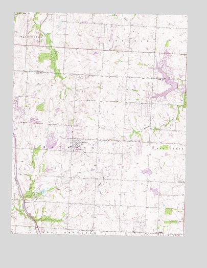
Raymore, MO USGS Topographic Map
Click on map above to begin viewing in our Map Viewer.

This topographic map contains these locations and features:
Feature Name Type Latitude Longitude GNIS ID View Map
Alexander CreekStreamN38.8336°W94.3772°713202View Map
Bethany ChurchChurchN38.7806°W94.3755°714019View Map
Bridle Ridge Intermediate SchoolSchoolN38.7692°W94.4719°2545182View Map
City of RaymoreCivilN38.8029°W94.4582°2396328View Map
ColemanPopulated PlaceN38.7514°W94.3947°740758View Map
Creekmoor Elementary SchoolSchoolN38.8283°W94.4803°2545181View Map
Delavan (historical)Populated PlaceN38.8700°W94.4627°767628View Map
Eagle Glen Intermediate SchoolSchoolN38.8060°W94.4809°2545183View Map
Falcon HelipadAirportN38.8078°W94.4475°758884View Map
HarrelsonPopulated PlaceN38.7689°W94.4913°740907View Map
Hawthorn Hill Elementary SchoolSchoolN38.8697°W94.4143°2477848View Map
High Mound School (historical)SchoolN38.8542°W94.4169°746662View Map
Johnson LakeReservoirN38.8200°W94.4680°763304View Map
Johnson Lake DamDamN38.8217°W94.4686°763303View Map
KCFX-FM (Harrisonville)TowerN38.7572°W94.4344°754241View Map
Kentucky Trail Elementary SchoolSchoolN38.8265°W94.4950°2545476View Map
Kinehaven Farm (historical)LocaleN38.8558°W94.4619°746661View Map
KZKC-TV (Kansas City)TowerN38.7572°W94.4344°759318View Map
Lake Winnebago Police DepartmentBuildingN38.8343°W94.3750°2752574View Map
Larga Vista ForkStreamN38.8689°W94.4853°2573472View Map
Lee's Summit Fire Department Station 5BuildingN38.8534°W94.3876°2620431View Map
Lee's Summit West High SchoolSchoolN38.8727°W94.3999°2477871View Map
Miller HillSummitN38.7814°W94.4347°722378View Map
Mononame 87 DamDamN38.8517°W94.4419°763016View Map
Mononame 88 DamDamN38.8683°W94.4686°763017View Map
Raintree Lake DamDamN38.8350°W94.3819°763284View Map
RaymorePopulated PlaceN38.8020°W94.4527°725135View Map
Raymore CemeteryCemeteryN38.7981°W94.4488°725136View Map
Raymore City Police DepartmentBuildingN38.8101°W94.4676°2752563View Map
Raymore Elementary SchoolSchoolN38.7990°W94.4581°745911View Map
Raymore International Airport (historical)AirportN38.8095°W94.4522°758885View Map
Raymore Junction (historical)LocaleN38.7781°W94.4183°740271View Map
Raymore Post OfficePost OfficeN38.8110°W94.4560°2477777View Map
Rosedale School (historical)SchoolN38.8542°W94.4500°746663View Map
Silver LakeReservoirN38.7996°W94.4716°762900View Map
Silverlake Enterprizes Lake DamDamN38.7983°W94.4736°762899View Map
Sims LakeReservoirN38.7862°W94.4025°763306View Map
Sims Lake DamDamN38.7867°W94.4002°763305View Map
South Metropolitan Fire Protection District Station 1BuildingN38.8113°W94.4631°2620275View Map
South Metropolitan Fire Protection District Station 3BuildingN38.7678°W94.4734°2620618View Map
Stonegate Elementary SchoolSchoolN38.7906°W94.4824°2477520View Map
Summit Lakes Middle SchoolSchoolN38.8564°W94.3871°2477521View Map
Summit Pointe Elementary SchoolSchoolN38.8556°W94.4339°2545128View Map
Summit Ridge AcademySchoolN38.8727°W94.4001°2545138View Map
Timber Creek Elementary SchoolSchoolN38.8148°W94.4458°2477526View Map
Township of RaymoreCivilN38.7968°W94.4575°766444View Map
Trailridge Elementary SchoolSchoolN38.8543°W94.3859°2477528View Map
Uhlmann LakeReservoirN38.7751°W94.3967°763308View Map
Uhlmann Lake DamDamN38.7750°W94.3952°763307View Map
Welborn Development Incorporated LakeReservoirN38.7864°W94.4741°763235View Map
Welborn Development Incorporated Lake DamDamN38.7850°W94.4752°763234View Map

Note: Coordinates in the location and feature list above are referenced to NAD83 datum.


Copyright (C) 2008-2024 Ryan Niemi / Sunset Dynamics ... All Rights Reserved