TopoQuest Logo
Do you find TopoQuest useful?
Help keep TopoQuest running and adding new maps/features by donating!
Bitcoin:  19c7KJd3qBynnjoSw5npx9KScwjBe4ifkT
Litecoin:  LXs6TkuXGGXo1vDsWCkWVdjQX94eUKd6ui
Home View Maps Find Maps Find Places Resources & Links


Soda Springs, Idaho Topographic Map

USGS Map Title: Soda Springs, ID
USGS Map MRC: 42111F5
DRG (GeoTIFF) Download: o42111f5.tif


Neighboring USGS Topographic Map Quads:


  The Dip, ID  
42111G6
 

  China Hat, ID  
42111G5
 

  Lower Valley, ID  
42111G4
 

  Alexander, ID  
42111F6
 

  Soda Springs, ID  
42111F5
 

  Johnson Creek, ID  
42111F4
 

  Grace, ID  
42111E6
 

  Soda Peak, ID  
42111E5
 

  Fossil Canyon, ID  
42111E4


Map MRC Location:

N43°
W112°
N43°
W111°
H8 H7 H6 H5 H4 H3 H2 H1
G8 G7 G6 G5 G4 G3 G2 G1
F8 F7 F6 F5 F4 F3 F2 F1
E8 E7 E6 E5 E4 E3 E2 E1
D8 D7 D6 D5 D4 D3 D2 D1
C8 C7 C6 C5 C4 C3 C2 C1
B8 B7 B6 B5 B4 B3 B2 B1
A8 A7 A6 A5 A4 A3 A2 A1
N42°
W112°
N42°
W111°

Soda Springs, ID USGS 1:24K Topographic Map Preview:
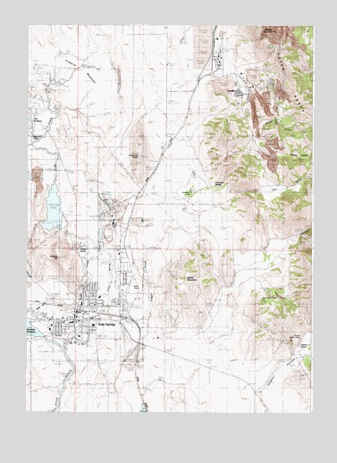
Soda Springs, ID USGS Topographic Map
Click on map above to begin viewing in our Map Viewer.

This topographic map contains these locations and features:
Feature Name Type Latitude Longitude GNIS ID View Map
Allen H Tigert AirportAirportN42.6481°W111.5814°400932View Map
Beker Tailings Number Three DamDamN42.7416°W111.5524°398969View Map
Big Spring CreekStreamN42.6455°W111.6083°371529View Map
Caribou County Fire DepartmentBuildingN42.6550°W111.5854°2619290View Map
Caribou County Sheriff's OfficeBuildingN42.6553°W111.5896°2722443View Map
Caribou Emergency Medical Services Soda SpringsBuildingN42.6559°W111.6050°2642827View Map
Caribou Memorial HospitalHospitalN42.6516°W111.6147°2721839View Map
Chester HillSummitN42.6749°W111.6122°371987View Map
City of Soda SpringsCivilN42.6590°W111.5878°2411921View Map
CondaPopulated PlaceN42.7283°W111.5324°397567View Map
Conda MineMineN42.7288°W111.5274°372104View Map
Conda Site Tailings DamDamN42.7299°W111.5341°398970View Map
Dewey Sulphur MineLocaleN42.6480°W111.5097°376338View Map
Fivemile MeadowsFlatN42.7330°W111.6091°372717View Map
Formation SpringSpringN42.6982°W111.5432°395394View Map
Hooper SchoolSchoolN42.6602°W111.6011°401496View Map
Hooper SpringSpringN42.6791°W111.6042°373129View Map
Howard E Thirkill Primary SchoolSchoolN42.6496°W111.6022°401375View Map
Idaho Sulphur MineLocaleN42.6633°W111.5152°376346View Map
Jouglard CanyonValleyN42.7085°W111.5133°395538View Map
KBRV-AM (Soda Springs)TowerN42.6416°W111.6119°401749View Map
Kelly ParkParkN42.6655°W111.5791°395546View Map
KFIS-FM (Soda Springs)TowerN42.6416°W111.6119°401801View Map
Little Spring CreekStreamN42.6471°W111.6074°373671View Map
Mammoth SpringSpringN42.7135°W111.6237°395672View Map
Middle Sulphur CanyonValleyN42.6421°W111.5063°386874View Map
North Sulphur CanyonValleyN42.6421°W111.5061°387853View Map
Rabbit MountainSummitN42.6688°W111.5558°374561View Map
Shield CanyonValleyN42.7230°W111.5308°390318View Map
Soda CreekStreamN42.6546°W111.6211°375107View Map
Soda Creek DamDamN42.6866°W111.6091°398668View Map
Soda SpringsPopulated PlaceN42.6544°W111.6047°400099View Map
Soda Springs Fire DepartmentBuildingN42.6566°W111.6030°2618962View Map
Soda Springs High SchoolSchoolN42.6621°W111.5933°401155View Map
Soda Springs Junior High SchoolSchoolN42.6533°W111.5958°401154View Map
Soda Springs Police DepartmentBuildingN42.6550°W111.5990°2722454View Map
Soda Springs Post OfficePost OfficeN42.6538°W111.6041°2781741View Map
South Sulphur CanyonValleyN42.6421°W111.5063°391078View Map
Sulphur SpringSpringN42.6454°W111.5043°400120View Map
The ReservoirLakeN42.7191°W111.6236°375476View Map
Threemile KnollSummitN42.7083°W111.5763°375510View Map
Trail CanyonValleyN42.6927°W111.5361°392266View Map
Wood CanyonValleyN42.6796°W111.5105°393647View Map

Note: Coordinates in the location and feature list above are referenced to NAD83 datum.


Copyright (C) 2008-2024 Ryan Niemi / Sunset Dynamics ... All Rights Reserved