TopoQuest Logo
Do you find TopoQuest useful?
Help keep TopoQuest running and adding new maps/features by donating!
Bitcoin:  19c7KJd3qBynnjoSw5npx9KScwjBe4ifkT
Litecoin:  LXs6TkuXGGXo1vDsWCkWVdjQX94eUKd6ui
Home View Maps Find Maps Find Places Resources & Links


Johnson Creek, Idaho Topographic Map

USGS Map Title: Johnson Creek, ID
USGS Map MRC: 42111F4
DRG (GeoTIFF) Download: o42111f4.tif


Neighboring USGS Topographic Map Quads:


  China Hat, ID  
42111G5
 

  Lower Valley, ID  
42111G4
 

  Upper Valley, ID  
42111G3
 

  Soda Springs, ID  
42111F5
 

  Johnson Creek, ID  
42111F4
 

  Dry Valley, ID  
42111F3
 

  Soda Peak, ID  
42111E5
 

  Fossil Canyon, ID  
42111E4
 

  Harrington Peak, ID  
42111E3


Map MRC Location:

N43°
W112°
N43°
W111°
H8 H7 H6 H5 H4 H3 H2 H1
G8 G7 G6 G5 G4 G3 G2 G1
F8 F7 F6 F5 F4 F3 F2 F1
E8 E7 E6 E5 E4 E3 E2 E1
D8 D7 D6 D5 D4 D3 D2 D1
C8 C7 C6 C5 C4 C3 C2 C1
B8 B7 B6 B5 B4 B3 B2 B1
A8 A7 A6 A5 A4 A3 A2 A1
N42°
W112°
N42°
W111°

Johnson Creek, ID USGS 1:24K Topographic Map Preview:
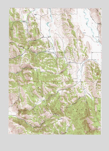
Johnson Creek, ID USGS Topographic Map
Click on map above to begin viewing in our Map Viewer.

This topographic map contains these locations and features:
Feature Name Type Latitude Longitude GNIS ID View Map
Aspen RangeRangeN42.6808°W111.4716°376759View Map
Bennett RanchLocaleN42.7474°W111.4627°377373View Map
Burchertt CanyonValleyN42.6652°W111.3974°378511View Map
Burchertt SpringSpringN42.6523°W111.4174°378512View Map
Caldwell CanyonValleyN42.7408°W111.3797°378702View Map
Caribou National ForestForestN42.6483°W111.4384°1448228View Map
Columbia River Great Basin DivideRidgeN42.6863°W111.4538°379593View Map
Dry ForkStreamN42.6769°W111.4077°380850View Map
Finlayson RanchLocaleN42.7246°W111.4488°381690View Map
G PortalMineN42.7324°W111.4988°382137View Map
Jougelard RanchLocaleN42.7396°W111.4813°384030View Map
Junction SpringSpringN42.6950°W111.4187°384059View Map
Meadow SpringSpringN42.6379°W111.3808°386722View Map
Petterson CanyonValleyN42.6674°W111.3935°388383View Map
Saddle SpringSpringN42.6330°W111.3783°389789View Map
Simplot Number Six Tailings DamDamN42.7333°W111.4774°398895View Map
Sulphur PeakSummitN42.6421°W111.4283°391606View Map
Vent RanchLocaleN42.7269°W111.3786°392718View Map
Wolf MountainSummitN42.6766°W111.3819°397316View Map

Note: Coordinates in the location and feature list above are referenced to NAD83 datum.


Copyright (C) 2008-2024 Ryan Niemi / Sunset Dynamics ... All Rights Reserved