TopoQuest Logo
Do you find TopoQuest useful?
Help keep TopoQuest running and adding new maps/features by donating!
Bitcoin:  19c7KJd3qBynnjoSw5npx9KScwjBe4ifkT
Litecoin:  LXs6TkuXGGXo1vDsWCkWVdjQX94eUKd6ui
Home View Maps Find Maps Find Places Resources & Links


Snowy Mountain, West Virginia Topographic Map

USGS Map Title: Snowy Mountain, WV
USGS Map MRC: 38079E5
DRG (GeoTIFF) Download: o38079e5.tif


Neighboring USGS Topographic Map Quads:


  Sinks of Gandy, WV  
38079F6
 

  Spruce Knob, WV  
38079F5
 

  Circleville, WV  
38079F4
 

  Thornwood, WV  
38079E6
 

  Snowy Mountain, WV  
38079E5
 

  Moatstown, WV  
38079E4
 

  Hightown, VA  
38079D6
 

  Monterey, VA  
38079D5
 

  Doe Hill, VA  
38079D4


Map MRC Location:

N39°
W80°
N39°
W79°
H8 H7 H6 H5 H4 H3 H2 H1
G8 G7 G6 G5 G4 G3 G2 G1
F8 F7 F6 F5 F4 F3 F2 F1
E8 E7 E6 E5 E4 E3 E2 E1
D8 D7 D6 D5 D4 D3 D2 D1
C8 C7 C6 C5 C4 C3 C2 C1
B8 B7 B6 B5 B4 B3 B2 B1
A8 A7 A6 A5 A4 A3 A2 A1
N38°
W80°
N38°
W79°

Snowy Mountain, WV USGS 1:24K Topographic Map Preview:
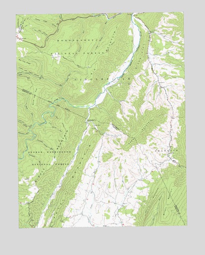
Snowy Mountain, WV USGS Topographic Map
Click on map above to begin viewing in our Map Viewer.

This topographic map contains these locations and features:
Feature Name Type Latitude Longitude GNIS ID View Map
Bee Tree RidgeRidgeN38.5973°W79.6228°1550244View Map
Big MountainSummitN38.5921°W79.5650°1550301View Map
Big Mountain TrailTrailN38.6193°W79.5487°1550302View Map
Blue GrassPopulated PlaceN38.5001°W79.5498°1481852View Map
Blue Grass CemeteryCemeteryN38.5015°W79.5509°1481853View Map
Bluegrass ValleyValleyN38.5009°W79.5684°1481878View Map
Brushy MountainSummitN38.5232°W79.5081°1482073View Map
Buck RunStreamN38.5615°W79.6112°1482123View Map
Bud HollowValleyN38.6118°W79.6014°1550541View Map
Christian RunStreamN38.5532°W79.6114°1482530View Map
Christian Run TrailTrailN38.5471°W79.6020°1482531View Map
Cold SpringSpringN38.5959°W79.5706°1677778View Map
Cold Spring RunStreamN38.5623°W79.6034°1482631View Map
Cold Spring RunStreamN38.6212°W79.5553°1550763View Map
Devils BackboneRidgeN38.5140°W79.5262°1482986View Map
Dry RunStreamN38.6221°W79.5387°1550984View Map
Dry RunPopulated PlaceN38.6129°W79.5248°1550971View Map
Dry Run ChurchChurchN38.5837°W79.5187°1550989View Map
East Dry Run ChurchChurchN38.5423°W79.5125°1551009View Map
Elk Mountain ChapelChurchN38.6107°W79.6220°1551031View Map
HardscrabblePopulated PlaceN38.5615°W79.5731°1499527View Map
Hemlock RunStreamN38.6223°W79.5748°1551408View Map
Hendrick Farm SpringSpringN38.5987°W79.5387°1677779View Map
Knotmaul RunStreamN38.5457°W79.6178°1484630View Map
Laurel ForkStreamN38.5704°W79.5703°1484703View Map
Laurel ForkStreamN38.5704°W79.5706°1551711View Map
Laurel Fork TrailTrailN38.5604°W79.6056°1484707View Map
Leonard Spring HollowValleyN38.6212°W79.5906°1551779View Map
Little Low Place HollowValleyN38.5879°W79.6070°1551874View Map
Locust Spring RunStreamN38.5598°W79.6126°1485025View Map
Middle MountainSummitN38.5187°W79.6209°1485379View Map
Middle Mountain TrailTrailN38.5635°W79.5937°1485381View Map
Middle Ridge HollowValleyN38.6173°W79.5942°1552088View Map
New ChurchChurchN38.5132°W79.5473°1485839View Map
North Fork ChurchChurchN38.6237°W79.5381°1552328View Map
Owl Knob HollowValleyN38.5912°W79.6201°1552402View Map
River HillSummitN38.5918°W79.5353°1555484View Map
Sams RunStreamN38.5826°W79.5909°1552786View Map
Sawmill BranchStreamN38.6248°W79.5603°1552809View Map
Slabcamp RunStreamN38.5568°W79.6159°1487293View Map
Snowy MountainSummitN38.5537°W79.5337°1500132View Map
Straight ForkStreamN38.5726°W79.5714°1553093View Map
Straight ForkStreamN38.5704°W79.5703°1487655View Map
Swank ChapelChurchN38.5593°W79.5678°1487748View Map
Teeter Camp RunStreamN38.6234°W79.5662°1553192View Map
The StampSummitN38.5290°W79.6164°1487855View Map
Vance RunStreamN38.5754°W79.5898°1553341View Map
White Oak FlatFlatN38.5776°W79.6103°1553424View Map
White Oak FlatFlatN38.5762°W79.6109°1488295View Map

Note: Coordinates in the location and feature list above are referenced to NAD83 datum.


Copyright (C) 2008-2024 Ryan Niemi / Sunset Dynamics ... All Rights Reserved