TopoQuest Logo
Do you find TopoQuest useful?
Help keep TopoQuest running and adding new maps/features by donating!
Bitcoin:  19c7KJd3qBynnjoSw5npx9KScwjBe4ifkT
Litecoin:  LXs6TkuXGGXo1vDsWCkWVdjQX94eUKd6ui
Home View Maps Find Maps Find Places Resources & Links


Hightown, Virginia Topographic Map

USGS Map Title: Hightown, VA
USGS Map MRC: 38079D6
DRG (GeoTIFF) Download: o38079d6.tif


Neighboring USGS Topographic Map Quads:


  Durbin, WV  
38079E7
 

  Thornwood, WV  
38079E6
 

  Snowy Mountain, WV  
38079E5
 

  Green Bank, WV  
38079D7
 

  Hightown, VA  
38079D6
 

  Monterey, VA  
38079D5
 

  Paddy Knob, WV  
38079C7
 

  Mustoe, VA  
38079C6
 

  Monterey SE, VA  
38079C5


Map MRC Location:

N39°
W80°
N39°
W79°
H8 H7 H6 H5 H4 H3 H2 H1
G8 G7 G6 G5 G4 G3 G2 G1
F8 F7 F6 F5 F4 F3 F2 F1
E8 E7 E6 E5 E4 E3 E2 E1
D8 D7 D6 D5 D4 D3 D2 D1
C8 C7 C6 C5 C4 C3 C2 C1
B8 B7 B6 B5 B4 B3 B2 B1
A8 A7 A6 A5 A4 A3 A2 A1
N38°
W80°
N38°
W79°

Hightown, VA USGS 1:24K Topographic Map Preview:
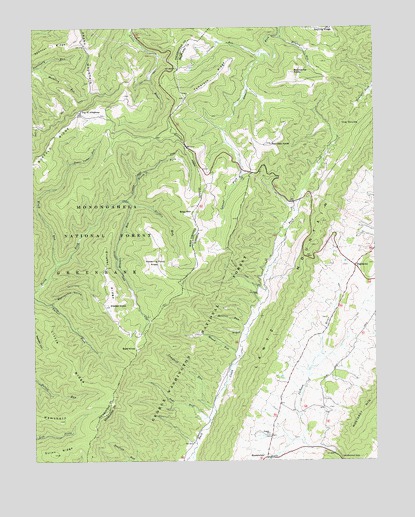
Hightown, VA USGS Topographic Map
Click on map above to begin viewing in our Map Viewer.

This topographic map contains these locations and features:
Feature Name Type Latitude Longitude GNIS ID View Map
Bald KnobSummitN38.4073°W79.7123°1495224View Map
Bare RidgeRidgeN38.4571°W79.7276°1560638View Map
Bear MountainSummitN38.4468°W79.6906°1495245View Map
Bearcamp KnobSummitN38.4871°W79.6534°1481534View Map
Blights RunStreamN38.4979°W79.6581°1481847View Map
Block RunStreamN38.4315°W79.7414°1550390View Map
Blue Grass DistrictCivilN38.4264°W79.6618°1927102View Map
Broad RunStreamN38.4046°W79.6742°1482014View Map
Campbell RunStreamN38.3896°W79.6837°1482289View Map
Collins RunStreamN38.4923°W79.6659°1482657View Map
Elleber KnobSummitN38.4201°W79.7226°1551049View Map
Elleber RidgeRidgeN38.4287°W79.7228°1551050View Map
Elleber RunStreamN38.4501°W79.7167°1551051View Map
Griffin RunStreamN38.4490°W79.7137°1551305View Map
Guinn RidgeRidgeN38.3782°W79.7476°1551308View Map
Hevener RunStreamN38.4132°W79.6712°1484051View Map
HightownPopulated PlaceN38.4312°W79.6317°1495691View Map
Little RidgeRidgeN38.4048°W79.7376°1551883View Map
MeadowdalePopulated PlaceN38.3762°W79.6651°1495926View Map
Mount Hobart CemeteryCemeteryN38.4843°W79.7287°1728119View Map
Mount Hobart Methodist Church (historical)ChurchN38.4840°W79.7287°1728120View Map
Mountain PathTrailN38.4296°W79.6731°1485682View Map
Mulberry RunStreamN38.4890°W79.7481°1552262View Map
Page RunStreamN38.3871°W79.6851°1486037View Map
Pisgah ChurchChurchN38.3829°W79.6639°1486279View Map
Rattlesnake HollowValleyN38.4207°W79.7431°1552586View Map
Rattlesnake TrailTrailN38.4257°W79.7326°1552588View Map
Red Oak KnobSummitN38.4662°W79.6623°1486539View Map
Spencer RidgeRidgeN38.4954°W79.7426°1552990View Map
Sugar Camp RunStreamN38.4607°W79.7362°1553110View Map
Summit School (historical)SchoolN38.4315°W79.6906°1728168View Map
Tamarack RidgeRidgeN38.4857°W79.6817°1487768View Map
The DivideRidgeN38.4721°W79.6342°1487823View Map
Top Allegheny Chapel (historical)ChurchN38.4757°W79.7320°1728179View Map
Top of AlleghenyLocaleN38.4757°W79.7323°1553250View Map
Vanderpool GapGapN38.3754°W79.6373°1488109View Map
Watering Pond KnobSummitN38.4337°W79.7056°1555925View Map

Note: Coordinates in the location and feature list above are referenced to NAD83 datum.


Copyright (C) 2008-2024 Ryan Niemi / Sunset Dynamics ... All Rights Reserved