TopoQuest Logo
Do you find TopoQuest useful?
Help keep TopoQuest running and adding new maps/features by donating!
Bitcoin:  19c7KJd3qBynnjoSw5npx9KScwjBe4ifkT
Litecoin:  LXs6TkuXGGXo1vDsWCkWVdjQX94eUKd6ui
Home View Maps Find Maps Find Places Resources & Links


Rockford, Minnesota Topographic Map

USGS Map Title: Rockford, MN
USGS Map MRC: 45093A6
DRG (GeoTIFF) Download: o45093a6.tif


Neighboring USGS Topographic Map Quads:


  Buffalo East, MN  
45093B7
 

  Saint Michael, MN  
45093B6
 

  Rogers, MN  
45093B5
 

  Delano, MN  
45093A7
 

  Rockford, MN  
45093A6
 

  Hamel, MN  
45093A5
 

  Watertown, MN  
44093H7
 

  Mound, MN  
44093H6
 

  Excelsior, MN  
44093H5


Map MRC Location:

N46°
W94°
N46°
W93°
H8 H7 H6 H5 H4 H3 H2 H1
G8 G7 G6 G5 G4 G3 G2 G1
F8 F7 F6 F5 F4 F3 F2 F1
E8 E7 E6 E5 E4 E3 E2 E1
D8 D7 D6 D5 D4 D3 D2 D1
C8 C7 C6 C5 C4 C3 C2 C1
B8 B7 B6 B5 B4 B3 B2 B1
A8 A7 A6 A5 A4 A3 A2 A1
N45°
W94°
N45°
W93°

Rockford, MN USGS 1:24K Topographic Map Preview:
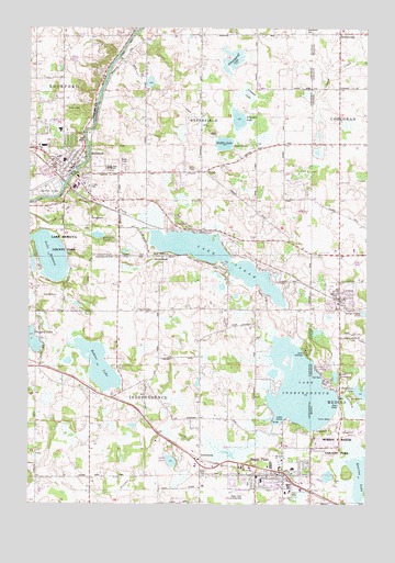
Rockford, MN USGS Topographic Map
Click on map above to begin viewing in our Map Viewer.

This topographic map contains these locations and features:
Feature Name Type Latitude Longitude GNIS ID View Map
Academy of Saints Peter and PaulSchoolN45.0541°W93.6335°2433450View Map
Anna Mason CemeteryCemeteryN45.0056°W93.6472°2101117View Map
ArmstrongPopulated PlaceN45.0114°W93.6869°654573View Map
BurschvillePopulated PlaceN45.1250°W93.6364°640684View Map
Burschville Post Office (historical)Post OfficeN45.1247°W93.6361°2101185View Map
Camp IhduhapiLocaleN45.0402°W93.6475°640805View Map
Carver ParkParkN45.0917°W93.7389°2067446View Map
Christ Lutheran ChurchChurchN45.0081°W93.6525°2104078View Map
City of GreenfieldCivilN45.0997°W93.6884°2394988View Map
City of IndependenceCivilN45.0219°W93.7076°2395420View Map
City of LorettoCivilN45.0548°W93.6353°2395764View Map
City of Maple PlainCivilN45.0088°W93.6618°2395841View Map
City of RockfordCivilN45.0921°W93.7453°2396406View Map
County Ditch Number NineCanalN45.1061°W93.6975°1815379View Map
County Sheriff's OfficeBuildingN45.0871°W93.6851°2104113View Map
Cross Evangelical Lutheran ChurchChurchN45.0883°W93.7350°2067439View Map
Crow River ReservoirReservoirN45.1000°W93.6669°1776426View Map
Elm Hill SchoolSchoolN45.0869°W93.7075°643299View Map
Elmwood CemeteryCemeteryN45.0936°W93.7319°2067448View Map
Evergreen Grove SchoolSchoolN45.0508°W93.7050°643469View Map
Faith Community ChurchChurchN45.0111°W93.6856°2104079View Map
GreenfieldPopulated PlaceN45.1033°W93.6914°1669530View Map
Greenfield City HallBuildingN45.0875°W93.7033°2104115View Map
Greenfield Fire DepartmentBuildingN45.0875°W93.7033°2104114View Map
Greenwood CemeteryCemeteryN45.1237°W93.6465°659555View Map
Hafften LakeLakeN45.0946°W93.6785°645278View Map
Halfmoon LakeLakeN45.0295°W93.6266°644577View Map
Haughey LakeLakeN45.0426°W93.7484°645279View Map
IndependencePopulated PlaceN45.0252°W93.7075°645396View Map
Ingleside AirportAirportN45.0632°W93.6568°660263View Map
Jehovah's WitnessesChurchN45.0889°W93.7272°2104121View Map
Katrina LakeLakeN45.0079°W93.6256°650033View Map
L and S OrchardsLocaleN45.0397°W93.7436°2663762View Map
Lake ArdmoreLakeN45.0336°W93.6367°659548View Map
Lake IndependenceLakeN45.0300°W93.6496°645398View Map
Lake IreneLakeN45.0112°W93.6974°662880View Map
Lake RebeccaLakeN45.0649°W93.7423°649859View Map
Lake Rebecca County ParkParkN45.0650°W93.7011°659550View Map
Lake SarahPopulated PlaceN45.0719°W93.6902°646390View Map
Lake SarahLakeN45.0645°W93.6813°651210View Map
Lake Sarah Post Office (historical)Post OfficeN45.0719°W93.6900°2101155View Map
Lewis CemeteryCemeteryN45.0085°W93.6854°646618View Map
LorettoPopulated PlaceN45.0547°W93.6355°647188View Map
Loretto City HallBuildingN45.0547°W93.6353°2104110View Map
Loretto Post OfficePost OfficeN45.0547°W93.6353°2104111View Map
Loretto StationLocaleN45.0536°W93.6353°2104108View Map
Loretto Volunteer Fire DepartmentBuildingN45.0550°W93.6348°2104109View Map
Maple AirportAirportN45.0028°W93.6718°659549View Map
Maple Hill ParkParkN45.0202°W93.6358°647475View Map
Maple PlainLocaleN45.0064°W93.6553°2104087View Map
Maple PlainPopulated PlaceN45.0072°W93.6558°647497View Map
Maple Plain Community ChurchChurchN45.0117°W93.6561°2104080View Map
Maple Plain Fire DepartmentBuildingN45.0085°W93.6636°2104083View Map
Maple Plain LibraryBuildingN45.0078°W93.6550°2104081View Map
Maple Plain Police DepartmentBuildingN45.0056°W93.6700°2104084View Map
Maple Plain Post OfficePost OfficeN45.0074°W93.6554°2104082View Map
Mill Pond DamDamN45.1000°W93.6669°1776425View Map
North Memorial Ambulance Service LorettoBuildingN45.0550°W93.6347°2721335View Map
Orono Primary SchoolSchoolN45.0094°W93.6514°2104085View Map
Perkinsville Post Office (historical)Post OfficeN45.0194°W93.6528°2101135View Map
Rattail LakeLakeN45.0704°W93.7250°659553View Map
Riverwood Covenant ChurchChurchN45.0806°W93.7264°2104122View Map
Robina LakeLakeN45.0362°W93.7242°648228View Map
RockfordLocaleN45.0875°W93.7417°2067441View Map
RockfordPopulated PlaceN45.0883°W93.7344°650206View Map
Rockford Baptist ChurchChurchN45.0883°W93.7342°2067436View Map
Rockford Christian and Missionary ChurchChurchN45.0981°W93.7361°2067438View Map
Rockford City HallBuildingN45.0889°W93.7344°2067443View Map
Rockford Elementary Arts Magnet SchoolSchoolN45.0889°W93.7232°2432914View Map
Rockford Elementary SchoolSchoolN45.0981°W93.7389°2067445View Map
Rockford High SchoolSchoolN45.0881°W93.7206°2104123View Map
Rockford Middle SchoolSchoolN45.0903°W93.7373°2067444View Map
Rockford Post OfficePost OfficeN45.0939°W93.7455°2067510View Map
Rockford Public LibraryBuildingN45.0883°W93.7342°2067442View Map
Rockford Riverview EstatesPopulated PlaceN45.0833°W93.7417°2067447View Map
Rockford Volunteer Fire and Rescue DepartmentBuildingN45.0960°W93.7317°2666553View Map
Saints Peter and Paul CemeteryCemeteryN45.0443°W93.6332°659551View Map
Sarah CreekStreamN45.0797°W93.7419°651209View Map
Schauer LakeSwampN45.1076°W93.6701°659554View Map
Schendel LakeLakeN45.1009°W93.6732°651282View Map
Schwappauff LakeLakeN45.1166°W93.6750°651795View Map
Seventh Day Adventist ChurchChurchN45.0075°W93.6467°2104086View Map
Spurzem CreekStreamN45.0286°W93.6363°652515View Map
Three Rivers Park District Public Safety DepartmentBuildingN45.0197°W93.6278°2758797View Map
Township of Greenfield (historical)CivilN45.1086°W93.6869°1669531View Map
Twin Ponds SchoolSchoolN45.1225°W93.6858°653463View Map
United Presbyterian ChurchChurchN45.0914°W93.7333°2067437View Map
Village Free ChurchChurchN45.0508°W93.7044°659552View Map

Note: Coordinates in the location and feature list above are referenced to NAD83 datum.


Copyright (C) 2008-2024 Ryan Niemi / Sunset Dynamics ... All Rights Reserved