TopoQuest Logo
Do you find TopoQuest useful?
Help keep TopoQuest running and adding new maps/features by donating!
Bitcoin:  19c7KJd3qBynnjoSw5npx9KScwjBe4ifkT
Litecoin:  LXs6TkuXGGXo1vDsWCkWVdjQX94eUKd6ui
Home View Maps Find Maps Find Places Resources & Links


Delano, Minnesota Topographic Map

USGS Map Title: Delano, MN
USGS Map MRC: 45093A7
DRG (GeoTIFF) Download: o45093a7.tif


Neighboring USGS Topographic Map Quads:


  Buffalo West, MN  
45093B8
 

  Buffalo East, MN  
45093B7
 

  Saint Michael, MN  
45093B6
 

  Waverly, MN  
45093A8
 

  Delano, MN  
45093A7
 

  Rockford, MN  
45093A6
 

  Mayer, MN  
44093H8
 

  Watertown, MN  
44093H7
 

  Mound, MN  
44093H6


Map MRC Location:

N46°
W94°
N46°
W93°
H8 H7 H6 H5 H4 H3 H2 H1
G8 G7 G6 G5 G4 G3 G2 G1
F8 F7 F6 F5 F4 F3 F2 F1
E8 E7 E6 E5 E4 E3 E2 E1
D8 D7 D6 D5 D4 D3 D2 D1
C8 C7 C6 C5 C4 C3 C2 C1
B8 B7 B6 B5 B4 B3 B2 B1
A8 A7 A6 A5 A4 A3 A2 A1
N45°
W94°
N45°
W93°

Delano, MN USGS 1:24K Topographic Map Preview:
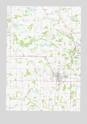
Delano, MN USGS Topographic Map
Click on map above to begin viewing in our Map Viewer.

This topographic map contains these locations and features:
Feature Name Type Latitude Longitude GNIS ID View Map
Adickes SchoolSchoolN45.0430°W93.8580°639213View Map
Apple Jack OrchardsLocaleN45.0994°W93.7900°2663718View Map
Brandt AirportAirportN45.0473°W93.8364°2676843View Map
Calvary CemeteryCemeteryN45.0330°W93.7836°1815370View Map
Cassel CemeteryCemeteryN45.0655°W93.8477°640966View Map
Cedar LakeLakeN45.0233°W93.8305°641012View Map
City of DelanoCivilN45.0378°W93.7918°2394495View Map
Cook LakeLakeN45.0783°W93.8052°1815374View Map
Crawford LakeLakeN45.1018°W93.8603°642433View Map
Crawford Lake SchoolSchoolN45.1077°W93.8694°642435View Map
Crow Spring County ParkParkN45.0916°W93.8722°1815375View Map
Dean LakeLakeN45.1207°W93.8344°642690View Map
DelanoPopulated PlaceN45.0419°W93.7891°642749View Map
DelanoLocaleN45.0403°W93.7856°2067421View Map
Delano Assembly of God ChurchChurchN45.0356°W93.7528°2104124View Map
Delano CemeteryCemeteryN45.0266°W93.7867°642750View Map
Delano City HallBuildingN45.0422°W93.7867°2067418View Map
Delano Elementary SchoolSchoolN45.0491°W93.7749°2067430View Map
Delano Evangelical Free ChurchChurchN45.0436°W93.7708°2067422View Map
Delano Fire DepartmentBuildingN45.0426°W93.7882°2067419View Map
Delano Healthcare CenterHospitalN45.0492°W93.7828°2067435View Map
Delano High SchoolSchoolN45.0449°W93.7791°2067429View Map
Delano LibraryBuildingN45.0411°W93.7883°2067420View Map
Delano Middle SchoolSchoolN45.0453°W93.7775°2433443View Map
Delano Post OfficePost OfficeN45.0408°W93.7891°2067532View Map
Dickenson Spring Wayside ParkParkN45.1214°W93.8144°2067522View Map
Dickinson SpringSpringN45.1211°W93.8136°1815378View Map
Dixon SchoolSchoolN45.1080°W93.8283°642856View Map
Hilltop SchoolSchoolN45.0141°W93.8689°645024View Map
Light of Christ Lutheran ChurchChurchN45.0497°W93.7661°2104125View Map
Mount Olive Lutheran ChurchChurchN45.0417°W93.7844°2067423View Map
Mount Olive Lutheran East CemeteryCemeteryN45.0434°W93.7684°1815372View Map
Mount Olive Lutheran SchoolSchoolN45.0415°W93.7827°2067427View Map
Mount Olive Lutheran West CemeteryCemeteryN45.0654°W93.8345°648178View Map
North Fork Crow RiverStreamN45.0814°W93.7625°648637View Map
Old Saint Peters CemeteryCemeteryN45.0488°W93.8119°2067226View Map
Our Father's Lutheran ChurchChurchN45.0950°W93.7525°2067440View Map
Ridgeview Delano ClinicHospitalN45.0358°W93.7700°2067431View Map
Saint Joseph Catholic ChurchChurchN45.0450°W93.7894°2067424View Map
Saint Josephs CemeteryCemeteryN45.0442°W93.7674°1815373View Map
Saint Marys ChurchChurchN45.0133°W93.8522°650873View Map
Saint Paul's United Church of ChristChurchN45.0422°W93.7936°2067425View Map
Saint Pauls CemeteryCemeteryN45.0654°W93.8352°643434View Map
Saint Peter Catholic ChurchChurchN45.0386°W93.7881°2067426View Map
Saint Peter's SchoolSchoolN45.0381°W93.7883°2067428View Map
Saint Peters - Calvary CemeteryCemeteryN45.0325°W93.7837°651020View Map
School Number 48SchoolN45.0647°W93.8252°651665View Map
Sheridan LakeLakeN45.1189°W93.7902°1815377View Map
South Fork Crow RiverStreamN45.0814°W93.7625°663175View Map
Southfork Recreational ParkParkN45.0361°W93.7894°2067417View Map
Spotanski LakeLakeN45.1109°W93.7628°1815376View Map
Township of FranklinCivilN45.0338°W93.8319°664219View Map
Township of RockfordCivilN45.1214°W93.8021°665436View Map
Trinity CemeteryCemeteryN45.1080°W93.8699°2067220View Map
United Methodist ChurchChurchN45.0375°W93.7661°2104126View Map

Note: Coordinates in the location and feature list above are referenced to NAD83 datum.


Copyright (C) 2008-2024 Ryan Niemi / Sunset Dynamics ... All Rights Reserved