TopoQuest Logo
Do you find TopoQuest useful?
Help keep TopoQuest running and adding new maps/features by donating!
Bitcoin:  19c7KJd3qBynnjoSw5npx9KScwjBe4ifkT
Litecoin:  LXs6TkuXGGXo1vDsWCkWVdjQX94eUKd6ui
Home View Maps Find Maps Find Places Resources & Links


Post, Mississippi Topographic Map

USGS Map Title: Post, MS
USGS Map MRC: 32088E8
DRG (GeoTIFF) Download: o32088e8.tif


Neighboring USGS Topographic Map Quads:


  Deemer, MS  
32089F1
 

  House, MS  
32088F8
 

  Moscow, MS  
32088F7
 

  Union East, MS  
32089E1
 

  Post, MS  
32088E8
 

  Center Hill, MS  
32088E7
 

  Decatur, MS  
32089D1
 

  Duffee, MS  
32088D8
 

  Collinsville, MS  
32088D7


Map MRC Location:

N33°
W89°
N33°
W88°
H8 H7 H6 H5 H4 H3 H2 H1
G8 G7 G6 G5 G4 G3 G2 G1
F8 F7 F6 F5 F4 F3 F2 F1
E8 E7 E6 E5 E4 E3 E2 E1
D8 D7 D6 D5 D4 D3 D2 D1
C8 C7 C6 C5 C4 C3 C2 C1
B8 B7 B6 B5 B4 B3 B2 B1
A8 A7 A6 A5 A4 A3 A2 A1
N32°
W89°
N32°
W88°

Post, MS USGS 1:24K Topographic Map Preview:
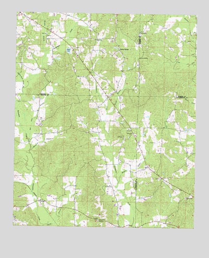
Post, MS USGS Topographic Map
Click on map above to begin viewing in our Map Viewer.

This topographic map contains these locations and features:
Feature Name Type Latitude Longitude GNIS ID View Map
Alawine Springs ChurchChurchN32.5993°W88.9142°666171View Map
Antioch CemeteryCemeteryN32.6093°W88.9442°707185View Map
Antioch ChurchChurchN32.6093°W88.9445°666312View Map
Battlefield (historical)Populated PlaceN32.5465°W88.9401°689443View Map
Battlefield School (historical)SchoolN32.5549°W88.9326°689444View Map
Bethel ChurchChurchN32.6126°W88.9795°666920View Map
Big John BranchStreamN32.5499°W88.9903°667119View Map
Calverts Store (historical)LocaleN32.6051°W88.8762°686695View Map
Church of ChristChurchN32.5038°W88.9406°668449View Map
Collinsville ChurchChurchN32.5290°W88.8978°668707View Map
Double Reed Brake BranchStreamN32.5807°W88.9951°669347View Map
Duffee Volunteer Fire DepartmentBuildingN32.5011°W88.9268°2667786View Map
Friendship CemeteryCemeteryN32.5043°W88.9412°670209View Map
Herbert SpringsPopulated PlaceN32.6035°W88.9287°671125View Map
Joiner Lake DamDamN32.6035°W88.9634°681528View Map
Joyner LakeLakeN32.6033°W88.9637°672043View Map
King CanalCanalN32.5974°W88.8759°672144View Map
Lee Pond DamDamN32.5585°W88.8834°681501View Map
Liberty School (historical)SchoolN32.5032°W88.9359°689500View Map
Mayatte CreekStreamN32.5265°W88.9276°673258View Map
Mount Nebo ChurchChurchN32.5571°W88.9198°674093View Map
Mount Pleasant ChurchChurchN32.5529°W88.9242°674230View Map
Murphy BranchStreamN32.5996°W88.9798°674479View Map
Nelson CreekStreamN32.5690°W88.9987°674554View Map
PerduePopulated PlaceN32.5146°W88.9823°692139View Map
Pleasant Grove ChurchChurchN32.5540°W88.9812°676013View Map
Pleasant Hill ChurchChurchN32.6143°W88.9145°676069View Map
Pleasant Ridge CemeteryCemeteryN32.5176°W88.8812°706398View Map
Pleasant Ridge ChurchChurchN32.5176°W88.8806°676111View Map
PostLocaleN32.5354°W88.9073°676273View Map
Prospect ChurchChurchN32.5551°W88.9189°676357View Map
Reese BranchStreamN32.5010°W88.9789°676580View Map
RioPopulated PlaceN32.6140°W88.8756°692177View Map
Texas (historical)Populated PlaceN32.5987°W88.8939°686706View Map
Threat BranchStreamN32.5665°W88.9362°678735View Map
Townsend BranchStreamN32.5446°W88.9889°678848View Map
Trussel CemeteryCemeteryN32.5499°W88.9067°678909View Map
Zion CemeteryCemeteryN32.6090°W88.8806°708010View Map
Zion ChurchChurchN32.6090°W88.8814°679996View Map

Note: Coordinates in the location and feature list above are referenced to NAD83 datum.


Copyright (C) 2008-2024 Ryan Niemi / Sunset Dynamics ... All Rights Reserved