TopoQuest Logo
Do you find TopoQuest useful?
Help keep TopoQuest running and adding new maps/features by donating!
Bitcoin:  19c7KJd3qBynnjoSw5npx9KScwjBe4ifkT
Litecoin:  LXs6TkuXGGXo1vDsWCkWVdjQX94eUKd6ui
Home View Maps Find Maps Find Places Resources & Links


House, Mississippi Topographic Map

USGS Map Title: House, MS
USGS Map MRC: 32088F8
DRG (GeoTIFF) Download: o32088f8.tif


Neighboring USGS Topographic Map Quads:


  Philadelphia, MS  
32089G1
 

  Owl Creek, MS  
32088G8
 

  Lynville, MS  
32088G7
 

  Deemer, MS  
32089F1
 

  House, MS  
32088F8
 

  Moscow, MS  
32088F7
 

  Union East, MS  
32089E1
 

  Post, MS  
32088E8
 

  Center Hill, MS  
32088E7


Map MRC Location:

N33°
W89°
N33°
W88°
H8 H7 H6 H5 H4 H3 H2 H1
G8 G7 G6 G5 G4 G3 G2 G1
F8 F7 F6 F5 F4 F3 F2 F1
E8 E7 E6 E5 E4 E3 E2 E1
D8 D7 D6 D5 D4 D3 D2 D1
C8 C7 C6 C5 C4 C3 C2 C1
B8 B7 B6 B5 B4 B3 B2 B1
A8 A7 A6 A5 A4 A3 A2 A1
N32°
W89°
N32°
W88°

House, MS USGS 1:24K Topographic Map Preview:
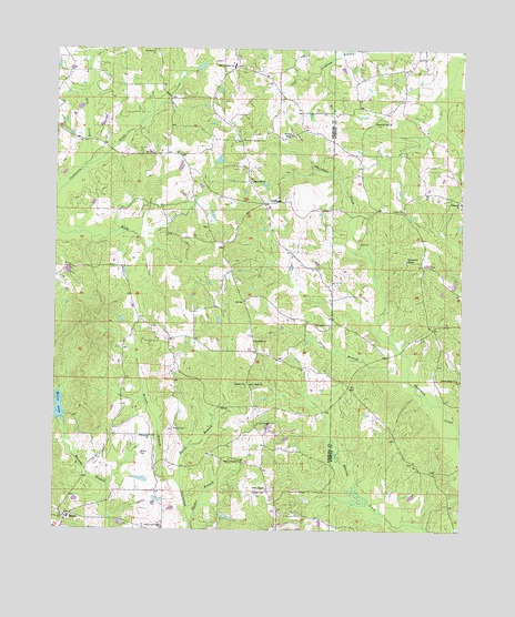
House, MS USGS Topographic Map
Click on map above to begin viewing in our Map Viewer.

This topographic map contains these locations and features:
Feature Name Type Latitude Longitude GNIS ID View Map
Center Ridge ChurchChurchN32.6643°W88.8762°668253View Map
Cushtusha (historical)LocaleN32.7112°W88.9584°707206View Map
DeWeesePopulated PlaceN32.7101°W88.9376°691803View Map
Dry CreekStreamN32.7187°W88.9926°669436View Map
Eason BranchStreamN32.6365°W88.9609°669555View Map
East Neshoba SchoolSchoolN32.7462°W88.9473°669596View Map
East Neshoba Volunteer Fire Department Station 3BuildingN32.7086°W88.9349°2665823View Map
Emoqualosha Plantation (historical)LocaleN32.6557°W88.9617°685020View Map
Friendship ChurchChurchN32.6496°W88.9703°670227View Map
Harmony ChurchChurchN32.6743°W88.9395°670936View Map
Herbert (historical)Populated PlaceN32.6746°W88.9028°686698View Map
Herbert CemeteryCemeteryN32.6626°W88.9414°707201View Map
Herbert ChurchChurchN32.6629°W88.9417°671124View Map
Hester CemeteryCemeteryN32.6354°W88.9348°671139View Map
Hester ChapelChurchN32.6429°W88.9434°671141View Map
Hester Lake DamDamN32.6368°W88.9734°681546View Map
Hesters Chapel CemeteryCemeteryN32.6435°W88.9431°707202View Map
Hopewell CemeteryCemeteryN32.7104°W88.8762°707967View Map
Hopewell ChurchChurchN32.7104°W88.8756°671425View Map
HousePopulated PlaceN32.6287°W88.9948°671517View Map
House CemeteryCemeteryN32.6512°W88.9634°671518View Map
House LakeReservoirN32.6552°W88.9985°671520View Map
House Volunteer Fire Department Station 1 HeadquartersBuildingN32.6279°W88.9955°2665804View Map
House Volunteer Fire Department Station 2BuildingN32.6405°W88.9360°2665841View Map
Java (historical)LocaleN32.6349°W88.9342°707205View Map
Liberty Baptist ChurchChurchN32.7085°W88.8939°692345View Map
Liberty CemeteryCemeteryN32.7090°W88.8934°707972View Map
Mars Hill CemeteryCemeteryN32.7154°W88.9403°707209View Map
Mars Hill ChurchChurchN32.7157°W88.9412°673149View Map
Mc Lain - Calico AirportAirportN32.7369°W88.9265°2676398View Map
McClain ChapelChurchN32.7279°W88.9295°673299View Map
McDonald CemeteryCemeteryN32.6260°W88.9714°673333View Map
Mount Carmel ChurchChurchN32.6787°W88.9162°673958View Map
New Hope ChurchChurchN32.6629°W88.9406°674700View Map
Old Herbert CemeteryCemeteryN32.6529°W88.9375°675194View Map
Persimmon ChapelChurchN32.6954°W88.8923°675630View Map
Smith BranchStreamN32.6643°W88.8912°677894View Map
Smith ChapelChurchN32.6360°W88.9348°677914View Map
Spanish Oak ChurchChurchN32.7312°W88.9028°678035View Map
Spinks (historical)Populated PlaceN32.7085°W88.8931°707999View Map
Tucker BranchStreamN32.6274°W88.9578°678915View Map
Union Sportsman Club Lake DamDamN32.6551°W88.9967°681562View Map
West Imongalasha (historical)LocaleN32.6418°W88.9737°711089View Map
Wilson BranchStreamN32.6365°W88.9609°679754View Map
Wilson CemeteryCemeteryN32.6449°W88.9731°679760View Map
Yazoo (historical)LocaleN32.7085°W88.9251°685064View Map
Yazoo Plantation (historical)LocaleN32.7307°W88.9237°685065View Map

Note: Coordinates in the location and feature list above are referenced to NAD83 datum.


Copyright (C) 2008-2024 Ryan Niemi / Sunset Dynamics ... All Rights Reserved