TopoQuest Logo
Do you find TopoQuest useful?
Help keep TopoQuest running and adding new maps/features by donating!
Bitcoin:  19c7KJd3qBynnjoSw5npx9KScwjBe4ifkT
Litecoin:  LXs6TkuXGGXo1vDsWCkWVdjQX94eUKd6ui
Home View Maps Find Maps Find Places Resources & Links


Pemberville, Ohio Topographic Map

USGS Map Title: Pemberville, OH
USGS Map MRC: 41083D4
DRG (GeoTIFF) Download: o41083d4.tif


Neighboring USGS Topographic Map Quads:


  Rossford, OH  
41083E5
 

  Walbridge, OH  
41083E4
 

  Genoa, OH  
41083E3
 

  Dunbridge, OH  
41083D5
 

  Pemberville, OH  
41083D4
 

  Elmore, OH  
41083D3
 

  Jerry City, OH  
41083C5
 

  Bradner, OH  
41083C4
 

  Helena, OH  
41083C3


Map MRC Location:

N42°
W84°
N42°
W83°
H8 H7 H6 H5 H4 H3 H2 H1
G8 G7 G6 G5 G4 G3 G2 G1
F8 F7 F6 F5 F4 F3 F2 F1
E8 E7 E6 E5 E4 E3 E2 E1
D8 D7 D6 D5 D4 D3 D2 D1
C8 C7 C6 C5 C4 C3 C2 C1
B8 B7 B6 B5 B4 B3 B2 B1
A8 A7 A6 A5 A4 A3 A2 A1
N41°
W84°
N41°
W83°

Pemberville, OH USGS 1:24K Topographic Map Preview:
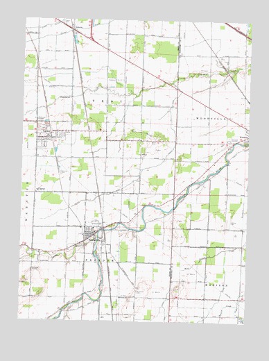
Pemberville, OH USGS Topographic Map
Click on map above to begin viewing in our Map Viewer.

This topographic map contains these locations and features:
Feature Name Type Latitude Longitude GNIS ID View Map
Calers RidgeRidgeN41.4128°W83.4152°1063332View Map
Eastwood High SchoolSchoolN41.4287°W83.4905°1040040View Map
Eastwood Middle SchoolSchoolN41.4285°W83.4884°1951692View Map
Eisenhour CemeteryCemeteryN41.3868°W83.4350°1040102View Map
Foos DitchCanalN41.3812°W83.4199°1040543View Map
Freedom Township HallBuildingN41.4095°W83.4580°1951761View Map
Hiview Airport (historical)AirportN41.4167°W83.3841°1083133View Map
Laffertys Trailer CourtPopulated PlaceN41.4989°W83.4788°1951838View Map
LemoynePopulated PlaceN41.4959°W83.4741°1057793View Map
Lemoyne Elementary SchoolSchoolN41.4980°W83.4776°1050445View Map
Lemoyne Post OfficePost OfficeN41.4956°W83.4719°1951842View Map
LuckeyPopulated PlaceN41.4506°W83.4874°1048939View Map
Luckey Elementary SchoolSchoolN41.4537°W83.4760°1050444View Map
Luckey Police DepartmentBuildingN41.4506°W83.4858°2732554View Map
Luckey Post OfficePost OfficeN41.4509°W83.4849°1951845View Map
Luckey QuarryMineN41.4548°W83.4891°1951846View Map
Martin DitchCanalN41.4378°W83.4347°1043024View Map
North Branch Portage RiverStreamN41.4106°W83.4577°1043899View Map
PembervillePopulated PlaceN41.4109°W83.4610°1049070View Map
Pemberville - Freedom Fire DepartmentBuildingN41.4095°W83.4602°2549355View Map
Pemberville CemeteryCemeteryN41.3959°W83.4913°1044363View Map
Pemberville Elementary SchoolSchoolN41.4132°W83.4596°1050443View Map
Pemberville Police DepartmentBuildingN41.4101°W83.4604°2732700View Map
Pemberville Post OfficePost OfficeN41.4109°W83.4602°1951936View Map
Salem CemeteryCemeteryN41.4439°W83.4341°1731448View Map
Salem Lutheran ChurchChurchN41.4445°W83.4341°1731449View Map
Schwan CreekStreamN41.3820°W83.3788°1046031View Map
South Branch Coon CreekStreamN41.4051°W83.3866°1056194View Map
Tousaint (historical)Populated PlaceN41.4795°W83.3874°1067214View Map
Township of FreedomCivilN41.3800°W83.4669°1087182View Map
Township of TroyCivilN41.4755°W83.4646°1087198View Map
Trimmers RidgeRidgeN41.4162°W83.3888°1067215View Map
Troy Township CemeteryCemeteryN41.4522°W83.3939°1731451View Map
Troy Township Volunteer Fire Department and Emergency Medical ServicesBuildingN41.4525°W83.4837°2549797View Map
Village of LuckeyCivilN41.4524°W83.4839°2399199View Map
Village of PembervilleCivilN41.4096°W83.4588°2399646View Map
Westwood CemeteryCemeteryN41.4501°W83.3863°1047836View Map
William Henry Harrison ParkParkN41.4023°W83.4566°1952102View Map
WRED-FM (Gibsonburg)TowerN41.4720°W83.4180°1085364View Map
Yankey CreekStreamN41.4020°W83.4941°1065836View Map
Zion ChurchChurchN41.4531°W83.4769°1048283View Map

Note: Coordinates in the location and feature list above are referenced to NAD83 datum.


Copyright (C) 2008-2024 Ryan Niemi / Sunset Dynamics ... All Rights Reserved