TopoQuest Logo
Do you find TopoQuest useful?
Help keep TopoQuest running and adding new maps/features by donating!
Bitcoin:  19c7KJd3qBynnjoSw5npx9KScwjBe4ifkT
Litecoin:  LXs6TkuXGGXo1vDsWCkWVdjQX94eUKd6ui
Home View Maps Find Maps Find Places Resources & Links


Elmore, Ohio Topographic Map

USGS Map Title: Elmore, OH
USGS Map MRC: 41083D3
DRG (GeoTIFF) Download: o41083d3.tif


Neighboring USGS Topographic Map Quads:


  Walbridge, OH  
41083E4
 

  Genoa, OH  
41083E3
 

  Oak Harbor, OH  
41083E2
 

  Pemberville, OH  
41083D4
 

  Elmore, OH  
41083D3
 

  Lindsey, OH  
41083D2
 

  Bradner, OH  
41083C4
 

  Helena, OH  
41083C3
 

  Fremont West, OH  
41083C2


Map MRC Location:

N42°
W84°
N42°
W83°
H8 H7 H6 H5 H4 H3 H2 H1
G8 G7 G6 G5 G4 G3 G2 G1
F8 F7 F6 F5 F4 F3 F2 F1
E8 E7 E6 E5 E4 E3 E2 E1
D8 D7 D6 D5 D4 D3 D2 D1
C8 C7 C6 C5 C4 C3 C2 C1
B8 B7 B6 B5 B4 B3 B2 B1
A8 A7 A6 A5 A4 A3 A2 A1
N41°
W84°
N41°
W83°

Elmore, OH USGS 1:24K Topographic Map Preview:
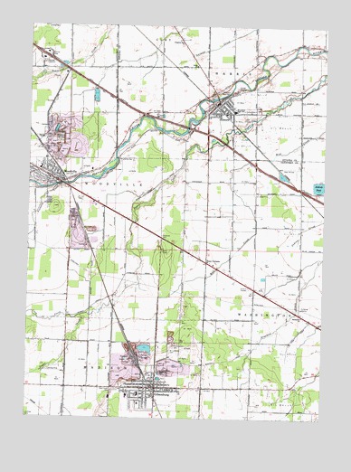
Elmore, OH USGS Topographic Map
Click on map above to begin viewing in our Map Viewer.

This topographic map contains these locations and features:
Feature Name Type Latitude Longitude GNIS ID View Map
Aldrich PondReservoirN41.4492°W83.2523°1037355View Map
Bench's GreenhouseBuildingN41.4878°W83.2819°2652246View Map
Busy CornersPopulated PlaceN41.4248°W83.2999°1048572View Map
Christ Community ChurchChurchN41.4737°W83.2988°1807302View Map
Collins CemeteryCemeteryN41.4381°W83.3296°1963234View Map
Coon CreekStreamN41.4073°W83.3527°1039342View Map
ElmorePopulated PlaceN41.4762°W83.2958°1048703View Map
Elmore Church of GodChurchN41.4728°W83.2977°1807303View Map
Elmore Post OfficePost OfficeN41.4751°W83.2955°1082341View Map
Elmore Village Police DepartmentBuildingN41.4752°W83.2953°2732808View Map
Emmanuel ChurchChurchN41.4076°W83.2588°1068200View Map
Faith United Methodist ChurchChurchN41.3842°W83.3352°1067683View Map
First English Lutheran ChurchChurchN41.3845°W83.3230°1067686View Map
GibsonburgPopulated PlaceN41.3845°W83.3205°1061095View Map
Gibsonburg - Madison Township Volunteer Fire DepartmentBuildingN41.3854°W83.3204°2550547View Map
Gibsonburg Church of the NazareneChurchN41.3839°W83.3319°1067684View Map
Gibsonburg Junction (historical)Populated PlaceN41.4326°W83.3188°1067208View Map
Gibsonburg Police DepartmentBuildingN41.3848°W83.3212°2732478View Map
Gibsonburg Post OfficePost OfficeN41.3848°W83.3208°2044077View Map
Grace Lutheran ChurchChurchN41.4876°W83.3063°1041002View Map
Haar AirportAirportN41.4558°W83.2604°1082669View Map
Harris - Elmore Fire Department Emergency Medical ServicesBuildingN41.4748°W83.2967°2549683View Map
Harris-Elmore Public LibraryBuildingN41.4756°W83.2946°1807305View Map
James J Hilfiker Elementary SchoolSchoolN41.3823°W83.3274°1056105View Map
Kingdom Hall ChurchChurchN41.4945°W83.3124°1042277View Map
North Union CemeteryCemeteryN41.3981°W83.3135°1043974View Map
Rice CemeteryCemeteryN41.4834°W83.2871°1964666View Map
Saint Johns United Church of ChristChurchN41.4770°W83.2930°1807307View Map
Saint Lawrence CemeteryCemeteryN41.3964°W83.3146°1045602View Map
Saint Michaels ChurchChurchN41.3845°W83.3174°1068219View Map
Saint Paul Trinity United Methodist ChurchChurchN41.4745°W83.2935°1807310View Map
Solomon Lutheran ChurchChurchN41.4514°W83.3663°1067689View Map
Solomon Lutheran SchoolSchoolN41.4512°W83.3663°1067690View Map
Sugar Creek Golf CourseLocaleN41.4706°W83.2833°1049711View Map
Township of HarrisCivilN41.4851°W83.2526°1086762View Map
Township of WoodvilleCivilN41.4488°W83.3642°1086920View Map
Trinity Assembly of God ChurchChurchN41.4531°W83.3710°1067688View Map
Trinity Lutheran ChurchChurchN41.4717°W83.2946°1807311View Map
Trinity United Methodist ChurchChurchN41.3851°W83.3185°1067687View Map
Union CemeteryCemeteryN41.4739°W83.2788°1047295View Map
Veterans Memorial CemeteryCemeteryN41.4800°W83.2921°1047448View Map
Victoria CreekStreamN41.4489°W83.3635°1047449View Map
Village of ElmoreCivilN41.4706°W83.2912°2398815View Map
Village of GibsonburgCivilN41.3880°W83.3219°2398959View Map
Village of WoodvilleCivilN41.4509°W83.3638°2399739View Map
Welter School (historical)SchoolN41.3828°W83.3277°1058118View Map
West Branch CreekStreamN41.4078°W83.3746°1047736View Map
West Union CemeteryCemeteryN41.3842°W83.3377°1047807View Map
Woodmore Elementary SchoolSchoolN41.4545°W83.3699°1056127View Map
Woodmore High SchoolSchoolN41.4731°W83.2884°1048116View Map
WoodvillePopulated PlaceN41.4514°W83.3658°1049343View Map
Woodville CemeteryCemeteryN41.4642°W83.3624°1048125View Map
Woodville Township Fire DepartmentBuildingN41.4478°W83.3602°2550253View Map
Woodville United Methodist ChurchChurchN41.4520°W83.3644°1067691View Map
Woodville Village Police DepartmentBuildingN41.4510°W83.3649°2732935View Map
WRED-FM (Gibsonburg)TowerN41.4881°W83.3235°1085365View Map
WXKR-FM (Port Clinton)TowerN41.4976°W83.2699°1085399View Map
Zion Evangelical Lutheran ChurchChurchN41.3798°W83.3274°1067685View Map

Note: Coordinates in the location and feature list above are referenced to NAD83 datum.


Copyright (C) 2008-2024 Ryan Niemi / Sunset Dynamics ... All Rights Reserved