TopoQuest Logo
Do you find TopoQuest useful?
Help keep TopoQuest running and adding new maps/features by donating!
Bitcoin:  19c7KJd3qBynnjoSw5npx9KScwjBe4ifkT
Litecoin:  LXs6TkuXGGXo1vDsWCkWVdjQX94eUKd6ui
Home View Maps Find Maps Find Places Resources & Links


Dunbridge, Ohio Topographic Map

USGS Map Title: Dunbridge, OH
USGS Map MRC: 41083D5
DRG (GeoTIFF) Download: o41083d5.tif


Neighboring USGS Topographic Map Quads:


  Maumee, OH  
41083E6
 

  Rossford, OH  
41083E5
 

  Walbridge, OH  
41083E4
 

  Bowling Green North, OH  
41083D6
 

  Dunbridge, OH  
41083D5
 

  Pemberville, OH  
41083D4
 

  Bowling Green South, OH  
41083C6
 

  Jerry City, OH  
41083C5
 

  Bradner, OH  
41083C4


Map MRC Location:

N42°
W84°
N42°
W83°
H8 H7 H6 H5 H4 H3 H2 H1
G8 G7 G6 G5 G4 G3 G2 G1
F8 F7 F6 F5 F4 F3 F2 F1
E8 E7 E6 E5 E4 E3 E2 E1
D8 D7 D6 D5 D4 D3 D2 D1
C8 C7 C6 C5 C4 C3 C2 C1
B8 B7 B6 B5 B4 B3 B2 B1
A8 A7 A6 A5 A4 A3 A2 A1
N41°
W84°
N41°
W83°

Dunbridge, OH USGS 1:24K Topographic Map Preview:
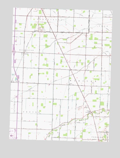
Dunbridge, OH USGS Topographic Map
Click on map above to begin viewing in our Map Viewer.

This topographic map contains these locations and features:
Feature Name Type Latitude Longitude GNIS ID View Map
Belleville Ridge CemeteryCemeteryN41.4775°W83.5897°1731419View Map
Brandeberry CemeteryCemeteryN41.3839°W83.5016°1038263View Map
Center Township Fire DepartmentBuildingN41.3750°W83.5904°2550127View Map
Creason Golf CourseLocaleN41.3828°W83.6213°1084735View Map
Devils Hole PrairieAreaN41.4501°W83.5624°1063335View Map
DowlingPopulated PlaceN41.4784°W83.5935°1064551View Map
Drake AirportAirportN41.4536°W83.5882°1082514View Map
DunbridgePopulated PlaceN41.4581°W83.6102°1064563View Map
Dunbridge Post OfficePost OfficeN41.4578°W83.6091°1951684View Map
Fenton (historical)Populated PlaceN41.4542°W83.5583°1050441View Map
Interchange 187CrossingN41.4581°W83.6224°1061269View Map
Middleton Township Fire Department Station 2BuildingN41.4583°W83.6095°2550469View Map
New Belleville Ridge CemeteryCemeteryN41.4796°W83.5916°1043822View Map
Perry FieldParkN41.3784°W83.6224°1084763View Map
Perrysburg Estates Mobile Home ParkPopulated PlaceN41.4953°W83.5652°1951939View Map
Ranchport Airport (historical)AirportN41.4820°W83.5305°1083032View Map
Scotch RidgePopulated PlaceN41.4026°W83.5230°1084140View Map
Scotch Ridge CemeteryCemeteryN41.4071°W83.5313°1731450View Map
Sugar RidgePopulated PlaceN41.4289°W83.6224°1058057View Map
Tanglewood Golf CourseLocaleN41.4812°W83.5863°1050440View Map
Township of CenterCivilN41.3830°W83.5930°1087180View Map
Township of WebsterCivilN41.4326°W83.5383°1087200View Map
Village Green Mobile Home ParkPopulated PlaceN41.4945°W83.5408°1952006View Map
Webster ChurchChurchN41.4284°W83.5522°1058114View Map
Webster Elementary SchoolSchoolN41.4033°W83.5243°1050442View Map
Whittaker TrackParkN41.3770°W83.6208°1084773View Map

Note: Coordinates in the location and feature list above are referenced to NAD83 datum.


Copyright (C) 2008-2024 Ryan Niemi / Sunset Dynamics ... All Rights Reserved