TopoQuest Logo
Do you find TopoQuest useful?
Help keep TopoQuest running and adding new maps/features by donating!
Bitcoin:  19c7KJd3qBynnjoSw5npx9KScwjBe4ifkT
Litecoin:  LXs6TkuXGGXo1vDsWCkWVdjQX94eUKd6ui
Home View Maps Find Maps Find Places Resources & Links


Peaked Mountain, Maine Topographic Map

USGS Map Title: Peaked Mountain, ME
USGS Map MRC: 44067H8
DRG (GeoTIFF) Download: o44067h8.tif


Neighboring USGS Topographic Map Quads:


  Gassabias Lake, ME  
45068A1
 

  Fletcher Peak, ME  
45067A8
 

  Monroe Lake, ME  
45067A7
 

  Quillpig Mountain, ME  
44068H1
 

  Peaked Mountain, ME  
44067H8
 

  Tug Mountain, ME  
44067H7
 

  Lead Mountain, ME  
44068G1
 

  Northeast Bluff, ME  
44067G8
 

  Montegail Pond, ME  
44067G7


Map MRC Location:

N45°
W68°
N45°
W67°
H8 H7 H6 H5 H4 H3 H2 H1
G8 G7 G6 G5 G4 G3 G2 G1
F8 F7 F6 F5 F4 F3 F2 F1
E8 E7 E6 E5 E4 E3 E2 E1
D8 D7 D6 D5 D4 D3 D2 D1
C8 C7 C6 C5 C4 C3 C2 C1
B8 B7 B6 B5 B4 B3 B2 B1
A8 A7 A6 A5 A4 A3 A2 A1
N44°
W68°
N44°
W67°

Peaked Mountain, ME USGS 1:24K Topographic Map Preview:
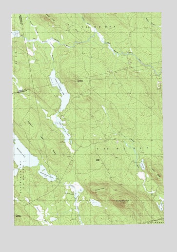
Peaked Mountain, ME USGS Topographic Map
Click on map above to begin viewing in our Map Viewer.

This topographic map contains these locations and features:
Feature Name Type Latitude Longitude GNIS ID View Map
Cranberry Lake RidgeRidgeN44.9295°W67.9814°564466View Map
Cranberry MountainSummitN44.9602°W67.9480°564468View Map
Cranberry StreamStreamN44.9842°W67.9683°564484View Map
Elwell DamLocaleN44.9123°W67.9295°565884View Map
Elwell RidgeRidgeN44.9120°W67.9297°565890View Map
Indian RidgeRidgeN44.9029°W67.8825°568606View Map
Ingalls BrookStreamN44.9903°W67.9322°568621View Map
Libby BrookStreamN44.9890°W67.9322°569513View Map
Lily LakeLakeN44.8852°W67.8774°569563View Map
Lower Cranberry LakeLakeN44.9547°W67.9599°570483View Map
Lower PondReservoirN44.9868°W67.9920°570532View Map
Lower Sabao Lake DamDamN44.9869°W67.9921°574626View Map
Mopang First LakeLakeN44.8933°W67.9477°571652View Map
Mopang Second LakeLakeN44.9053°W67.9723°571654View Map
Mopang Second Lake DamDamN44.9030°W67.9638°1774703View Map
Peaked MountainSummitN44.8880°W67.9102°573098View Map
Peep LakeLakeN44.9095°W67.8921°573130View Map
Rolford BrookStreamN44.9848°W67.9783°574435View Map
Rolford DamLocaleN44.9823°W67.9247°574436View Map
T30 MD BPPCivilN44.9260°W67.9118°1987571View Map
Tibbets RidgeRidgeN44.8959°W67.9294°577089View Map
Upper Cranberry LakeLakeN44.9281°W67.9552°577585View Map

Note: Coordinates in the location and feature list above are referenced to NAD83 datum.


Copyright (C) 2008-2024 Ryan Niemi / Sunset Dynamics ... All Rights Reserved