TopoQuest Logo
Do you find TopoQuest useful?
Help keep TopoQuest running and adding new maps/features by donating!
Bitcoin:  19c7KJd3qBynnjoSw5npx9KScwjBe4ifkT
Litecoin:  LXs6TkuXGGXo1vDsWCkWVdjQX94eUKd6ui
Home View Maps Find Maps Find Places Resources & Links


Lead Mountain, Maine Topographic Map

USGS Map Title: Lead Mountain, ME
USGS Map MRC: 44068G1
DRG (GeoTIFF) Download: o44068g1.tif


Neighboring USGS Topographic Map Quads:


  Alligator Lake, ME  
44068H2
 

  Quillpig Mountain, ME  
44068H1
 

  Peaked Mountain, ME  
44067H8
 

  Rocky Pond, ME  
44068G2
 

  Lead Mountain, ME  
44068G1
 

  Northeast Bluff, ME  
44067G8
 

  Molasses Pond, ME  
44068F2
 

  Tunk Mountain, ME  
44068F1
 

  Schoodic Lake, ME  
44067F8


Map MRC Location:

N45°
W69°
N45°
W68°
H8 H7 H6 H5 H4 H3 H2 H1
G8 G7 G6 G5 G4 G3 G2 G1
F8 F7 F6 F5 F4 F3 F2 F1
E8 E7 E6 E5 E4 E3 E2 E1
D8 D7 D6 D5 D4 D3 D2 D1
C8 C7 C6 C5 C4 C3 C2 C1
B8 B7 B6 B5 B4 B3 B2 B1
A8 A7 A6 A5 A4 A3 A2 A1
N44°
W69°
N44°
W68°

Lead Mountain, ME USGS 1:24K Topographic Map Preview:
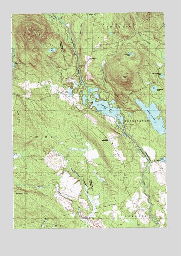
Lead Mountain, ME USGS Topographic Map
Click on map above to begin viewing in our Map Viewer.

This topographic map contains these locations and features:
Feature Name Type Latitude Longitude GNIS ID View Map
Bear PondLakeN44.8539°W68.0920°561860View Map
BeddingtonPopulated PlaceN44.8481°W68.0620°561976View Map
Beddington LakeLakeN44.8205°W68.0500°561977View Map
Beddington Volunteer Fire DepartmentBuildingN44.7994°W68.0450°2553185View Map
Bobcat BrookStreamN44.8559°W68.0720°562636View Map
Bog BrookStreamN44.7879°W68.0125°1774692View Map
Bog Brook DamDamN44.7891°W68.0051°1774691View Map
Chalk PondLakeN44.8293°W68.0767°563798View Map
Gray PondLakeN44.8631°W68.0436°567105View Map
Horseshoe PondLakeN44.8307°W68.0090°568317View Map
Humpback BrookStreamN44.8737°W68.0889°568449View Map
Lead MountainSummitN44.8646°W68.1103°569419View Map
Lead Mountain TrailTrailN44.8612°W68.1058°1911732View Map
Little Horseshoe PondLakeN44.8380°W68.0024°569828View Map
Little Narraguagus RiverStreamN44.8354°W68.0683°569936View Map
Lower BeddingtonPopulated PlaceN44.8015°W68.0458°570475View Map
Meadow BrookStreamN44.8479°W68.1228°571080View Map
Mountain PondLakeN44.8510°W68.0273°571808View Map
Pork BrookStreamN44.7542°W68.0647°573673View Map
Shorey BrookStreamN44.8240°W68.0461°575433View Map
Sinclair BrookStreamN44.8737°W68.0853°575490View Map
Smith RidgeRidgeN44.8134°W68.1183°575641View Map
Spruce MountainSummitN44.8365°W68.0325°576143View Map
Spruce Mountain LakeLakeN44.8142°W68.0096°576150View Map
Town of BeddingtonCivilN44.8139°W68.0090°582346View Map

Note: Coordinates in the location and feature list above are referenced to NAD83 datum.


Copyright (C) 2008-2024 Ryan Niemi / Sunset Dynamics ... All Rights Reserved